Mill Township, Grant County, Indiana
Mill Township is one of thirteen townships in Grant County, Indiana, United States. As of the 2010 census, its population was 10,882 and it contained 4,809 housing units.[1]
Mill Township | |
|---|---|
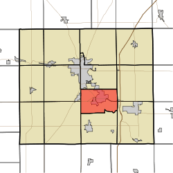 Location of Mill Township in Grant County | |
| Coordinates: 40°28′53″N 85°37′05″W | |
| Country | United States |
| State | Indiana |
| County | Grant |
| Government | |
| • Type | Indiana township |
| Area | |
| • Total | 23.19 sq mi (60.1 km2) |
| • Land | 23.18 sq mi (60.0 km2) |
| • Water | 0.01 sq mi (0.03 km2) 0.04% |
| Elevation | 850 ft (259 m) |
| Population (2010) | |
| • Total | 10,882 |
| • Density | 469.5/sq mi (181.3/km2) |
| GNIS feature ID | 0453626 |
Geography
According to the 2010 census, the township has a total area of 23.19 square miles (60.1 km2), of which 23.18 square miles (60.0 km2) (or 99.96%) is land and 0.01 square miles (0.026 km2) (or 0.04%) is water.[1] The streams of Bean Run, City Run, Ethel Run, Long Branch, Octain Creek, Regular Run and Shell Run run through this township.
Adjacent townships
- Center Township (north)
- Monroe Township (east)
- Jefferson Township (southeast)
- Fairmount Township (south)
- Liberty Township (southwest)
- Franklin Township (west)
Cemeteries
The township contains two cemeteries: Riverside and Walnut Creek.
Education
Mill Township residents may obtain a library card from the Gas City-Mill Township Public Library in Gas City.[2]
References
- "Population, Housing Units, Area, and Density: 2010 - County -- County Subdivision and Place -- 2010 Census Summary File 1". United States Census. Archived from the original on 2020-02-12. Retrieved 2013-05-10.
- "Homepage". Gas City-Mill Township Public Library. Retrieved 7 March 2018.
External links
Municipalities and communities of Grant County, Indiana, United States | ||
|---|---|---|
| Cities | Map of Indiana highlighting Grant County | |
| Towns | ||
| Townships | ||
| CDPs | ||
| Unincorporated communities | ||
| Footnotes | ‡This populated place also has portions in an adjacent county or counties | |
This article is issued from Wikipedia. The text is licensed under Creative Commons - Attribution - Sharealike. Additional terms may apply for the media files.