Fairmount Township, Grant County, Indiana
Fairmount Township is one of thirteen townships in Grant County, Indiana, United States. As of the 2010 census, its population was 4,239 and it contained 1,909 housing units.[1]
Fairmount Township | |
|---|---|
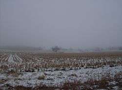 Snowy fields in Fairmount Township | |
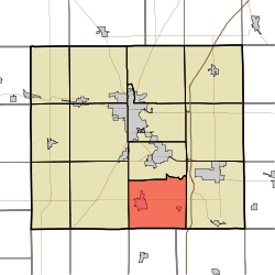 Location of Fairmount Township in Grant County | |
| Coordinates: 40°25′N 85°37′W | |
| Country | United States |
| State | Indiana |
| County | Grant |
| Government | |
| • Type | Indiana township |
| Area | |
| • Total | 30.47 sq mi (78.9 km2) |
| • Land | 30.43 sq mi (78.8 km2) |
| • Water | 0.03 sq mi (0.08 km2) 0.10% |
| Elevation | 873 ft (266 m) |
| Population (2010) | |
| • Total | 4,239 |
| • Density | 139.3/sq mi (53.8/km2) |
| GNIS feature ID | 0453287 |
Geography
According to the 2010 census, the township has a total area of 30.47 square miles (78.9 km2), of which 30.43 square miles (78.8 km2) (or 99.87%) is land and 0.03 square miles (0.078 km2) (or 0.10%) is water.[1] The streams of Back Creek, Winslow Ditch, Barren Creek, Fowlerton Drain, New Prairie Creek and Van Run run through this township. Lake Galatia, the southernmost natural lake in Indiana, lies in this township.
Adjacent townships
- Mill Township (north)
- Jefferson Township (east)
- Washington Township, Delaware County (southeast)
- Van Buren Township, Madison County (south)
- Boone Township, Madison County (southwest)
- Liberty Township (west)
Cemeteries
The township contains two cemeteries: Bethel and Park.
Education
Fairmount Township residents may obtain a free library card from the Fairmount Public Library in Fairmount.[2]
References
- "Fairmount Township, Grant County, Indiana". Geographic Names Information System. United States Geological Survey. Retrieved 2009-09-24.
- United States Census Bureau cartographic boundary files
- "Population, Housing Units, Area, and Density: 2010 - County -- County Subdivision and Place -- 2010 Census Summary File 1". United States Census. Archived from the original on 2020-02-12. Retrieved 2013-05-10.
- "Library Cards". Fairmount Public Library. Retrieved 7 March 2018.
External links
Municipalities and communities of Grant County, Indiana, United States | ||
|---|---|---|
| Cities | Map of Indiana highlighting Grant County | |
| Towns | ||
| Townships | ||
| CDPs | ||
| Unincorporated communities | ||
| Footnotes | ‡This populated place also has portions in an adjacent county or counties | |
| Authority control |
|
|---|