Magness, Arkansas
Magness is a town in Independence County, Arkansas, United States. The population was 202 at the 2010 census.[3]
Magness, Arkansas | |
|---|---|
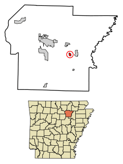 Location of Magness in Independence County, Arkansas | |
| Coordinates: 35°42′11″N 91°28′52″W | |
| Country | United States |
| State | Arkansas |
| County | Independence |
| Area | |
| • Total | 0.61 sq mi (1.59 km2) |
| • Land | 0.61 sq mi (1.59 km2) |
| • Water | 0.00 sq mi (0.00 km2) |
| Elevation | 276 ft (84 m) |
| Population (2010) | |
| • Total | 202 |
| • Estimate (2019)[2] | 211 |
| • Density | 343.65/sq mi (132.58/km2) |
| Time zone | UTC-6 (Central (CST)) |
| • Summer (DST) | UTC-5 (CDT) |
| ZIP code | 72553 |
| Area code(s) | 870 |
| FIPS code | 05-43370 |
| GNIS feature ID | 0051603 |
Geography
Magness is located in eastern Independence County at 35°42′11″N 91°28′52″W (35.703168, -91.481058).[4] Arkansas Highway 69 passes through the town, leading east 2 miles (3 km) to Newark and north 3 miles (5 km) to Sulphur Rock. Batesville, the county seat, is 12 miles (19 km) to the northwest via Highway 69.
According to the United States Census Bureau, Magness has an area of 0.58 square miles (1.5 km2), all land.[3] The town is named after a family, or one of its members (probably Colonel Morgan Magness), who was prominent in Independence County before the Civil War. They were the largest slaveholding family in the county, but since Independence County, located in the mountains, had few slaves, the Magnesses had less than 20.
Transportation
Demographics
| Historical population | |||
|---|---|---|---|
| Census | Pop. | %± | |
| 1910 | 216 | — | |
| 1920 | 199 | −7.9% | |
| 1930 | 179 | −10.1% | |
| 1940 | 226 | 26.3% | |
| 1950 | 229 | 1.3% | |
| 1960 | 140 | −38.9% | |
| 1970 | 139 | −0.7% | |
| 1980 | 196 | 41.0% | |
| 1990 | 158 | −19.4% | |
| 2000 | 191 | 20.9% | |
| 2010 | 202 | 5.8% | |
| Est. 2019 | 211 | [2] | 4.5% |
| U.S. Decennial Census[5] | |||
As of the census[6] of 2000, there were 191 people, 82 households, and 55 families residing in the town. The population density was 129.4/km2 (333.3/mi2). There were 91 housing units at an average density of 61.6/km2 (158.8/mi2). The racial makeup of the town was 98.95% White, and 1.05% from two or more races. 0.52% of the population were Hispanic or Latino of any race.
There were 82 households, out of which 28.0% had children under the age of 18 living with them, 52.4% were married couples living together, 9.8% had a female householder with no husband present, and 32.9% were non-families. 29.3% of all households were made up of individuals, and 17.1% had someone living alone who was 65 years of age or older. The average household size was 2.33 and the average family size was 2.89.
In the town, the population was spread out, with 24.6% under the age of 18, 5.2% from 18 to 24, 22.5% from 25 to 44, 24.6% from 45 to 64, and 23.0% who were 65 years of age or older. The median age was 43 years. For every 100 females, there were 91.0 males. For every 100 females age 18 and over, there were 94.6 males.
The median income for a household in the town was $27,969, and the median income for a family was $35,000. Males had a median income of $27,750 versus $16,058 for females. The per capita income for the town was $24,967. About 14.3% of families and 22.6% of the population were below the poverty line, including 23.1% of those under the age of eighteen and 32.7% of those 65 or over.
References
- "2019 U.S. Gazetteer Files". United States Census Bureau. Retrieved June 30, 2020.
- "Population and Housing Unit Estimates". United States Census Bureau. May 24, 2020. Retrieved May 27, 2020.
- "Geographic Identifiers: 2010 Census Summary File 1 (G001): Magness town, Arkansas". American Factfinder. U.S. Census Bureau. Archived from the original on February 13, 2020. Retrieved March 23, 2018.
- "US Gazetteer files: 2010, 2000, and 1990". United States Census Bureau. 2011-02-12. Retrieved 2011-04-23.
- "Census of Population and Housing". Census.gov. Retrieved June 4, 2015.
- "U.S. Census website". United States Census Bureau. Retrieved 2008-01-31.
Municipalities and communities of Independence County, Arkansas, United States | ||
|---|---|---|
| Cities | 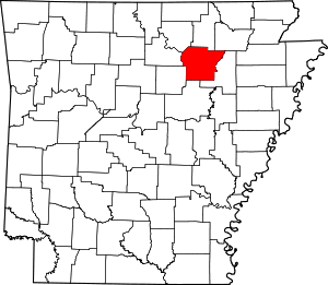 Map of Arkansas highlighting Independence County | |
| Towns | ||
| Unincorporated communities | ||
| Footnotes | ‡This populated place also has portions in an adjacent county or counties | |