Cushman, Arkansas
Cushman is a city[3] in Independence County, Arkansas, United States. The population was 452 at the 2010 census.
Cushman, Arkansas | |
|---|---|
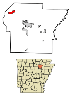 Location of Cushman in Independence County, Arkansas. | |
| Coordinates: 35°52′10″N 91°45′53″W | |
| Country | United States |
| State | Arkansas |
| County | Independence |
| Area | |
| • Total | 4.08 sq mi (10.56 km2) |
| • Land | 4.08 sq mi (10.56 km2) |
| • Water | 0.00 sq mi (0.00 km2) |
| Elevation | 715 ft (218 m) |
| Population (2010) | |
| • Total | 452 |
| • Estimate (2019)[2] | 459 |
| • Density | 112.61/sq mi (43.48/km2) |
| Time zone | UTC-6 (Central (CST)) |
| • Summer (DST) | UTC-5 (CDT) |
| ZIP code | 72526 |
| Area code(s) | 870 |
| FIPS code | 05-16930 |
| GNIS feature ID | 0048278 |
Geography
Cushman is located at 35°52′10″N 91°45′53″W (35.869346, -91.764695).[4]
According to the United States Census Bureau, the town has a total area of 4.0 square miles (10 km2), all land.
Only Highway
Demographics
| Historical population | |||
|---|---|---|---|
| Census | Pop. | %± | |
| 1910 | 244 | — | |
| 1920 | 349 | 43.0% | |
| 1930 | 412 | 18.1% | |
| 1940 | 427 | 3.6% | |
| 1950 | 314 | −26.5% | |
| 1960 | 241 | −23.2% | |
| 1970 | 427 | 77.2% | |
| 1980 | 556 | 30.2% | |
| 1990 | 428 | −23.0% | |
| 2000 | 461 | 7.7% | |
| 2010 | 452 | −2.0% | |
| Est. 2019 | 459 | [2] | 1.5% |
| U.S. Decennial Census[5] 2018 Estimate[6] | |||
As of the census[7] of 2000, there were 461 people, 178 households, and 140 families residing in the town. The population density was 115.6 inhabitants per square mile (44.6/km2). There were 208 housing units at an average density of 52.2 per square mile (20.1/km2). The racial makeup of the town was 96.53% White, 1.08% Native American, and 2.39% from two or more races. 1.08% of the population were Hispanic or Latino of any race.
There were 178 households, out of which 35.4% had children under the age of 18 living with them, 66.3% were married couples living together, 11.8% had a female householder with no husband present, and 20.8% were non-families. 18.5% of all households were made up of individuals, and 6.7% had someone living alone who was 65 years of age or older. The average household size was 2.59 and the average family size was 2.95.
In the town the population was spread out, with 25.8% under the age of 18, 7.2% from 18 to 24, 26.5% from 25 to 44, 31.0% from 45 to 64, and 9.5% who were 65 years of age or older. The median age was 39 years. For every 100 females, there were 97.0 males. For every 100 females age 18 and over, there were 94.3 males.
The median income for a household in the town was $25,000, and the median income for a family was $29,125. Males had a median income of $22,266 versus $16,625 for females. The per capita income for the town was $11,836. About 15.1% of families and 20.8% of the population were below the poverty line, including 22.9% of those under age 18 and 29.2% of those age 65 or over.
Climate
The climate in this area is characterized by hot, humid summers and generally mild to cool winters. According to the Köppen Climate Classification system, Cushman has a humid subtropical climate, abbreviated "Cfa" on climate maps.[8]
Education
Batesville School District serves the community. Cushman School District consolidated into the Batesville district on July 1, 2009.[9]
References
- "2019 U.S. Gazetteer Files". United States Census Bureau. Retrieved June 30, 2020.
- "Population and Housing Unit Estimates". United States Census Bureau. May 24, 2020. Retrieved May 27, 2020.
- Local.Arkansas.gov - Cushman, retrieved September 3, 2012
- "US Gazetteer files: 2010, 2000, and 1990". United States Census Bureau. 2011-02-12. Retrieved 2011-04-23.
- "Census of Population and Housing". Census.gov. Retrieved June 4, 2015.
- "Population Estimates". United States Census Bureau. Retrieved June 8, 2018.
- "U.S. Census website". United States Census Bureau. Retrieved 2008-01-31.
- Climate Summary for Cushman, Arkansas
- "ConsolidationAnnex_from_1983.xls." Arkansas Department of Education. Retrieved on October 13, 2017.
Municipalities and communities of Independence County, Arkansas, United States | ||
|---|---|---|
| Cities | 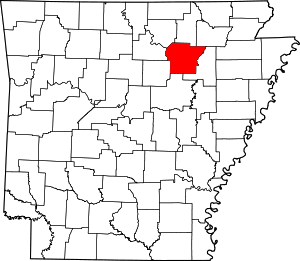 Map of Arkansas highlighting Independence County | |
| Towns | ||
| Unincorporated communities | ||
| Footnotes | ‡This populated place also has portions in an adjacent county or counties | |
| Authority control |
|
|---|