La Quinta Formation
The La Quinta Formation is a Jurassic geologic formation which crops out in the Cordillera de Mérida and Serranía del Perijá of western Venezuela and northeastern Colombia. The formation is also present in the subsurface of the Cesar-Ranchería and Maracaibo Basins. At its type locality near La Grita, Táchira, it consists of a basal dacitic tuff followed by interlayered sandstones, tuffs, siltstones and rare limestones.[1] Dinosaur remains including Laquintasaura,[2] and Tachiraptor, are among the fossils that have been recovered from the formation.[3]
| La Quinta Formation Stratigraphic range: Hettangian 201.46–200.36 Ma | |
|---|---|
 | |
| Type | Geological formation |
| Underlies | Río Negro Formation |
| Overlies | Mucuchachi Formation |
| Thickness | up to 11,000 ft (3,400 m) |
| Lithology | |
| Primary | Sandstone |
| Other | Tuff, conglomerate |
| Location | |
| Coordinates | 8.15°N 72.02°W |
| Approximate paleocoordinates | 0.1°N 42.7°W |
| Region | Cesar-Ranchería & Maracaibo Basins Serranía del Perijá & Cordillera de Mérida |
| Country | |
| Type section | |
| Named for | La Quinta quarry |
.jpg) La Quinta Formation (Venezuela) | |
Fossil associations suggested that the La Quinta Formation was of Early to Middle Jurassic age,[4] while a more recent estimate based on U–Pb zircon analysis demonstrates that the bonebed has a maximum depositional age of 200.91+0.55 Ma.[5]
Regional correlations
| Ma | Age | Paleomap | Regional events | Catatumbo | Cordillera | proximal Llanos | distal Llanos | Putumayo | VSM | Environments | Maximum thickness | Petroleum geology | Notes |
|---|---|---|---|---|---|---|---|---|---|---|---|---|---|
| 0.01 | Holocene | 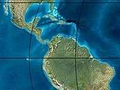 | Holocene volcanism Seismic activity | alluvium | Overburden | ||||||||
| 1 | Pleistocene | 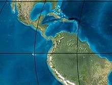 | Pleistocene volcanism Andean orogeny 3 Glaciations | Guayabo | Soatá Sabana | Necesidad | Guayabo | Gigante Neiva | Alluvial to fluvial (Guayabo) | 550 m (1,800 ft) (Guayabo) | [6][7][8][9] | ||
| 2.6 | Pliocene | 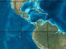 | Pliocene volcanism Andean orogeny 3 GABI | Subachoque | |||||||||
| 5.3 | Messinian | Andean orogeny 3 Foreland | Marichuela | Caimán | Honda | [8][10] | |||||||
| 13.5 | Langhian | Regional flooding | León | hiatus | Caja | León | Lacustrine (León) | 400 m (1,300 ft) (León) | Seal | [9][11] | |||
| 16.2 | Burdigalian | Miocene inundations Andean orogeny 2 | C1 | Carbonera C1 | Ospina | Proximal fluvio-deltaic (C1) | 850 m (2,790 ft) (Carbonera) | Reservoir | [10][9] | ||||
| 17.3 | C2 | Carbonera C2 | Distal lacustrine-deltaic (C2) | Seal | |||||||||
| 19 | C3 | Carbonera C3 | Proximal fluvio-deltaic (C3) | Reservoir | |||||||||
| 21 | Early Miocene | Pebas wetlands | C4 | Carbonera C4 | Barzalosa | Distal fluvio-deltaic (C4) | Seal | ||||||
| 23 | Late Oligocene | 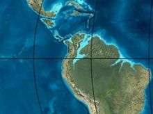 | Andean orogeny 1 Foredeep | C5 | Carbonera C5 | Orito | Proximal fluvio-deltaic (C5) | Reservoir | [7][10] | ||||
| 25 | C6 | Carbonera C6 | Distal fluvio-lacustrine (C6) | Seal | |||||||||
| 28 | Early Oligocene | C7 | C7 | Pepino | Gualanday | Proximal deltaic-marine (C7) | Reservoir | [7][10][12] | |||||
| 32 | Oligo-Eocene | C8 | Usme | C8 | onlap | Marine-deltaic (C8) | Seal Source | [12] | |||||
| 35 | Late Eocene | 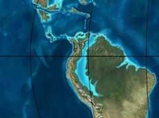 | Mirador | Mirador | Coastal (Mirador) | 240 m (790 ft) (Mirador) | Reservoir | [9][13] | |||||
| 40 | Middle Eocene | Regadera | hiatus | ||||||||||
| 45 | |||||||||||||
| 50 | Early Eocene |  | Socha | Los Cuervos | Deltaic (Los Cuervos) | 260 m (850 ft) (Los Cuervos) | Seal Source | [9][13] | |||||
| 55 | Late Paleocene | PETM 2000 ppm CO2 | Los Cuervos | Bogotá | Gualanday | ||||||||
| 60 | Early Paleocene | SALMA | Barco | Guaduas | Barco | Rumiyaco | Fluvial (Barco) | 225 m (738 ft) (Barco) | Reservoir | [6][7][10][9][14] | |||
| 65 | Maastrichtian |  | KT extinction | Catatumbo | Guadalupe | Monserrate | Deltaic-fluvial (Guadalupe) | 750 m (2,460 ft) (Guadalupe) | Reservoir | [6][9] | |||
| 72 | Campanian | End of rifting | Colón-Mito Juan | [9][15] | |||||||||
| 83 | Santonian | Villeta/Güagüaquí | |||||||||||
| 86 | Coniacian | ||||||||||||
| 89 | Turonian | Cenomanian-Turonian anoxic event | La Luna | Chipaque | Gachetá | hiatus | Restricted marine (all) | 500 m (1,600 ft) (Gachetá) | Source | [6][9][16] | |||
| 93 | Cenomanian |  | Rift 2 | ||||||||||
| 100 | Albian | Une | Une | Caballos | Deltaic (Une) | 500 m (1,600 ft) (Une) | Reservoir | [10][16] | |||||
| 113 | Aptian |  | Capacho | Fómeque | Motema | Yaví | Open marine (Fómeque) | 800 m (2,600 ft) (Fómeque) | Source (Fóm) | [7][9][17] | |||
| 125 | Barremian | High biodiversity | Aguardiente | Paja | Shallow to open marine (Paja) | 940 m (3,080 ft) (Paja) | Reservoir | [6] | |||||
| 129 | Hauterivian |  | Rift 1 | Tibú- Mercedes | Las Juntas | hiatus | Deltaic (Las Juntas) | 910 m (2,990 ft) (Las Juntas) | Reservoir (LJun) | [6] | |||
| 133 | Valanginian | Río Negro | Cáqueza Macanal Rosablanca | Restricted marine (Macanal) | 2,935 m (9,629 ft) (Macanal) | Source (Mac) | [7][18] | ||||||
| 140 | Berriasian | Girón | |||||||||||
| 145 | Tithonian | Break-up of Pangea | Jordán | Arcabuco | Buenavista Batá | Saldaña | Alluvial, fluvial (Buenavista) | 110 m (360 ft) (Buenavista) | "Jurassic" | [10][19] | |||
| 150 | Early-Mid Jurassic |  | Passive margin 2 | La Quinta | Montebel Noreán | hiatus | Coastal tuff (La Quinta) | 100 m (330 ft) (La Quinta) | [20] | ||||
| 201 | Late Triassic |  | Mucuchachi | Payandé | [10] | ||||||||
| 235 | Early Triassic |  | Pangea | hiatus | "Paleozoic" | ||||||||
| 250 | Permian | 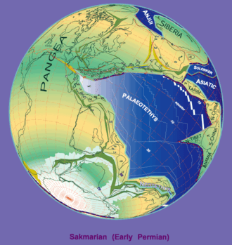 | |||||||||||
| 300 | Late Carboniferous |  | Famatinian orogeny | Cerro Neiva () | [21] | ||||||||
| 340 | Early Carboniferous | Fossil fish Romer's gap | Cuche (355-385) | Farallones () | Deltaic, estuarine (Cuche) | 900 m (3,000 ft) (Cuche) | |||||||
| 360 | Late Devonian |  | Passive margin 1 | Río Cachirí (360-419) | Ambicá () | Alluvial-fluvial-reef (Farallones) | 2,400 m (7,900 ft) (Farallones) | [18][22][23][24][25] | |||||
| 390 | Early Devonian |  | High biodiversity | Floresta (387-400) El Tíbet | Shallow marine (Floresta) | 600 m (2,000 ft) (Floresta) | |||||||
| 410 | Late Silurian | Silurian mystery | |||||||||||
| 425 | Early Silurian | hiatus | |||||||||||
| 440 | Late Ordovician |  | Rich fauna in Bolivia | San Pedro (450-490) | Duda () | ||||||||
| 470 | Early Ordovician | First fossils | Busbanzá (>470±22) Chuscales Otengá | Guape () | Río Nevado () | Hígado () | [26][27][28] | ||||||
| 488 | Late Cambrian |  | Regional intrusions | Chicamocha (490-515) | Quetame () | Ariarí () | SJ del Guaviare (490-590) | San Isidro () | [29][30] | ||||
| 515 | Early Cambrian | Cambrian explosion | [28][31] | ||||||||||
| 542 | Ediacaran |  | Break-up of Rodinia | pre-Quetame | post-Parguaza | El Barro () | Yellow: allochthonous basement (Chibcha Terrane) Green: autochthonous basement (Río Negro-Juruena Province) | Basement | [32][33] | ||||
| 600 | Neoproterozoic | 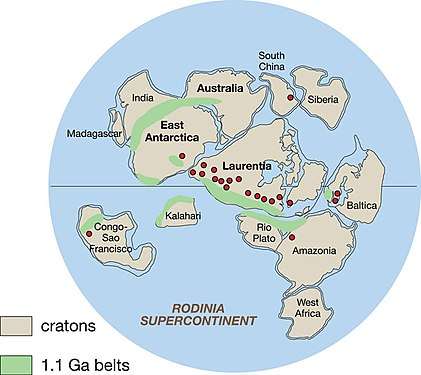 | Cariri Velhos orogeny | Bucaramanga (600-1400) | pre-Guaviare | [29] | |||||||
| 800 |  | Snowball Earth | [34] | ||||||||||
| 1000 | Mesoproterozoic |  | Sunsás orogeny | Ariarí (1000) | La Urraca (1030-1100) | [35][36][37][38] | |||||||
| 1300 | Rondônia-Juruá orogeny | pre-Ariarí | Parguaza (1300-1400) | Garzón (1180-1550) | [39] | ||||||||
| 1400 |  | pre-Bucaramanga | [40] | ||||||||||
| 1600 | Paleoproterozoic | Maimachi (1500-1700) | pre-Garzón | [41] | |||||||||
| 1800 |  | Tapajós orogeny | Mitú (1800) | [39][41] | |||||||||
| 1950 | Transamazonic orogeny | pre-Mitú | [39] | ||||||||||
| 2200 | Columbia | ||||||||||||
| 2530 | Archean |  | Carajas-Imataca orogeny | [39] | |||||||||
| 3100 | Kenorland | ||||||||||||
| Sources | |||||||||||||
- Legend
- group
- important formation
- fossiliferous formation
- minor formation
- (age in Ma)
- proximal Llanos (Medina)[note 1]
- distal Llanos (Saltarin 1A well)[note 2]
See also
- List of dinosaur-bearing rock formations
Notes
References
- Barret et al., 2008, p.164
- Barret et al., 2014
- Weishampel, et al. (2004). "Dinosaur distribution." Pp. 517-607
- Barret et al., 2008, p.175
- La Quinta quarry at Fossilworks.org
- García González et al., 2009, p.27
- García González et al., 2009, p.50
- García González et al., 2009, p.85
- Barrero et al., 2007, p.60
- Barrero et al., 2007, p.58
- Plancha 111, 2001, p.29
- Plancha 177, 2015, p.39
- Plancha 111, 2001, p.26
- Plancha 111, 2001, p.24
- Plancha 111, 2001, p.23
- Pulido & Gómez, 2001, p.32
- Pulido & Gómez, 2001, p.30
- Pulido & Gómez, 2001, pp.21-26
- Pulido & Gómez, 2001, p.28
- Correa Martínez et al., 2019, p.49
- Plancha 303, 2002, p.27
- Terraza et al., 2008, p.22
- Plancha 229, 2015, pp.46-55
- Plancha 303, 2002, p.26
- Moreno Sánchez et al., 2009, p.53
- Mantilla Figueroa et al., 2015, p.43
- Manosalva Sánchez et al., 2017, p.84
- Plancha 303, 2002, p.24
- Mantilla Figueroa et al., 2015, p.42
- Arango Mejía et al., 2012, p.25
- Plancha 350, 2011, p.49
- Pulido & Gómez, 2001, pp.17-21
- Plancha 111, 2001, p.13
- Plancha 303, 2002, p.23
- Plancha 348, 2015, p.38
- Planchas 367-414, 2003, p.35
- Toro Toro et al., 2014, p.22
- Plancha 303, 2002, p.21
- Bonilla et al., 2016, p.19
- Gómez Tapias et al., 2015, p.209
- Bonilla et al., 2016, p.22
- Duarte et al., 2019
- García González et al., 2009
- Pulido & Gómez, 2001
- García González et al., 2009, p.60
Bibliography
- Barrett, Paul M.; Richard J. Butler; Roland Mundil; Torsten M. Scheyer; Randall B. Irmis, and Marcelo R. Sánchez-Villagra. 2014. A palaeoequatorial ornithischian and new constraints on early dinosaur diversification. Proceedings of the Royal Society B 281. 1–7. Accessed 2018-08-18.
- Barrett, P. M., R. J. Butler, S. C. Moore-Fay, F. E. Novas, J. M. Moody, J. M. Clark, and M. R. Sänchez-Villagra. ‘Dinosaur Remains from the La Quinta Formation (Lower or Middle Jurassic) of the Venezuelan Andes’. Paläontologische Zeitschrift 82, no. 2 (2008): 163–177.
- Weishampel, David B.; Dodson, Peter; and Osmólska, Halszka (eds.): The Dinosauria, 2nd, Berkeley: University of California Press. 861 pp. ISBN 0-520-24209-2.
Maps
- Colmenares, Fabio; Milena Mesa; Jairo Roncancio; Edgar Arciniegas; Pablo Pedraza; Agustín Cardona; César Silva; Jhoamna Romero, and Sonia Alvarado and Oscar Romero, Felipe Vargas, Carlos Santamaría. 2007. Plancha 14 - Albania - 1:100,000, 1. INGEOMINAS. Accessed 2017-06-06.
- Colmenares, Fabio; Milena Mesa; Jairo Roncancio; Edgar Arciniegas; Pablo Pedraza; Agustín Cardona; César Silva; Jhoamna Romero, and Sonia Alvarado and Oscar Romero, Felipe Vargas, Carlos Santamaría. 2007. Plancha 21 - Fonseca - 1:100,000, 1. INGEOMINAS. Accessed 2017-06-06.
- Colmenares, Fabio; Milena Mesa; Jairo Roncancio; Edgar Arciniegas; Pablo Pedraza; Agustín Cardona; César Silva; Jhoamna Romero, and Sonia Alvarado and Oscar Romero, Felipe Vargas, Carlos Santamaría. 2007. Plancha 34 - Agustín Codazzi - 1:100,000, 1. INGEOMINAS. Accessed 2017-06-06.
- González, Javier; Jairo Clavijo; Marina Hernández, and Carlos García. 2002. Plancha 40 - Bosconia - 1:100,000, 1. INGEOMINAS. Accessed 2017-06-06.
- Hernández, Marina; Jairo Clavijo, and Javier González. 2001. Plancha 47 - Chiriguaná - 1:100,000, 1. INGEOMINAS. Accessed 2017-06-06.
- Hernández, Marina, and Jairo Clavijo. 2008. Plancha 48 - La Jagua de Ibirico - 1:100,000, 1. INGEOMINAS. Accessed 2017-06-06.