Judith Basin County, Montana
Judith Basin County is a county in the U.S. state of Montana. As of the 2010 United States Census, the population was 2,072.[1] Its county seat is the town of Stanford.[2]
Judith Basin County | |
|---|---|
 Judith Basin County Courthouse in Stanford | |
 Location within the U.S. state of Montana | |
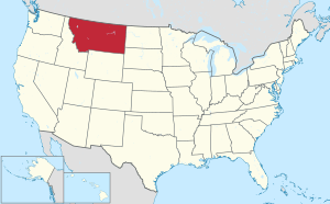 Montana's location within the U.S. | |
| Coordinates: 47°02′N 110°16′W | |
| Country | |
| State | |
| Founded | December 10, 1920 |
| Seat | Stanford |
| Largest town | Stanford |
| Area | |
| • Total | 1,871 sq mi (4,850 km2) |
| • Land | 1,870 sq mi (4,800 km2) |
| • Water | 0.8 sq mi (2 km2) 0.04% |
| Population (2010) | |
| • Total | 2,072 |
| • Estimate (2018) | 1,952 |
| • Density | 1.1/sq mi (0.43/km2) |
| Time zone | UTC−7 (Mountain) |
| • Summer (DST) | UTC−6 (MDT) |
| Congressional district | At-large |
| Website | www |
| |
History
Judith Basin County was formed of area taken from western Fergus County, Montana and eastern Cascade County, Montana on December 10, 1920.[3][4] In 1895, Yogo sapphires were discovered at Yogo Gulch, about 15 miles southwest of Utica, which at the time was in Fergus County.
Geography
According to the US Census Bureau, the county has a total area of 1,871 square miles (4,850 km2), of which 1,870 square miles (4,800 km2) is land and 0.8 square miles (2.1 km2) (0.04%) is water.[5]
Adjacent counties
- Chouteau County – north
- Fergus County – east
- Wheatland County – south
- Meagher County – south
- Cascade County – west
National protected area
Politics
This small county strongly leans Republican; a Democrat has not won this county since Lyndon Johnson's landslide win in 1964.
| Year | Republican | Democratic | Third parties |
|---|---|---|---|
| 2016 | 72.2% 872 | 19.5% 235 | 8.4% 101 |
| 2012 | 70.3% 854 | 27.7% 337 | 2.0% 24 |
| 2008 | 64.8% 801 | 32.1% 397 | 3.1% 38 |
| 2004 | 73.4% 944 | 25.0% 322 | 1.6% 20 |
| 2000 | 75.8% 1,057 | 19.9% 278 | 4.2% 59 |
| 1996 | 56.3% 753 | 33.8% 452 | 9.9% 133 |
| 1992 | 42.2% 610 | 28.3% 409 | 29.6% 428 |
| 1988 | 59.5% 902 | 38.9% 590 | 1.6% 24 |
| 1984 | 67.7% 1,050 | 31.2% 483 | 1.1% 17 |
| 1980 | 63.3% 1,030 | 29.5% 480 | 7.2% 117 |
| 1976 | 50.1% 809 | 47.8% 772 | 2.0% 33 |
| 1972 | 59.5% 961 | 34.5% 557 | 6.0% 96 |
| 1968 | 53.0% 804 | 40.0% 606 | 7.0% 106 |
| 1964 | 45.1% 678 | 54.7% 822 | 0.1% 2 |
| 1960 | 46.1% 721 | 53.8% 842 | 0.1% 1 |
| 1956 | 48.2% 789 | 51.8% 848 | 0.0% 0 |
| 1952 | 58.0% 1,074 | 40.3% 746 | 1.8% 33 |
| 1948 | 36.6% 609 | 56.2% 934 | 7.2% 119 |
| 1944 | 39.6% 691 | 60.1% 1,049 | 0.4% 7 |
| 1940 | 35.0% 670 | 63.5% 1,215 | 1.5% 28 |
| 1936 | 28.9% 645 | 68.8% 1,534 | 2.3% 52 |
| 1932 | 33.8% 720 | 60.1% 1,280 | 6.2% 131 |
| 1928 | 56.8% 1,342 | 41.4% 978 | 1.9% 44 |
| 1924 | 41.3% 888 | 22.4% 480 | 36.3% 780 |
Demographics
| Historical population | |||
|---|---|---|---|
| Census | Pop. | %± | |
| 1930 | 5,238 | — | |
| 1940 | 3,655 | −30.2% | |
| 1950 | 3,200 | −12.4% | |
| 1960 | 3,085 | −3.6% | |
| 1970 | 2,667 | −13.5% | |
| 1980 | 2,646 | −0.8% | |
| 1990 | 2,282 | −13.8% | |
| 2000 | 2,329 | 2.1% | |
| 2010 | 2,072 | −11.0% | |
| Est. 2018 | 1,952 | [7] | −5.8% |
| US Decennial Census[8] 1790-1960[9] 1900-1990[10] 1990-2000[11] 2010-2018[1] | |||
2000 census
As of the 2000 United States Census,[12] there were 2,329 people, 951 households, and 661 families living in the county. The population density was <1/km² (1/sq mi). There were 1,325 housing units at an average density of <1/km² (1/sq mi). The racial makeup of the county was 98.63% White, 0.04% Black or African American, 0.34% Native American, 0.09% Asian, 0.04% from other races, and 0.86% from two or more races. 0.56% of the population were Hispanic or Latino of any race. 27.1% were of German, 11.3% Norwegian, 10.0% Irish, 9.8% English and 8.7% American ancestry. 92.0% spoke English and 7.5% German as their first language. Many of the German-speaking residents of Judith Basin County are Hutterites.
There were 951 households out of which 30.00% had children under the age of 18 living with them, 62.70% were married couples living together, 4.30% had a female householder with no husband present, and 30.40% were non-families. 27.50% of all households were made up of individuals and 12.30% had someone living alone who was 65 years of age or older. The average household size was 2.45 and the average family size was 3.02.
the county population contained 26.80% under the age of 18, 4.60% from 18 to 24, 23.30% from 25 to 44, 28.20% from 45 to 64, and 17.20% who were 65 years of age or older. The median age was 42 years. For every 100 females there were 107.90 males. For every 100 females age 18 and over, there were 103.90 males.
The median income for a household in the county was $29,241, and the median income for a family was $34,243. Males had a median income of $21,789 versus $14,615 for females. The per capita income for the county was $14,291. About 16.30% of families and 21.10% of the population were below the poverty line, including 30.60% of those under age 18 and 13.30% of those age 65 or over.
2010 census
As of the 2010 United States Census, there were 2,072 people, 924 households, and 600 families living in the county.[13] The population density was 1.1 inhabitants per square mile (0.42/km2). There were 1,336 housing units at an average density of 0.7 per square mile (0.27/km2).[14] The racial makeup of the county was 98.3% white, 0.8% American Indian, 0.1% Asian, 0.1% from other races, and 0.7% from two or more races. Those of Hispanic or Latino origin made up 1.2% of the population.[13] In terms of ancestry, 30.9% were German, 16.7% were English, 16.1% were Irish, 10.3% were Norwegian, 6.7% were Czech, 5.0% were Danish, and 1.7% were American.[15]
Of the 924 households, 24.0% had children under the age of 18 living with them, 55.7% were married couples living together, 5.2% had a female householder with no husband present, 35.1% were non-families, and 30.3% of all households were made up of individuals. The average household size was 2.24 and the average family size was 2.80. The median age was 48.3 years.[13]
The median income for a household in the county was $41,473 and the median income for a family was $54,479. Males had a median income of $36,295 versus $29,750 for females. The per capita income for the county was $24,029. About 6.4% of families and 9.9% of the population were below the poverty line, including 8.9% of those under age 18 and 9.0% of those age 65 or over.[16]
Communities
City
Town
- Stanford (county seat)
Census-designated place
Unincorporated communities
Ghost town
See also
- List of cemeteries in Judith Basin County, Montana
- List of lakes in Judith Basin County, Montana
- List of mountains in Judith Basin County, Montana
- National Register of Historic Places listings in Judith Basin County, Montana
References
- "State & County QuickFacts". US Census Bureau. Archived from the original on June 6, 2011. Retrieved September 15, 2013.
- "Find a County". National Association of Counties. Archived from the original on May 31, 2011. Retrieved June 7, 2011.
- "Descriptions – County Boundaries" (PDF). Montana Legislature. p. 22. Retrieved November 5, 2011.
- "Montana Highway Map" (PDF). Montana Natural Resource Information System. Retrieved November 5, 2011.
- "2010 Census Gazetteer Files". US Census Bureau. August 22, 2012. Archived from the original on December 5, 2014. Retrieved November 28, 2014.
- Leip, David. "Atlas of US Presidential Elections". uselectionatlas.org. Retrieved April 3, 2018.
- "Population and Housing Unit Estimates". Retrieved August 6, 2019.
- "US Decennial Census". US Census Bureau. Retrieved November 28, 2014.
- "Historical Census Browser". University of Virginia Library. Retrieved November 28, 2014.
- "Population of Counties by Decennial Census: 1900 to 1990". US Census Bureau. Retrieved November 28, 2014.
- "Census 2000 PHC-T-4. Ranking Tables for Counties: 1990 and 2000" (PDF). US Census Bureau. Retrieved November 28, 2014.
- "U.S. Census website". US Census Bureau. Retrieved January 31, 2008.
- "Profile of General Population and Housing Characteristics: 2010 Demographic Profile Data". US Census Bureau. Archived from the original on February 13, 2020. Retrieved January 10, 2016.
- "Population, Housing Units, Area, and Density: 2010 - County". US Census Bureau]]. Archived from the original on February 13, 2020. Retrieved January 10, 2016.
- "Selected Social Characteristics in the US – 2006-2010 American Community Survey 5-Year Estimates". US Census Bureau. Archived from the original on February 13, 2020. Retrieved January 10, 2016.
- "Selected Economic Characteristics – 2006-2010 American Community Survey 5-Year Estimates". US Census Bureau. Archived from the original on February 13, 2020. Retrieved January 10, 2016.
- Hughesville MT Google Maps (accessed 2 January 2019)
- Kolin, Judith Basin County MT Google Maps (accessed 2 January 2019)
- Sapphire Village MT Google Maps (accessed 2 January 2019)
- Sipple MT Google Maps (accessed 2 January 2019)
- Spion Kop MT Google Maps (accessed 2 January 2019)
- Surprise Creek Colony MT Google Maps (accessed 2 January 2019)
- Windham, Judith Basin County MT Google Maps (accessed 2 January 2019)
External links
Places adjacent to Judith Basin County, Montana | ||||||||||
|---|---|---|---|---|---|---|---|---|---|---|
| ||||||||||
Municipalities and communities of Judith Basin County, Montana, United States | ||
|---|---|---|
| City | Judith Basin County map | |
| Town | ||
| CDP | ||
| Other unincorporated communities | ||
| Ghost town | ||
| Authority control |
|
|---|