Jefferson, Georgia
Jefferson is a city in Jackson County, Georgia, United States. The population was 9,432 at the 2010 census,[5] up from 3,825 at the 2000 census. As of 2019 the estimated population was 12,032.[2] The city is the county seat of Jackson County.[6]
Jefferson, Georgia | |
|---|---|
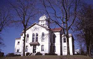 Jackson County Courthouse in Jefferson | |
Seal | |
 Location in Jackson County and the state of Georgia | |
| Coordinates: 34°7′36″N 83°35′25″W | |
| Country | United States |
| State | Georgia |
| County | Jackson |
| Named for | Thomas Jefferson |
| Government | |
| • Type | Local government |
| • Mayor | Steve Quinn |
| • City manager | Priscilla Murphy |
| • City council | Steve Kinney (D1) Malcolm "Mac" Gramley (D2) Jon Howell (D3) Mark Mobley (D4) Don Kupis (D5) |
| Area | |
| • Total | 22.80 sq mi (59.06 km2) |
| • Land | 22.47 sq mi (58.19 km2) |
| • Water | 0.34 sq mi (0.87 km2) |
| Elevation | 751 ft (229 m) |
| Population (2010) | |
| • Total | 9,432 |
| • Estimate (2019)[2] | 12,032 |
| • Density | 535.54/sq mi (206.77/km2) |
| Time zone | UTC-5 (Eastern (EST)) |
| • Summer (DST) | UTC-4 (EDT) |
| ZIP code | 30549 |
| Area code(s) | 706 |
| FIPS code | 13-41988[3] |
| GNIS feature ID | 0356332[4] |
| Website | www |
History
Jefferson was founded in 1800. That same year, the seat of Jackson County was transferred to Jefferson from Clarkesboro. Jefferson was incorporated as a town in 1806 and as a city in 1896.[7] The city was named after Thomas Jefferson.[8]
Geography

Jefferson is located in central Jackson County at 34°7′36″N 83°35′25″W (34.126736, -83.590297).[9] It is bordered to the northwest by Pendergrass and to the southeast by Arcade. U.S. Route 129 passes through the southwest side of the city, leading northwest 21 miles (34 km) to Gainesville and southeast 19 miles (31 km) to Athens. Interstate 85 runs through the northern end of Jefferson, 5 miles (8 km) northwest of the center of town, with access from Exits 137 and 140. I-85 leads southwest 55 miles (89 km) to Atlanta and northeast 90 miles (140 km) to Greenville, South Carolina.
According to the United States Census Bureau, Jefferson has a total area of 22.0 square miles (57.0 km2), of which 21.7 square miles (56.1 km2) are land and 0.3 square miles (0.9 km2), or 1.53%, are water.[5] Curry Creek, a tributary of the North Oconee River, flows just to the east of downtown, and the Middle Oconee River runs along the western edge of the city.
Demographics

| Historical population | |||
|---|---|---|---|
| Census | Pop. | %± | |
| 1880 | 419 | — | |
| 1890 | 540 | 28.9% | |
| 1900 | 726 | 34.4% | |
| 1910 | 1,207 | 66.3% | |
| 1920 | 1,626 | 34.7% | |
| 1930 | 1,869 | 14.9% | |
| 1940 | 1,839 | −1.6% | |
| 1950 | 2,040 | 10.9% | |
| 1960 | 1,746 | −14.4% | |
| 1970 | 1,647 | −5.7% | |
| 1980 | 1,820 | 10.5% | |
| 1990 | 2,763 | 51.8% | |
| 2000 | 3,825 | 38.4% | |
| 2010 | 9,432 | 146.6% | |
| Est. 2019 | 12,032 | [2] | 27.6% |
| U.S. Decennial Census[10] | |||
As of the census of 2010, there were 9,432 people, 3,328 households, and 2,531 families residing in the city. There were 3,666 housing units, of which 338, or 9.2%, were vacant. The racial makeup of the city was 83.1% white, 10.0% African American, 0.3% Native American, 1.6% Asian, 0.1% Native Hawaiian or Pacific Islander, 3.2% some other race, and 1.8% from two or more races. 7.5% of the population were Hispanic or Latino of any race.[11]
Of the 3,328 households, 46.6% had children under the age of 18 living with them, 59.3% were headed by married couples living together, 12.8% had a female householder with no husband present, and 23.9% were non-families. 20.4% of all households were made up of individuals, and 9.4% were someone living alone who was 65 years of age or older. The average household size was 2.83, and the average family size was 3.28.[11]
In the city, 30.9% of the population were under the age of 18, 6.9% were from 18 to 24, 30.5% from 25 to 44, 20.2% from 45 to 64, and 11.4% were 65 years of age or older. The median age was 33.4 years. For every 100 females, there were 93.0 males. For every 100 females age 18 and over, there were 86.7 males.[11]
For the period 2012–2016, the estimated median annual income for a household was $51,419, and the median income for a family was $58,683. The per capita income for the city was $24,376. Male full-time workers had a median income of $49,832, versus $33,567 for females. 12.5% of the population and 11.7% of families were below the poverty line. 8.5% of the population under the age of 18 and 17.3% of those 65 or older were living in poverty.[12]
Education
Jackson County School District

The Jackson County School District holds pre-school to grade twelve, and consists of eight elementary schools, three middle schools, two high schools, and an alternative school.[13] The district has 345 full-time teachers and over 5,472 students.[14]
- Benton Elementary School
- East Jackson Elementary School
- Gum Springs Elementary School
- Maysville Elementary School
- North Jackson Elementary School
- South Jackson Elementary School
- West Jackson Intermediate School
- West Jackson Primary School
- East Jackson Middle School
- Kings Bridge Middle School
- West Jackson Middle School
- East Jackson Comprehensive High School
- Jackson County Comprehensive High School
- Regional Evening Alternative School
Jefferson City School District
The Jefferson City School District holds kindergarten to grade twelve, and consists of two elementary schools, a middle school, and a high school.[15] The district has 115 full-time teachers and over 1,525 students.[16]
- Jefferson Elementary School
- Jefferson Academy
- Jefferson Middle School
- Jefferson High School
Martin Institute
The Martin Institute was a school in Jefferson, Georgia, from 1818 to 1942.
Notable people
- Chris Beck, pitcher for New York Mets
- Damon Jesse Gause, war hero
- Brantley Gilbert, country music singer, songwriter
- Crawford W. Long, physician who first used ether for surgical anesthesia
- Brandon Mosley, former Auburn University and former New York Giants offensive lineman
- Corey Smith, country music singer, songwriter
References
- "2019 U.S. Gazetteer Files". United States Census Bureau. Retrieved July 9, 2020.
- "Population and Housing Unit Estimates". Retrieved May 21, 2020.
- "U.S. Census website". United States Census Bureau. Retrieved 2008-01-31.
- "US Board on Geographic Names". United States Geological Survey. 2007-10-25. Retrieved 2008-01-31.
- "Geographic Identifiers: 2010 Census Summary File 1 (G001): Jefferson city, Georgia". American Factfinder. U.S. Census Bureau. Archived from the original on February 13, 2020. Retrieved May 2, 2018.
- "Find a County". National Association of Counties. Archived from the original on 2011-05-31. Retrieved 2011-06-07.
- Hellmann, Paul T. (May 13, 2013). Historical Gazetteer of the United States. Routledge. p. 234. Retrieved 30 November 2013.
- Krakow, Kenneth K. (1975). Georgia Place-Names: Their History and Origins (PDF). Macon, GA: Winship Press. p. 119. ISBN 0-915430-00-2.
- "US Gazetteer files: 2010, 2000, and 1990". United States Census Bureau. 2011-02-12. Retrieved 2011-04-23.
- "Census of Population and Housing". Census.gov. Retrieved June 4, 2015.
- "Profile of General Population and Housing Characteristics: 2010 Census Summary File 1 (DP-1): Jefferson city, Georgia". American Factfinder. U.S. Census Bureau. Archived from the original on February 13, 2020. Retrieved May 2, 2018.
- "Selected Economic Characteristics: 2012-2016 American Community Survey 5-Year Estimates (DP03): Jefferson city, Georgia". American Factfinder. U.S. Census Bureau. Archived from the original on February 13, 2020. Retrieved May 2, 2018.
- Georgia Board of Education, Retrieved 21 April 2012.
- School Stats, Retrieved June 5, 2010.
- Georgia Board of Education, Retrieved 21 April 2012.
- School Stats, Retrieved June 5, 2010.
External links
- City of Jefferson official website
- The Jackson Herald, local newspaper
- Builder of the Nation historical marker
Municipalities and communities of Jackson County, Georgia, United States | ||
|---|---|---|
| Cities | 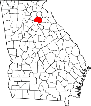 Map of Georgia highlighting Jackson County | |
| Towns | ||
| Unincorporated communities | ||
| Footnotes | ‡This populated place also has portions in an adjacent county or counties | |
| Authority control |
|---|