Hovde Glacier
Hovde Glacier (69°15′S 76°55′E) is a small glacier just west of the Brattstrand Bluffs, and east of Amanda Bay, on the south-eastern shore of Prydz Bay, Antarctica. A short tongue from this glacier extends seaward to nearby Hovde Island. The glacier was first mapped by the Lars Christensen Expedition, 1936–37, which named the island. It was named "Hovde Ice Tongue" by John H. Roscoe in 1952 following his study of aerial photographs of the area taken by U.S. Navy Operation Highjump, 1946–47, but the term glacier is considered appropriate to this small feature.[1]
| Hovde Glacier | |
|---|---|
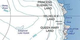 Location of Princess Elizabeth Land | |
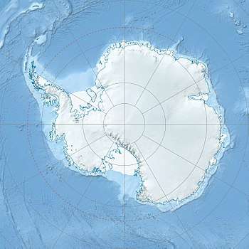 Location of Hovde Glacier in Antarctica | |
| Location | Princess Elizabeth Land |
| Coordinates | 69°15′S 76°55′E |
| Thickness | unknown |
| Terminus | Prydz Bay |
| Status | unknown |
References
- "Hovde Glacier". Geographic Names Information System. United States Geological Survey. Retrieved 2012-06-29.

| Types |
| ||||||
|---|---|---|---|---|---|---|---|
| Anatomy |
| ||||||
| Processes | |||||||
| Measurements | |||||||
| Volcanic relations | |||||||
| Landforms |
| ||||||
| |||||||
Glaciers of Princess Elizabeth Land | |
|---|---|
This article is issued from Wikipedia. The text is licensed under Creative Commons - Attribution - Sharealike. Additional terms may apply for the media files.