Dålk Glacier
Dålk Glacier (69°26′S 76°27′E) is a glacier, 8 nautical miles (15 km) long, draining into the southeast part of Prydz Bay between the Larsemann Hills and Steinnes. It was mapped by Norwegian cartographers from air photos taken by the Lars Christensen Expedition (1936–37), and named by John H. Roscoe in his 1952 study of features in the area as identified in air photos taken by U.S. Navy Operation Highjump (1946–47). It was named after Dålk Island lying at the terminus of the glacier.[1]
| Dålk Glacier | |
|---|---|
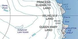 Location of Princess Elizabeth Land | |
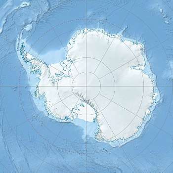 Location of Dålk Glacier in Antarctica | |
| Location | Princess Elizabeth Land |
| Coordinates | 69°26′S 76°27′E |
| Length | 8 nmi (15 km; 9 mi) |
| Thickness | unknown |
| Terminus | Prydz Bay |
| Status | unknown |
References
- "Dålk Glacier". Geographic Names Information System. United States Geological Survey. Retrieved 2011-12-13.
![]()
Glaciers of Princess Elizabeth Land | |
|---|---|
This article is issued from Wikipedia. The text is licensed under Creative Commons - Attribution - Sharealike. Additional terms may apply for the media files.