Hora Svaté Kateřiny
Hora Svaté Kateřiny (German: Sankt Katharinaberg) is a town in Most District in the Ústí nad Labem Region of the Czech Republic with a population of 453 (as of 1 January 2016).
Hora Svaté Kateřiny | |
|---|---|
Town | |
 Town square with school and Marian and Holy Trinity column | |
 Flag  Coat of arms | |
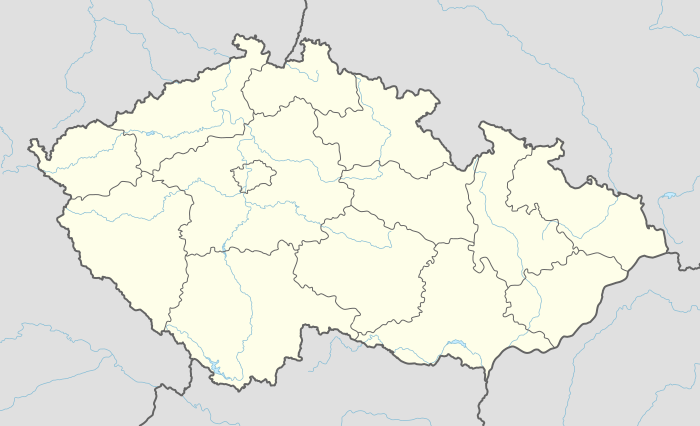
 Location in Most District | |
 Hora Svaté Kateřiny Location in the Czech Republic | |
| Coordinates: 50°35′45″N 13°26′17″E | |
| Country | |
| Region | Ústí nad Labem |
| District | Most |
| Area | |
| • Total | 18.45 km2 (7.12 sq mi) |
| Elevation | 645 m (2,116 ft) |
| Population (2016) | |
| • Total | 453 |
| • Density | 25/km2 (64/sq mi) |
| Postal code | 435 46 |
| Website | http://www.horasvatekateriny.cz/ |
Geography
Hora Svaté Kateřiny is located approximately 18 kilometres (11 mi) north-west of Most, 44 km (27 mi) west of Ústí nad Labem, and 90 km (56 mi) north-west of Prague, next to the border between the Czech Republic and Germany. It covers an area of 18.46 square kilometres (7.13 sq mi),[1] which includes the municipal districts of Malý Háj (Kleinhan) (449.3 ha) und Rudolice v Horách (Rudelsdorf) (665.5 ha).[2] Together with Hora Svaté Kateřiny proper (629.6 ha) and Svahová I (101.5 ha), these form the four basic settlements and cadastre districts in the town.[3] The small settlement of Pachenkov (Pachenhäuser) is also part of the town.
The stream Kateřinsky potok, a left tributary of Schweinitz, passes through the community area, and the southern boundary of the community follows approximately the stream Telčsky potok, a right tributary of Natzschung. Neighbouring communities are (clockwise from the north): Deutschneudorf in Saxony, Nová Ves v Horách, Boleboř, Kalek, and Brandov. The highest elevation in the community area is Eduardova skala (910 m a. s. l.) on the border to Boleboř community, followed by Kamenny vrch (842 m) near the border to Brandov community, and Růžový vrch at the eastern end of Hora Svaté Kateřiny proper.
The community is only accessed by secondary roads, chiefly road No. 25220 between the Czech-German border near Olbernhau and Boleboř, No. 25219 between Hora Svaté Kateřiny and Mikulovice (a district of Nová Ves v Horách), and No. 25218 connecting the two. A border crossing on a bridge across Schweinitz river connects the town with Deutschkatharinenberg, a part of Deutschneudorf.
History
The settlement was originally named Halleberg, which originated from the name Kupferhall for an old mine. It was first mentioned in 1443 as property of the Ileburg noble family residing in Rothenhaus, and passed in 1462 to Albrecht von Kompas. Lorenz Glatz of Altenhorst acquired the mines in 1473 and opened new ones as well as a smeltery. In 1516 his sister Anna, the wife of military leader and mining entrepreneur Sebastian von Weitmühl, inherited the property. Silver was struck in the 16th century, leading to a significant boom of the community which in 1528 was elevated to the status of a royal mining town. According to local tradition, the settlement was named after Catherine of Alexandria, a patron saint of the miners, St. Katharinaberg (also shortened to Katterberg) upon the discovery of silver deposits. Towards the end of the 16th century, the town passed into the hands of emperor Rudolf II. It had about 177 houses and up to 2500 inhabitants at this time.
Upon changing hands in 1605, the smelting works were closed and the copper ore brought to Grünthal near Olbernhay in Saxony for processing. The new owners hat little interest in continuing the mines, and overruled the privileges hitherto conceded to the mining towns and the miners. The inhabitants were burdened with socage despite the interventions of emperors Rudolf II and Ferdinand II. Instead of mining, the weaving of linen was taken up on a large scale. The evangelical church, which was begun in 1607 and consecrated in 1611, passed in the course of Counter-Reformation, upon compulsory conversion of the populace to Catholicism in 1627, to the patronage of the Jesuits of Dux in 1632.
During the Thirty Years' War the town suffered from troops passing through or taking quarters there, who also carried away food and property, from famine and epidemies, and from robber gangs. Further epidemies in 1680 and emigration reduced the population by 55 families, and only 70 houses were still inhabited, while 65 lay in ruins. In the early 18th century, knitting supplemented the linen industry, and inhabitants of St. Katharinaberg also supplied the cloth manufacturers in Oberleutensdorf. Mining flourished again until the late 1760s, but ceased completely in 1786. During the Seven Years' War the town was raided 14 times by Prussian troops, with financial damages amounting to 21736 Gulden.
Agriculture had never been practiced in the town to any large extent, and animal husbandry and forestry provided little income. Thus, many families went to work in nearby Brandov or across the border in Saxony. In 1850, the town had become the seat of a judicial district, a notary's office, a post and telegraph office, a police station, and a customs office. In the 19th century, wood working was taken up on an industrial scale and prospered, so that in 1874 a vocational school for this sector was established in St. Katharinaberg, but moved to Oberleutensdorf five years later. A fire in 1904 destroyed 44 homes.
In 1933, the town had 1544 inhabitants, 65% of which were industry workers, 17% worked in commerce, 10% in agriculture, and 8% were public servants. 98% of the population were of German ethnicity. After World War II, the Germans were expelled, causing the municipality to be depopulated and to lose its town privileges. These were only restored on 2 April 2008. The main source of income is now tourism.
Plans to expand the nearby lignite surface mine threatened the continuity of road communications in the area, which lead the mayor, Lukas Pakosta, in 2015 to publicly consider joining the town to Germany. This caused a political controversy.[4]
The former mine Nicolai-Stollen is under consideration as a site to support the candidature of the Ore Mountain Mining Region for the title of a World Heritage Site.
Notable people
- Gerhard Grimmer, German cross-country skier
Sights and attractions

- Observation tower on Růžový vrch, built in 1902 and restored in 2002
- Monument to popular poet Anton Günther near the observation tower
- Baroque St. Catherine's church originally opened on 15 June 1556
- Marian and Holy Trinity column
- Sculpture of a Pietà
References
- Obec Hora Svaté Kateřiny: podrobné informace
- Části obcí. Obec Hora Svaté Kateřiny
- Katastrální území. Obec Hora Svaté Kateřiny
- "Czech Republic: Mining plan prompts secession debate". BBC. 27 January 2015.
- "Okres Most". Historický lexikon obcí České republiky - 1869-2015 (PDF) (in Czech). Český statistický úřad. 18 December 2015. Retrieved 5 January 2017.
- Hora Svaté Kateřiny, Malý Háj, Rudolice v Horách, and Svahová I combined
| Wikimedia Commons has media related to Hora Svaté Kateřiny. |