Holly Grove, Arkansas
Holly Grove is a city in Monroe County, Arkansas, United States. As of the 2010 census, the city population was 602.
Holly Grove, Arkansas | |
|---|---|
 Location of Holly Grove in Monroe County, Arkansas. | |
| Coordinates: 34°35′51″N 91°12′2″W | |
| Country | United States |
| State | Arkansas |
| County | Monroe |
| Area | |
| • Total | 1.03 sq mi (2.67 km2) |
| • Land | 1.01 sq mi (2.62 km2) |
| • Water | 0.02 sq mi (0.05 km2) |
| Elevation | 180 ft (55 m) |
| Population (2010) | |
| • Total | 602 |
| • Estimate (2019)[2] | 528 |
| • Density | 521.22/sq mi (201.34/km2) |
| Time zone | UTC-6 (Central (CST)) |
| • Summer (DST) | UTC-5 (CDT) |
| ZIP code | 72069 |
| Area code(s) | 870 |
| FIPS code | 05-32800 |
| GNIS feature ID | 0077202 |
Geography
Holly Grove is located at 34°35′51″N 91°12′2″W (34.597556, -91.200462).[3]
According to the United States Census Bureau, the city has a total area of 0.7 square miles (1.8 km2), of which 0.7 square miles (1.8 km2) is land and 0.04 square miles (0.10 km2) (2.78%) is water.
Demographics
| Historical population | |||
|---|---|---|---|
| Census | Pop. | %± | |
| 1880 | 161 | — | |
| 1890 | 353 | 119.3% | |
| 1900 | 391 | 10.8% | |
| 1910 | 536 | 37.1% | |
| 1920 | 977 | 82.3% | |
| 1930 | 741 | −24.2% | |
| 1940 | 755 | 1.9% | |
| 1950 | 761 | 0.8% | |
| 1960 | 672 | −11.7% | |
| 1970 | 840 | 25.0% | |
| 1980 | 754 | −10.2% | |
| 1990 | 675 | −10.5% | |
| 2000 | 722 | 7.0% | |
| 2010 | 602 | −16.6% | |
| Est. 2019 | 528 | [2] | −12.3% |
| U.S. Decennial Census[4] | |||
As of the census[5] of 2000, there were 722 people, 301 households, and 176 families residing in the city. The population density was 1,023.0 people per square mile (392.6/km2). There were 347 housing units at an average density of 491.7/sq mi (188.7/km2). The racial makeup of the city was 26.87% White, 72.58% Black or African American, 0.14% Asian, and 0.42% from two or more races. 0.14% of the population were Hispanic or Latino of any race.
There were 301 households, out of which 26.9% had children under the age of 18 living with them, 24.9% were married couples living together, 28.2% had a female householder with no husband present, and 41.2% were non-families. 37.9% of all households were made up of individuals, and 24.9% had someone living alone who was 65 years of age or older. The average household size was 2.40 and the average family size was 3.17.
In the city, the population was spread out, with 29.4% under the age of 18, 5.7% from 18 to 24, 23.1% from 25 to 44, 19.8% from 45 to 64, and 22.0% who were 65 years of age or older. The median age was 39 years. For every 100 females, there were 77.0 males. For every 100 females age 18 and over, there were 70.0 males.
The median income for a household in the city was $15,294, and the median income for a family was $17,232. Males had a median income of $24,444 versus $18,438 for females. The per capita income for the city was $10,047. About 37.7% of families and 42.6% of the population were below the poverty line, including 61.3% of those under age 18 and 31.2% of those age 65 or over.
Education
It is within the Clarendon School District. On July 1, 2004, the Holly Grove School District was merged into the Clarendon School District.[6]
References
- "2019 U.S. Gazetteer Files". United States Census Bureau. Retrieved June 30, 2020.
- "Population and Housing Unit Estimates". United States Census Bureau. May 24, 2020. Retrieved May 27, 2020.
- "US Gazetteer files: 2010, 2000, and 1990". United States Census Bureau. 2011-02-12. Retrieved 2011-04-23.
- "Census of Population and Housing". Census.gov. Retrieved June 4, 2015.
- "U.S. Census website". United States Census Bureau. Retrieved 2008-01-31.
- "Consolidation/Annexations of LEA's (1983-2010)." () Arkansas Department of Education. Retrieved on March 6, 2011.
Municipalities and communities of Monroe County, Arkansas, United States | ||
|---|---|---|
| Cities | 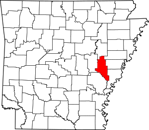 Map of Arkansas highlighting Monroe County | |
| Towns | ||
| Unincorporated communities | ||
| Footnotes | ‡This populated place also has portions in an adjacent county or counties | |