Highway M01 (Ukraine)
M01 is a Ukraine international highway (M-highway) that stretches from the state capital, Kiev, to the northern border with Belarus.[1]
| |
|---|---|
| Автошлях M01 | |
.png) | |
| Route information | |
| Length | 205.6 km (127.8 mi) 224.4 km (139.4 mi) with access roads |
| Length | 205.6 km (127.8 mi) 224.4 km (139.4 mi) with access roads |
| South end | (Kiev) |
| Major junctions | (Kipti) |
| North end | (Novi Yarylovychi) |
| Length | 91.0 km (56.5 mi) 96 km (59.7 mi) with access roads |
| South end | (Kiev) |
| North end | (Kipti) |
| Location | |
| Regions | Kiev City, Kiev Oblast, Chernihiv Oblast |
| Highway system | |
| Roads in Ukraine | |
Together with the M05 it is a part of the European routes E95 (Saint Petersburg – Kiev – Odessa … Samsun – Merzifon) and the Trans-European transportation corridor IX. Also together with the M02 it is part of E101 (Kiev – Moscow).[2]
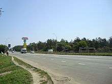
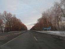
Route / Junctions
.jpg)
![]()
The intersection connects ![]()
![]()
![]()
![]()
![]()
![]()
![]()
![]()
![]()
| Highway M01 | |||
| Marker | Main settlements | Notes | Highway Interchanges |
|---|---|---|---|
| Kiev City | |||
| 0 km | Kiev | Brovarskyi prospect (follows) (Streets in Kiev) | |
| Kiev Oblast | |||
| 22 km | Brovary – Kalynivka | splits[lower-alpha 1] | P03 • T1026 • |
| Skybyn | northern side | T1034 | |
| Semypolky | southern side | T1004 | |
| Chernihiv Oblast | |||
| Kozelets | T2535 | ||
| Lemeshi | runs through | ||
| 91 km | Kipti | runs through | |
| Topchiyivka | Txxxx | ||
| 128 km | Chernihiv – Yahidne | splits[lower-alpha 2] | P67 • P56 • P69 • P12 • T2522 • T2506 |
| 164 km | Ripky | runs through | T2512 • T2537 |
| 206 km | Novi Yarylovychi | Belarus-Ukraine border | |
Repairs
Repairs to the highway in Ukraine have started in 2007 and are planned to be finished before UEFA Euro 2012.[3]
Notes
- city route (Kyivska vulytsia – Kalynivka) • detour route
- city route (prospekt Myru – Desna River – Kolychivka – Ivanivka) • detour route (Desna River – Kyinka – Trysviatska Sloboda – Koshivka)
References
- Ukraine International Highways in Russian
- European Highways in Russian
- Moscow-Kyiv highway sector to be launched by UEFA EURO 2012 Archived 2010-12-04 at the Wayback Machine, Radio Ukraine (December 24, 2009)
External links
- Highways in Ukraine — Автодороги Украины.(russian lang.) Information about highways, motorways, regional roads in Ukraine.
- International Roads in Ukraine in Russian
- European Roads in Russian
- List of automobile roads, Declaration of the Cabinet of Ministers of Ukraine
| E-roads in Ukraine | ||
|---|---|---|
| International | ||
| National | ||
| Regional |
| |
| ||