Farringdon, Sunderland
Farringdon is a suburb of Sunderland, Tyne and Wear, England. Originally a manor estate for hundreds of years, Farringdon was rebuilt as a post-war council housing estate in the 1950s. It is approximately 3 miles south of the city centre along the A690, close to Thorney Close, Silksworth, East Herrington, Gilley Law and Doxford Park.
| Farringdon | |
|---|---|
 Allendale Road, Farringdon | |
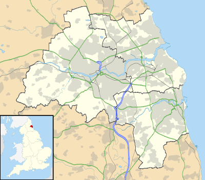 Farringdon Location within Tyne and Wear | |
| Population | 5,100 |
| Metropolitan borough | |
| Metropolitan county | |
| Region | |
| Country | England |
| Sovereign state | United Kingdom |
| Post town | SUNDERLAND |
| Postcode district | SR3 |
| Police | Northumbria |
| Fire | Tyne and Wear |
| Ambulance | North East |
| UK Parliament | |
History
Farringdon originated as an hamlet and estate within the parish of Bishopwearmouth and the township of Silksworth during the late Middle Ages. Although absent from the historic Boldon Book records of the area begin to emerge within the 14th century in association with the Blakiston family[1]. The name etymology of the name appears to derive from: "Farm or hill of Faer or his sons"[2] although it nevertheless had a variety of names throughout this period including Farnton Hall, Farrington Hall, Ffaernton and Ferenton Hall.
The land was owned by the Church in the 15th century as a Monastic grange.[3][4]. In 1479 the Black Book of Hexham detailed the area as possessing cottage lands, a Windmill, an oven and brewery[5]
The estate passed through various landowners throughout the ages, including John Forster (soldier), George Blakiston and the Pepper family of North Yorkshire.[6][7] In the 1420s, the land was represented by Robert Jakson who served as a local baliff.[8][9][10]

The manor estate and farm would exist upon the land up until the mid 20th century, whereby the land was purchased by Sunderland County Borough Council and transformed into a post-war housing state, complete with two schools and shopping arcades. By the end of the 20th century, many of the homes on the estate had been privately purchased through the right to buy scheme.
In the mid 19th century, the Hetton Colliery Railway, one of the first operational railways in History and the first of its kind to transport coal, passed through Farringdon and Gilley Law en route to the River Wear. Maps show that a former station existed on what is now the site of the school, a subsequent walking path remains.
Facilities and schools in Farringdon
Farringdon contains a large secondary school (Farringdon Community Academy), and a primary school (Farringdon Primary School). The police have a station in Farringdon that covers the west division of the city, and recently a fire station was built. There is also a large social club, two churches (one which is Roman Catholic, the other being Anglican), two pubs and three shopping parades. Also in Farringdon is the Jubilee Centre, a community centre offering activities and learning opportunities for people in the area( unfortunately the centre is now closed due to funding cuts) a McDonald's, and two residential homes for the elderly.
Street naming convention
All street names in Farringdon begin with the letter A. The main street running through the centre of the estate is Allendale Road. Other streets include Archer Road, Avonmouth Road, Aldwych Road, Aldwych Square, Abercorn Road, Arbroath Road, Antwerp Road, Arkle Road, Aboyne Square, Archer Square, Andrew Road.