Farmington, Arkansas
Farmington is a city in Washington County, Arkansas, United States. The community is nestled in a valley among the Boston Mountains, a subset of the Ozark Mountains. Although the first settlers came from the Deep South in 1828, the community did not incorporate until 1946. Located immediately west of Fayetteville in the Northwest Arkansas metropolitan statistical area, Farmington has been experiencing a population boom in recent years, as indicated by a 66% growth in population between the 2000 and 2010 censuses.[2] It has been characterized as a bedroom community by the University of Arkansas Community Design Center.[5]
Farmington, Arkansas | |
|---|---|
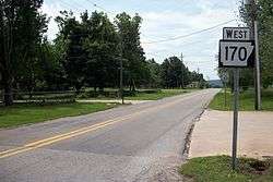 Looking south along Highway 170 | |
| Motto(s): "Feels Like Home"[1] | |
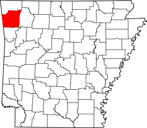
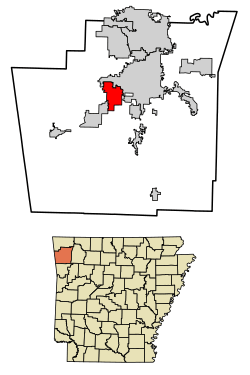 Location of Farmington in Washington County, Arkansas. | |
| Coordinates: 36°2′32″N 94°14′43″W | |
| Country | United States |
| State | Arkansas |
| County | Washington |
| Settled | 1828[2] |
| Incorporated | October 15, 1946[2] |
| Government | |
| Area | |
| • City | 9.88 sq mi (25.58 km2) |
| • Land | 9.83 sq mi (25.45 km2) |
| • Water | 0.05 sq mi (0.13 km2) |
| Elevation | 1,188 ft (362 m) |
| Population (2010) | |
| • City | 5,974 |
| • Estimate (2019)[4] | 7,400 |
| • Density | 753.10/sq mi (290.77/km2) |
| • Metro | 463,402 |
| Time zone | UTC-6 (Central (CST)) |
| • Summer (DST) | UTC-5 (CDT) |
| ZIP code | 72730 |
| Area code(s) | 479 |
| FIPS code | 05-23170 |
| GNIS feature ID | 0076910 |
| Website | City of Farmington Arkansas |
History
Settlement through Civil War
The first settlers came from the Deep South in 1828, and the area was known as Engel's Mill until a post office was built in 1868 and the village was renamed. The Civil War had a great impact on the community, as the area were mainly Confederates. The Battle of Prairie Grove occurred not far from Farmington, and the city was subject to raids by both armies as well as unaffiliated guerrillas and roughnecks.
Reconstruction through present
Around the 1890s, residents found prosperity by growing strawberries and grapes and shipping them on the St. Louis–San Francisco Railway. The tracks were pulled up during World War II, something the company had wanted to do for years, under the guise of the war effort. Farmington was incorporated on October 15, 1946.[7]
Geography
Farmington is located at 36°2′32″N 94°14′43″W (36.042343, -94.245254).[8]
According to the United States Census Bureau, the city has a total area of 4.8 square miles (12 km2), all land.
Demographics
| Historical population | |||
|---|---|---|---|
| Census | Pop. | %± | |
| 1960 | 216 | — | |
| 1970 | 908 | 320.4% | |
| 1980 | 1,283 | 41.3% | |
| 1990 | 1,322 | 3.0% | |
| 2000 | 3,605 | 172.7% | |
| 2010 | 5,974 | 65.7% | |
| Est. 2019 | 7,400 | [4] | 23.9% |
| U.S. Decennial Census[9] 2015 Estimate[2][10] | |||
As of the census[11] of 2000, there were 3,605 people, 1,337 households, and 1,013 families residing in the city. The population density was 750.6 people per square mile (290.0/km2). There were 1,390 housing units at an average density of 289.4 per square mile (111.8/km2). The racial makeup of the city was 94.01% White, 0.64% Black or African American, 1.75% Native American, 0.25% Asian, 0.94% from other races, and 2.41% from two or more races. 2.19% of the population were Hispanic or Latino of any race.
There were 1,337 households, out of which 43.6% had children under the age of 18 living with them, 58.8% were married couples living together, 14.1% had a female householder with no husband present, and 24.2% were non-families. 19.1% of all households were made up of individuals, and 7.4% had someone living alone who was 65 years of age or older. The average household size was 2.70 and the average family size was 3.09.
In the city, the population was spread out, with 30.7% under the age of 18, 10.3% from 18 to 24, 34.5% from 25 to 44, 16.1% from 45 to 64, and 8.4% who were 65 years of age or older. The median age was 30 years. For every 100 females, there were 93.8 males. For every 100 females age 18 and over, there were 85.3 males.
The median income for a household in the city was $38,969, and the median income for a family was $43,472. Males had a median income of $30,317 versus $21,250 for females. The per capita income for the city was $15,387. About 5.2% of families and 7.5% of the population were below the poverty line, including 7.3% of those under age 18 and 12.1% of those age 65 or over.
Economy
Farmington borders Fayetteville to the west and sections of Fayetteville along Highway 16 are north of the city.
Education

Farmington School District (http://www.farmcards.org) provides elementary and secondary education to area students. Farmington's mascot is the cardinal and their team colors are scarlet red and white.
Notable people
- Lance Eads, Republican member of the Arkansas State Senate for District 7; former member of the Arkansas House of Representatives for District 88 in Washington County; former resident of Farmington[12]
- Sarah Colonna, American comedian, actress, best-selling author known for her work and appearances on E!’s Chelsea Lately
See also
- Farmington Township, Washington County, Arkansas
- Walnut Grove, Washington County, Arkansas, unincorporated community located south of Farmington on Highway 170
References
- "City of Farmington Arkansas". City of Farmington Arkansas. Archived from the original on January 20, 2012. Retrieved September 12, 2012.
- Noble, Jane (March 1, 2012). "Farmington (Washington County)". Encyclopedia of Arkansas History and Culture. Butler Center for Arkansas Studies at the Central Arkansas Library System. Retrieved June 23, 2013.
- "2019 U.S. Gazetteer Files". United States Census Bureau. Retrieved June 30, 2020.
- "Population and Housing Unit Estimates". United States Census Bureau. May 24, 2020. Retrieved May 27, 2020.
- "Farmington Townscape". University of Arkansas. Archived from the original on July 12, 2014. Retrieved June 23, 2013.
- History of Benton, Washington, Carroll, Madison, Crawford, Franklin, and Sebastian Counties, Arkansas. Higginson Book Company. 1889. p. 269.
- "Farmington, Arkansas". City-Data.com. Retrieved September 12, 2012.
- "US Gazetteer files: 2010, 2000, and 1990". United States Census Bureau. 2011-02-12. Retrieved 2011-04-23.
- "Census of Population and Housing". Census.gov. Retrieved June 4, 2015.
- "Annual Estimates of the Resident Population for Incorporated Places: April 1, 2010 to July 1, 2015". Archived from the original on October 19, 2016. Retrieved June 4, 2016.
- "U.S. Census website". United States Census Bureau. Retrieved 2008-01-31.
- "Lance Ronaco Eads". intelius.com. Retrieved April 11, 2015.
External links
| Wikimedia Commons has media related to Farmington, Arkansas. |
- City of Farmington Arkansas Portal style website, Government, Business, Library, Recreation and more
- City-Data.com Comprehensive Statistical Data and more about Farmington
- ePodunk: Profile for Farmington, Arkansas, AR