Crawford Township, Washington County, Arkansas
Township of Crawford is one of 37 townships in Washington County, Arkansas, United States.[2] As of the 2000 census, its total population was 800.
Township of Crawford | |
|---|---|
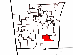 Location of Crawford Township in Washington County | |
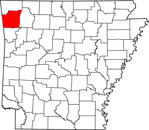 Location of Washington County in Arkansas | |
| Coordinates: 35°52′25″N 94°06′46″W | |
| Country | |
| State | |
| County | Washington |
| Established | 1878[1] |
| Area | |
| • Total | 23.8 sq mi (62 km2) |
| • Land | 23.8 sq mi (62 km2) |
| • Water | 0.0 sq mi (0 km2) 0% |
| Elevation | 1,749 ft (533 m) |
| Population (2000)[2] | |
| • Total | 800 |
| • Density | 34/sq mi (13/km2) |
| Time zone | UTC-6 (CST) |
| • Summer (DST) | UTC-5 (CDT) |
| Area code(s) | 479 |
| GNIS feature ID | 69784 |
| U.S. Geological Survey Geographic Names Information System: Crawford Township, Washington County, Arkansas | |
Geography

Crawford Twp. contains the Woolsey Bridge, which carries Washington CR 35 over the West Fork of the White River near the historic location of Woolsey, Arkansas.
According to the United States Census Bureau, Crawford Township covers an area of 23.8 square miles (62 km2); all land.[2] Crawford Township was created in 1878 from part of West Fork Township. It gave part to Lee's Creek Township in 1880.[1]
Cemeteries
The township contains Woolsey Cemetery.
Major routes
References
- United States Census Bureau 2008 TIGER/Line Shapefiles
- United States Board on Geographic Names (GNIS)
- United States National Atlas
- Baker, Russell (2003). Arkansas Township Atlas 1819-1930. Little Rock, AR: Arkansas Genealogical Society. p. 148. ISBN 0-9723085-6-3.
- "Township of Crawford, Washington County, Arkansas." U.S. Census Bureau. Breakdown. Retrieved September 25, 2010.
External links
Places adjacent to Crawford Township, Washington County, Arkansas | ||||||||||
|---|---|---|---|---|---|---|---|---|---|---|
| ||||||||||
This article is issued from Wikipedia. The text is licensed under Creative Commons - Attribution - Sharealike. Additional terms may apply for the media files.