Epsom
Epsom is the principal town of the Borough of Epsom and Ewell in Surrey, England, approximately 13.5 mi (21.7 km) south of central London. The town is recorded as Ebbesham in the 13th century and its name probably derives from that of a Saxon landowner.[2] Founded as a spring line settlement where the permeable chalk of the North Downs meets the impermeable London Clay, Epsom developed as a spa town in the Georgian period. The mineral waters were found to be rich in magnesium sulphate, which became known as Epsom salts.
| Epsom | |
|---|---|
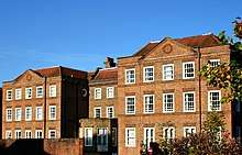
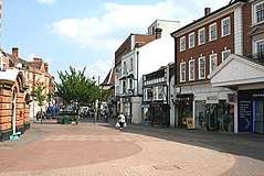 High Street, Epsom | |
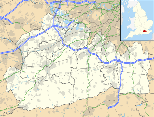 Epsom Location within Surrey | |
| Area | 18.04 km2 (6.97 sq mi) |
| Population | 31,489 (2011 census)[1] |
| • Density | 1,746/km2 (4,520/sq mi) |
| OS grid reference | TQ2060 |
| District | |
| Shire county | |
| Region | |
| Country | England |
| Sovereign state | United Kingdom |
| Post town | EPSOM |
| Dialling code | 01372 |
| Police | Surrey |
| Fire | Surrey |
| Ambulance | South East Coast |
| UK Parliament | |
Epsom station is an important railway junction, where lines to London Victoria and London Waterloo diverge.
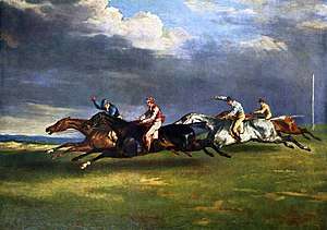
Each year, on the first Saturday in June, Epsom Downs Racecourse holds The Derby, the most prestigious of the five Classic flat season horse races.[3]
History
Epsom lies within the Copthorne Hundred used for periodic, strategic meetings of the wealthy and powerful in Anglo-Saxon England, and later having a Hundred Court. The name of Epsom is early recorded as forms of Ebba's ham (home or perhaps manor).[2] Ebba was a Saxon landowner. Many Spring line settlements by springs in Anglo-Saxon England were founded at the foot of dry valleys such as here and Effingham, Bookham, Cheam, Sutton, Carshalton, Croydon and Bromley. A relic from this period is a 7th-century brooch found in Epsom and now in the British Museum.
Chertsey Abbey, whose ownership of the main manor of Ebbisham was confirmed by King Æthelstan in 933, asserted during its Middle Ages existence that Frithwald and Bishop Erkenwald granted it 20 mansas of land in Epsom in 727.[2] Epsom appears in Domesday Book of 1086 as Evesham, held by Chertsey Abbey. Its domesday assets were: 11 hides; 2 churches, 2 mills worth 10 shillings, 18 ploughs, 24 acres (9.7 ha) of meadow, woodland worth 20 hogs; altogether it rendered £17 per year to its overlords.[4] The town at the time of Domesday Book had 38 households (and 6 serfs noteworthy enough to be recorded as assets), some of them in a nucleated village near the parish church of which there were two.[5] At various dates in the Middle Ages, manors were founded by subinfeudation at Epsom Court, Horton, Woodcote, Brettgrave and Langley Vale.[2]
Under Henry VIII and Queen Mary the manor passed to the Carew then related Darcy families. It passed via the Mynne, Buckle and Parkhurst families to Sir Charles Kemys Tynte and after his death to Sir Joseph Mawbey.
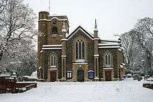
By the end of the Georgian period, Epsom was known as a spa town. Remnants of this are its water pump and multiple exhibits in the town's museum. There were entertainments at the Assembly Rooms (built c. 1690 and now a pub). A green-buffered housing estate has now been built upon the wells in the south-west of the town.
Epsom salts are named after the town. Epsom salt (magnesium sulphate) was originally prepared by boiling down mineral waters which sprung at Epsom. The town's market is built on the pond that existed in the Middle Ages.
Within the centuries-old boundaries is Epsom Downs Racecourse which features two of the five English Classic horse races; The Derby and The Oaks, which were first run in 1780 and 1779 respectively. On 4 June 1913, Emily Davison, a militant women's suffrage activist, stepped in front of King George V's horse running in the Derby, sustaining fatal injuries.
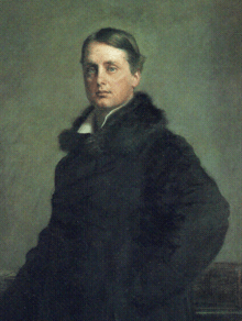
The British Prime Minister and first chairman of the London County Council, Lord Rosebery, was sent down (expelled) from the University of Oxford in 1869 for buying a racehorse and entering it in the Derby − it finished last. Lord Rosebery remained closely associated with the town throughout his life, leaving land to the borough, commemorated in the names of several roads, Rosebery Park and Rosebery School. A house was also named after him at Epsom College, one of Britain's public schools in Epsom.
The New Student's Reference Work of 1914 describes Epsom:[6]
Ep′som, a small town market of Surrey, England, fifteen miles southwest of London. The springs which made Epsom so fashionable a resort in the latter half of the 17th century, gave name to the Epsom salt, formerly made from them. The church, rebuilt in 1824, contains monuments by Flaxman and Chantrey. On Banstead Downs, one and a half miles south of the town, the most famous horse-races of the world are held yearly on Derby day. The grand stand was built in 1829–30 at a cost of $100,000, and seats 7,500 spectators. Population, 10,915.
Governance
The town lies within the parliamentary constituency of Epsom and Ewell, and is currently represented in parliament by Conservative Chris Grayling.
Economy and amenities
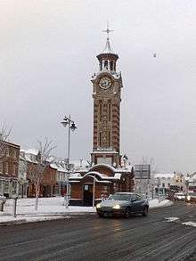
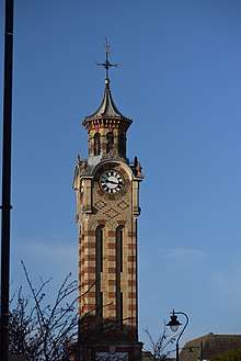
Epsom Clock Tower was built in 1847, replacing the watchhouse which stood from the 17th century, and was built to 70 feet of red and suffolk brick, with heraldic lions of Caen Stone at the four corners of the tower base. A bell was added in 1867. By 1902 the lions had been replaced by lanterns, (which were replaced by the current globe lights in 1920) and the toilet buildings added either side of the tower.[7]
Owing partly to its position and transport infrastructure in the London commuter belt allowing easy access to the Greater London conurbation to the north and the rolling Surrey countryside to the south, the borough of Epsom and Ewell was named in August 2005 by Channel 4's Location, Location, Location as the "Best Place to Live" in the United Kingdom, and ranked at numbers 8 and 3 in subsequent years.[8][9]
The Epsom Playhouse was opened in 1984 and is run by Epsom and Ewell Borough council.[10]
The Ashley Centre, a shopping mall, was built in the early 1980s and subsequently parts of the high street were pedestrianised as part of the construction of the town's one-way system. In the 1990s, a large multiplex Odeon cinema was built in Upper High Street.
The late 1990s saw the development of the Ebbisham Centre (not to be confused with the nearby early-18th-century Ebbisham House), a community service based development, including a doctors' surgery, Epsom Library and a café. The adjoining Epsom Square (formerly Derby Square) includes a number of eating and drinking establishments.
The University for the Creative Arts has one of its four main campuses in Epsom. Laine Theatre Arts, an independent performing arts college, is based in the town. Students have included Victoria Beckham. Leisure facilities in and around the town include a leisure centre (the Rainbow Centre) on East Street; Epsom Downs Racecourse; the Odeon cinema; and Hobbledown Children's Farm.
Major employers in the town include Epsom and Ewell Borough Council and WS Atkins.
As part of Epsom and Ewell, the town is twinned with Chantilly in northern France. Epsom and Ewell was ranked in the top ten of the Halifax Quality of Life Survey 2011.[11]
Sport and leisure
Epsom has a Non-League football club Epsom & Ewell F.C. who currently share a ground with Merstham F.C., as they sold their original ground off West Street. They are currently looking to move back into the Epsom area.[12] The town also has a running club called the Epsom and Ewell Harriers.[13]
Geography
Soil and elevation
The town is bisected in two in terms of soil: the north of the town is on gravel and sand deposited around the London Clay of most of London as the Thanet Formation, whereas the south-east of the town is on uneroded chalk slopes: Epsom Downs refers to these slopes reaching up to wide plateau (on which sit the formerly water-scarce settlements: Box Hill, Walton on the Hill, Tadworth and Kingswood, Surrey) and covers 990 acres (400 ha) of what is in traditional terms and in technical terms, part of the area of the settlement, called Epsom Downs.[2] In terms of topsoil, the northern soil is free draining, slightly acid but base-rich soils, producing extremely fertile pastures and deciduous woodland. The southern soil is of two types:
- shallow, lime-rich soil over chalk or limestone of the escarpment
- slightly acid, loamy and clayey soils with impeded drainage soil[14]
The town's clustered bulk is at 35m to 70m (above Ordnance Datum, mean sea level) and slopes incrementally from south and all other directions (to a lesser extent) towards the centre-north. The racecourse and Langley Vale parts of Epsom rise to high points of 140m and form a drainage divide between tributaries of the Thames flowing north and towards the Mole Gap south-west.[15]
Nearest settlements
Neighbouring areas of Surrey | ||||||||||
|---|---|---|---|---|---|---|---|---|---|---|
| ||||||||||
Demography and housing
| Ward | Detached | Semi-detached | Terraced | Flats and apartments | Caravans/temporary/mobile homes/houseboats | Shared between households[1] |
|---|---|---|---|---|---|---|
| College | 1,040 | 425 | 144 | 622 | 0 | 17 |
| Court | 160 | 721 | 947 | 738 | 1 | 0 |
| Stamford | 707 | 995 | 300 | 346 | 0 | 0 |
| Town | 237 | 849 | 455 | 1,584 | 2 | 27 |
| Woodcote | 1,111 | 513 | 232 | 430 | 0 | 0 |
| Ward | Population | Households | % Owned outright | % Owned with a loan | hectares[1] |
|---|---|---|---|---|---|
| College | 5,873 | 2,248 | 41.1 | 35.9 | 316 |
| Court | 6,830 | 2,567 | 13.8 | 39.8 | 213 |
| Stamford | 6,088 | 2,348 | 38.5 | 43.7 | 436 |
| Town | 6,979 | 3,154 | 27 | 29.1 | 136 |
| Woodcote | 5,719 | 2,286 | 41.4 | 37.9 | 703 |
Hospitals
As well as Epsom's General Hospital, the town was well known as the location of a group of five large Edwardian psychiatric hospitals, commonly known as the Epsom Cluster. Most of the hospitals closed in the 1990s and early 2000s, although psychiatric services are still offered on parts of the Horton, West Park, St. Ebba's and Manor Hospital sites.
The hospitals were (in order of date of opening):
- Manor Hospital[16] (1899)
- St Ebba's Hospital[17] (1902)
- Horton Hospital[18] (1903)
- Long Grove Hospital[19] (1907, an exact duplicate of Horton Hospital to save construction time)
- West Park Hospital[20] (construction started 1912, used as a military hospital from 1916 and officially opened in 1921)
The hospitals were built in close proximity to each other on a 1,096-acre (4.44 km2) estate on part of Epsom Common, which the London County Council bought to solve the overcrowding problems experienced in its other hospitals. The hospitals shared a central 'engineering works' next to Long Grove, which supplied all five institutions with water and electricity and were served by the private Horton Light Railway. Today, of the former hospitals, three have been largely redeveloped for housing (Horton, The Manor and Long Grove Hospital) and two are in the process of being redeveloped while retaining limited NHS services including day care and a cottage hospital.[21]
The surrounding land has now become the Horton Country Park and is also home to the Hobbledown Children's Farm.[22]
Localities
Epsom is contiguous apart from the neighbourhoods or localities below.
Horton
Horton covers the slightly elevated westernmost part of the borough. Suburban and rural, it is centred on Horton Lane, a wide road with gentle bends, 1.5 miles (2.4 km) in length with a 40 mph speed limit one of two routes between Chessington (including Hook) and the West Ewell-Epsom conurbation as an alternative route to Hook Road (the B284). It was a manor of the parish and remains a hamlet of the town as well as not qualifying for post town status. The place-name Horton is a common one in England. It derives from Old English horu 'dirt' and tūn 'settlement, farm, estate', presumably meaning 'farm on muddy soil'.[23] Formerly around it were a group of psychiatric hospitals which served London and Surrey, forming a socially distanced community and pre-dated the United Kingdom's shift to care in the community mental health treatments which commenced in the early 20th century.
Horton's amenities include:
- Horton Park Golf Club
- David Lloyd Leisure Centre
- Horton Country Park
- Hobbledown children's adventure park and farm
- Epsom Polo Club
Langley Vale
This locality is a sloped, developed network of streets, surrounded by steep farmland and the racecourse.
Transport
Rail
Epsom railway station has frequent rail services to London and other local towns operated by the Southern and South Western Railway franchises.
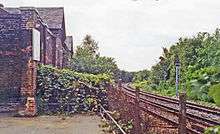
The town's other station, Epsom Town, was closed in 1929; although most of the listed buildings remain. The station is of historic interest being the arrival point for Queen Victoria and her entourage prior to taking a carriage up to Epsom Downs.
Two other railway lines were built to serve the Epsom Downs Racecourse, with termini at Epsom Downs and Tattenham Corner. The Horton Light Railway was built around 1905, as a branch from the main line near Ewell West Station, to deliver building materials to the mental hospitals (see above) being built on what is now Horton Country Park.
Bus
Bus services connect Epsom to neighbouring areas and a regular service connects with the London Underground at Morden. Some bus services are commercial, some run with the support of Surrey County Council, and others under contract to London Buses. Quality Line, a branch of RATP Dev operates buses from a depot in the town and offers services on a number of Transport for London and other routes.
Road
- The A24 passes through the centre of the town.
- The M25 motorway can be joined at Junction 9 Leatherhead, via the A24 south.
- The B280 runs from Epsom (West Hill) through Malden Rushett (A243) to Oxshott.
Education
State schools include Blenheim High School, Epsom and Ewell High School,[24] Glyn Technology School, North East Surrey College of Technology (NESCOT) and Rosebery School for Girls and also the Beacon School Banstead.[25] There is also a campus of the University for the Creative Arts.
Primary schools include Southfield Park Primary School,St Martins C of E Junior and Infant School, Wallace Fields Infant & Junior school Epsom Primary School and Children Centre, Stamford Green Primary School, St Joseph's Catholic Primary School and Danetree Junior School
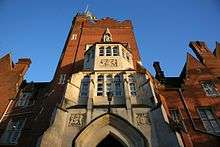
Independent schools include Epsom College, Kingswood House School, St. Christopher's School and Ewell Castle School.[26]
Emergency services
Epsom is served by these emergency services.
- Epsom Hospital, which has an Accident and Emergency facility.
- South East Coast Ambulance Service as of 1 July 2006. The Surrey Ambulance Service, Sussex, and Kent Ambulance services have all merged, and have now ceased to exist.
- Surrey Fire & Rescue Service
- Surrey Police
Notable people
Notable people who were born in Epsom include:
- Petula Clark, singer
- Warwick Davis
- Tom Felton
- Alex Kingston
- Catherine McCormack
- Nick Easter, England rugby union player
- James Chuter Ede, Home Secretary, educationist, and Mayor of Epsom when it received its Borough charter
- Glyn Johns, musician, record producer, sound engineer
- Andy Johns, record producer, sound engineer
- Thomas Mayr-Harting, former Ambassador of the European Union to the United Nations
- Julia Ormond, actress
- Martin Parr, photographer
- John Piper, painter and printmaker
- Isabella Potbury, portrait painter and suffragette
- Simon Starling, artist
- Andy Ward, drummer of the progressive rock band Camel
- Joe Wicks, fitness coach
- Rory Burns, cricketer
People who have lived in Epsom at some time include:
- Isabella Beeton, writer
- Andrew Garfield, actor, (The Amazing Spider-Man, The Social Network)
- Mel Giedroyc, comedian
- David Charles Manners, author and charity-founder
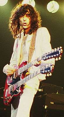
- Jimmy Page, guitarist of Led Zeppelin
- David Vine
- Kenneth Wolstenholme
- Jimmy White, snooker player
- Norman Wisdom, comedian
- Louis Cole, YouTuber
- Tyger Drew-Honey
- Michaela Strachan
- Freddy Eastwood, footballer
- Jody Morris, former footballer
- Peter Xavier Price, illustrator and academic
- Steven Savile, writer
- Nici Sterling, adult film actor
- Johnny Haynes, professional footballer
See also
References
- Key Statistics; Quick Statistics: Population Density United Kingdom Census 2011 Office for National Statistics Retrieved 20 December 2013
- H.E. Malden, ed. (1911). "Parishes: Epsom". A History of the County of Surrey: Volume 3. Institute of Historical Research. Retrieved 31 October 2013.
- Morris, Tony; Randall, John (1999). A Century of Champions. Portway Press. ISBN 1-90157015-0.
- Surrey Domesday Book Archived 30 October 2007 at the Wayback Machine
- Domesday Map. Retrieved 31 October 2013
- The New Student's Reference Work
- "Epsom Clock Tower". Retrieved 6 January 2010.
- Hull 'worst place to live in'
- Location, Location, Location: Best and Worst Live
- "Epsom Playhouse". Retrieved 16 November 2007.
- "UK's most desirable location named". London Evening Standard. Archived from the original on 10 January 2012.
- "History – From 1990s to the Present Day – Epsom & Ewell Football Club". Pitchero.com. 29 November 2012. Archived from the original on 4 November 2013. Retrieved 7 April 2013.
- "Runners impress at County Cross Country Championships - weekend round-up". Fast Running. 6 January 2019. Retrieved 13 January 2019.
- "Soilscapes soil types viewer – National Soil Resources Institute. Cranfield University". landis.org.uk.
- Grid square map Ordnance survey website
- "Manor Hospital". Thetimechamber.co.uk. Retrieved 29 April 2010.
- "St. Ebba's Hospital". Thetimechamber.co.uk. Retrieved 29 April 2010.
- "Horton Hospital". Thetimechamber.co.uk. Retrieved 29 April 2010.
- "Long Grove Hospital". Thetimechamber.co.uk. Retrieved 29 April 2010.
- "West Park Hospital". Thetimechamber.co.uk. Retrieved 29 April 2010.
- "Urbex". Simoncornwell.com. Retrieved 29 April 2010.
- "Hobbledown Children's Farm". hobbledown.com. Retrieved 14 June 2015.
- Victor Watts (ed.), The Cambridge Dictionary of English Place-Names, Based on the Collections of the English Place-Name Society (Cambridge: Cambridge University Press, 2004), s.v. HORTON.
- "Epsom and Ewell High School". Epsom and Ewell High School. Retrieved 29 April 2010.
- "Rosebery School". Rosebery.surrey.sch.uk. 9 April 2010. Archived from the original on 10 May 2010. Retrieved 29 April 2010.
- "ewell castle school". Ewellcastle.co.uk. 5 March 2010. Retrieved 29 April 2010.
External links
| Wikimedia Commons has media related to Epsom. |
| Wikivoyage has a travel guide for Epsom. |
- . Encyclopædia Britannica. 9 (11th ed.). 1911. pp. 708–709.
- Town of Epsom
- Epsom & Ewell Borough Council
- Exploring St.Ebbas Hospital
- Exploring West Park Asylum
- Detailed History of the Spa, Salts and Springs of Epsom and Ewell
| Towns, villages and hamlets | 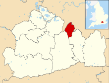 | |
|---|---|---|
| Parks | ||
| Places of worship | ||
| Education |
| |
| Transport | ||
| Buildings and structures | ||
| Sport | ||
| Authority control |
|
|---|