Enterprise, Clarke County, Mississippi
Enterprise is a town in Clarke County, Mississippi, United States.[3] The population was 526 at the 2010 census.[4]
Enterprise, Mississippi | |
|---|---|
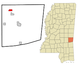 Location of Enterprise, Mississippi | |
 Enterprise, Mississippi Location in the United States | |
| Coordinates: 32°10′25″N 88°49′19″W | |
| Country | United States |
| State | Mississippi |
| County | Clarke |
| Area | |
| • Total | 2.46 sq mi (6.37 km2) |
| • Land | 2.45 sq mi (6.35 km2) |
| • Water | 0.01 sq mi (0.02 km2) |
| Elevation | 259 ft (79 m) |
| Population (2010) | |
| • Total | 526 |
| • Estimate (2019)[2] | 475 |
| • Density | 193.72/sq mi (74.79/km2) |
| Time zone | UTC-6 (Central (CST)) |
| • Summer (DST) | UTC-5 (CDT) |
| ZIP code | 39330 |
| Area code(s) | 601 |
| FIPS code | 28-22580 |
| GNIS feature ID | 0669792 |
| Website | www |
History
Enterprise was so named "to denote the policy of their inhabitants".[5]
Geography
Enterprise is located in northwestern Clarke County at 32°10′25″N 88°49′19″W (32.173620, -88.821935).[6] The Chickasawhay River is formed at Enterprise by the confluence of the Chunky River and Okatibbee Creek.
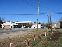
U.S. Route 11 passes through the west side of the town, leading north 17 miles (27 km) to Meridian and south 39 miles (63 km) to Laurel. Exit 134 on Interstate 59 is 2 miles (3 km) west of town.
According to the United States Census Bureau, the town has a total area of 2.4 square miles (6.3 km2), of which 0.0077 square miles (0.02 km2), or 0.27%, is water.[4]
Demographics
As of the census[8] of 2000, there were 474 people, 202 households, and 138 families residing in the town. The population density was 209.0 people per square mile (80.6/km2). There were 241 housing units at an average density of 106.3 per square mile (41.0/km2). The racial makeup of the town was 75.74% White, 23.84% African American, 0.21% Asian, and 0.21% from two or more races. Hispanic or Latino of any race were 0.21% of the population.
There were 202 households, out of which 29.7% had children under the age of 18 living with them, 53.0% were married couples living together, 12.9% had a female householder with no husband present, and 31.2% were non-families. 28.2% of all households were made up of individuals, and 13.9% had someone living alone who was 65 years of age or older. The average household size was 2.35 and the average family size was 2.83.
In the town, the population was spread out, with 23.6% under the age of 18, 7.4% from 18 to 24, 26.8% from 25 to 44, 24.7% from 45 to 64, and 17.5% who were 65 years of age or older. The median age was 39 years. For every 100 females, there were 97.5 males. For every 100 females age 18 and over, there were 92.6 males.
The median income for a household in the town was $33,125, and the median income for a family was $37,375. Males had a median income of $29,583 versus $21,719 for females. The per capita income for the town was $16,995. About 9.2% of families and 13.5% of the population were below the poverty line, including 14.5% of those under age 18 and 23.5% of those age 65 or over.
Education
The town of Enterprise is served by the Enterprise School District. Enterprise High School is one of two high schools in Clarke County.
Notable person
- Chester Harding, governor of the Panama Canal Zone from 1917 to 1921[9]
References
- "2019 U.S. Gazetteer Files". United States Census Bureau. Retrieved July 26, 2020.
- "Population and Housing Unit Estimates". United States Census Bureau. May 24, 2020. Retrieved May 27, 2020.
- U.S. Geological Survey Geographic Names Information System: Enterprise
- "Geographic Identifiers: 2010 Demographic Profile Data (G001): Enterprise town, Mississippi". U.S. Census Bureau, American Factfinder. Archived from the original on February 12, 2020. Retrieved October 6, 2014.
- Gannett, Henry (1905). The Origin of Certain Place Names in the United States. Govt. Print. Off. pp. 120.
- "US Gazetteer files: 2010, 2000, and 1990". United States Census Bureau. 2011-02-12. Retrieved 2011-04-23.
- "Census of Population and Housing". Census.gov. Retrieved June 4, 2015.
- "U.S. Census website". United States Census Bureau. Retrieved 2008-01-31.
- "Chester Harding". pancanal.com. Panama Canal Authority. Retrieved 17 May 2020.
External links
| Wikimedia Commons has media related to Enterprise, Clarke County, Mississippi. |
Municipalities and communities of Clarke County, Mississippi, United States | ||
|---|---|---|
| City |  Map of Mississippi highlighting Clarke County | |
| Towns | ||
| Unincorporated communities | ||
| Ghost town | ||