Ellsworth Township, Mahoning County, Ohio
Ellsworth Township is one of the fourteen townships of Mahoning County, Ohio, United States. The 2010 census found 2,217 people in the township.[3]
Ellsworth Township, Mahoning County, Ohio | |
|---|---|
 Ellsworth Town Hall | |
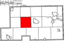 Location of Ellsworth Township in Mahoning County | |
| Coordinates: 41°2′21″N 80°50′52″W | |
| Country | United States |
| State | Ohio |
| County | Mahoning |
| Area | |
| • Total | 25.7 sq mi (66.6 km2) |
| • Land | 25.4 sq mi (65.7 km2) |
| • Water | 0.3 sq mi (0.9 km2) |
| Elevation | 1,060 ft (323 m) |
| Population (2010) | |
| • Total | 2,217 |
| • Density | 88/sq mi (33.8/km2) |
| Time zone | UTC-5 (Eastern (EST)) |
| • Summer (DST) | UTC-4 (EDT) |
| ZIP code | 44416 |
| Area code(s) | 234/330 |
| FIPS code | 39-25088[2] |
| GNIS feature ID | 1086562[1] |
| Website | www |
Geography
Located in the central part of the county, it borders the following townships:
- Jackson Township - north
- Austintown Township - northeast corner
- Canfield Township - east
- Green Township - southeast
- Goshen Township - southwest
- Berlin Township - west
- Milton Township - northwest corner
No municipalities are located in Ellsworth Township, although the unincorporated community of Ellsworth lies at the center of the township.
Name and history
Ellsworth Township was established in 1810. Ellsworth is the name of a "prominent citizen of Connecticut".[4]
It is the only Ellsworth Township statewide.[5]
Government
The township is governed by a three-member board of trustees, who are elected in November of odd-numbered years to a four-year term beginning on the following January 1. Two are elected in the year after the presidential election and one is elected in the year before it. There is also an elected township fiscal officer,[6] who serves a four-year term beginning on April 1 of the year after the election, which is held in November of the year before the presidential election. Vacancies in the fiscal officership or on the board of trustees are filled by the remaining trustees.
References
- "US Board on Geographic Names". United States Geological Survey. 2007-10-25. Retrieved 2008-01-31.
- "U.S. Census website". United States Census Bureau. Retrieved 2008-01-31.
- "Geographic Identifiers: 2010 Demographic Profile Data (G001): Ellsworth township, Mahoning County, Ohio". U.S. Census Bureau, American Factfinder. Archived from the original on February 10, 2020. Retrieved March 27, 2013.
- Sanderson, Thomas W. (1907). Twentieth Century History of Youngstown and Mahoning County. Biographical Publishing Company. pp. 200.
- "Detailed map of Ohio" (PDF). United States Census Bureau. 2000. Retrieved 2007-02-16.
- §503.24, §505.01, and §507.01 of the Ohio Revised Code. Accessed 4/30/2009.
External links
Municipalities and communities of Mahoning County, Ohio, United States | ||
|---|---|---|
| Cities | 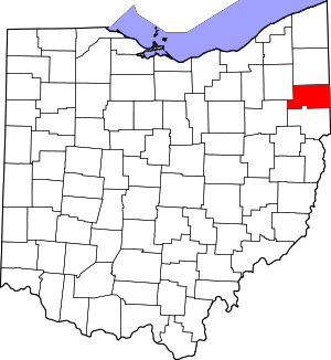 Map of Ohio highlighting Mahoning County | |
| Villages | ||
| Townships | ||
| CDPs | ||
| Unincorporated communities |
| |
| Footnotes | ‡This populated place also has portions in an adjacent county or counties | |