Doolandella, Queensland
Doolandella is an outer western suburb in the City of Brisbane, Queensland, Australia.[3] In the 2016 census, Doolandella had a population of 4,817 people.[1]
| Doolandella Brisbane, Queensland | |||||||||||||||
|---|---|---|---|---|---|---|---|---|---|---|---|---|---|---|---|
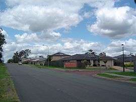 Rockfield Street | |||||||||||||||
 Doolandella | |||||||||||||||
| Coordinates | 27.6127°S 152.9863°E | ||||||||||||||
| Population | 4,817 (2016 census)[1] | ||||||||||||||
| • Density | 1,376/km2 (3,560/sq mi) | ||||||||||||||
| Postcode(s) | 4077 | ||||||||||||||
| Area | 3.5 km2 (1.4 sq mi) | ||||||||||||||
| Time zone | AEST (UTC+10:00) | ||||||||||||||
| Location | 21.2 km (13 mi) SW of Brisbane CBD | ||||||||||||||
| LGA(s) | City of Brisbane (Forest Lake Ward)[2] | ||||||||||||||
| State electorate(s) | Inala | ||||||||||||||
| Federal Division(s) | Oxley | ||||||||||||||
| |||||||||||||||
Geography
Doolandella is 21.2 kilometres (13 mi) south-west of the Brisbane central business district. Blunder Creek forms the eastern and southern boundaries of the suburb.[4]
The suburb has access to the Ipswich Motorway via Blunder Road as well as the Logan Motorway to the south.[4]
History
Doolandella was declared as an official suburb in 1976.[5] The name Doolandella, or Dulandella as expressed by Aboriginal Australians, is a Yuggera Yugarabul word referring to the Geebung tree, a broad leaved shrub with yellow fruit which grows in the area.[5]
In 2004, a total of 70 houses with a population of 255 was recorded in the suburb.
Demographics
In the 2011 census, Doolandella recorded a population of 3,105 people, 49% female and 51% male.
The median age of the Doolandella population was 30 years of age, 7 years below the Australian median.
55.6% of people living in Doolandella were born in Australia, compared to the national average of 69.8%; the next most common countries of birth were Vietnam 11.9%, New Zealand 5.6%, India 2.9%, England 2.1%, Fiji 1.7%.
53.3% of people spoke only English at home; the next most popular languages were 19.5% Vietnamese, 2.7% Samoan, 2.3% Hindi, 2.1% Mandarin, 1.9% Spanish.
Education
There are no schools within the suburb. There are primary schools in the neighbouring suburbs of Inala, Durack, Pallara, and Forest Lake and secondary schools in Durack and Forest Lake.[4]
References
- Australian Bureau of Statistics (27 June 2017). "Doolandella (SSC)". 2016 Census QuickStats. Retrieved 20 October 2018.

- "Forest Lake Ward". Brisbane City Council. Brisbane City Council. Archived from the original on 12 March 2017. Retrieved 12 March 2017.
- "Doolandella - suburb in City of Brisbane (entry 46544)". Queensland Place Names. Queensland Government. Retrieved 10 June 2019.
- "Queensland Globe". State of Queensland. Retrieved 10 October 2019.
- Mynott, Wicki (2009). 150 years: Richlands, Inala & neighbouring suburbs in Brisbane's South West. Richlands, Inala & Suburbs History Group. p. 78.