Dana, North Carolina
Dana is an unincorporated community and census-designated place (CDP) in Henderson County, North Carolina, United States. Its population was 3,329 as of the 2010 census.[2]
Dana, North Carolina | |
|---|---|
 Dana  Dana | |
| Coordinates: 35°19′45″N 82°22′31″W | |
| Country | United States |
| State | North Carolina |
| County | Henderson |
| Area | |
| • Total | 8.928 sq mi (23.12 km2) |
| • Land | 8.905 sq mi (23.06 km2) |
| • Water | 0.023 sq mi (0.06 km2) |
| Elevation | 2,251 ft (686 m) |
| Population | |
| • Total | 3,329 |
| • Density | 370/sq mi (140/km2) |
| Time zone | UTC-5 (Eastern (EST)) |
| • Summer (DST) | UTC-4 (EDT) |
| ZIP code | 28724 |
| Area code(s) | 828 |
| GNIS feature ID | 983935[3] |
| FIPS code | 37-16220 |
History
A post office called Dana has been in operation since 1892.[4] The community was named for Dana Hadley, the son of the original owner of the town site.[5]
Geography
Dana is in eastern Henderson County, with the town center sitting at an elevation of 2,256 feet (688 m) above sea level on the Eastern Continental Divide. The eastern half of the community drains to the Hungry River and is part of the Green River–Broad River–Congaree River–Santee River system flowing to the Atlantic Ocean, while the western half of Dana flows towards Mud Creek, part of the French Broad River–Tennessee River–Mississippi River system flowing to the Gulf of Mexico.
Dana is 5 miles (8 km) east of Hendersonville, the county seat, and 28 miles (45 km) southeast of Asheville. According to the U.S. Census Bureau, the Dana CDP has a total area of 8.9 square miles (23.1 km2), of which 0.02 square miles (0.06 km2), or 0.26%, are water.[6]
Notes
- "US Gazetteer files: 2010, 2000, and 1990". United States Census Bureau. 2011-02-12. Retrieved 2011-04-23.
- "U.S. Census website". United States Census Bureau. Retrieved 2011-05-14.
- "Dana". Geographic Names Information System. United States Geological Survey.
- "Henderson County". Jim Forte Postal History. Archived from the original on 24 May 2015. Retrieved 23 May 2015.
- Kramp, Penn (Feb 22, 1987). "Tuxedo: It's not formal wear". The Times-News. p. 27. Retrieved 23 May 2015.
- "Geographic Identifiers: 2010 Census Summary File 1 (G001): Dana CDP, North Carolina". American Factfinder. U.S. Census Bureau. Archived from the original on February 13, 2020. Retrieved December 19, 2017.
Municipalities and communities of Henderson County, North Carolina, United States | ||
|---|---|---|
| Cities | 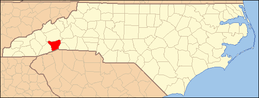 | |
| Towns | ||
| Village | ||
| CDPs | ||
| Unincorporated communities | ||
| Footnotes | ‡This populated place also has portions in an adjacent county or counties | |