Culloden, Georgia
Culloden is a city in Monroe County, Georgia, United States. The population was 223 at the 2000 census. It is part of the Macon Metropolitan Statistical Area.
Culloden, Georgia | |
|---|---|
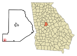 Location in Monroe County and the state of Georgia | |
| Coordinates: 32°51′47″N 84°5′37″W | |
| Country | United States |
| State | Georgia |
| County | Monroe |
| Area | |
| • Total | 0.79 sq mi (2.06 km2) |
| • Land | 0.78 sq mi (2.01 km2) |
| • Water | 0.02 sq mi (0.04 km2) |
| Elevation | 725 ft (221 m) |
| Population (2010) | |
| • Total | 175 |
| • Estimate (2019)[2] | 186 |
| • Density | 239.38/sq mi (92.40/km2) |
| Time zone | UTC-5 (Eastern (EST)) |
| • Summer (DST) | UTC-4 (EDT) |
| ZIP code | 31016 |
| Area code(s) | 478 |
| FIPS code | 13-20848[3] |
| GNIS feature ID | 0355402[4] |
History
The first settlement at Culloden was made ca. 1739.[5] The community was named after William Culloden, a local merchant.[5] A post office called Culloden has been in operation since 1825.[6] The Georgia General Assembly incorporated the place in 1887 as the "City of Culloden", with municipal corporate limits extending in a one-mile radius from the central town well.[7]
Geography
Culloden is located in the southwestern part of Monroe County at 32°51′47″N 84°5′37″W (32.863155, -84.093621).[8]
The city is located along U.S. Route 341 and Georgia State Route 74. U.S. 341 runs from north to south just east of the city, leading north 15 mi (24 km) to Barnesville and south 12 mi (19 km) to Roberta. GA-74 runs from west to east to the north of the city, leading east 32 mi (51 km) to Macon and west 17 mi (27 km) to Thomaston.
According to the United States Census Bureau, the city has a total area of 0.8 square miles (2.1 km2), of which 0.8 square miles (2.1 km2) is land and 1.27% is water.
Demographics
| Historical population | |||
|---|---|---|---|
| Census | Pop. | %± | |
| 1880 | 381 | — | |
| 1900 | 334 | — | |
| 1910 | 365 | 9.3% | |
| 1920 | 361 | −1.1% | |
| 1930 | 337 | −6.6% | |
| 1940 | 251 | −25.5% | |
| 1950 | 261 | 4.0% | |
| 1960 | 260 | −0.4% | |
| 1970 | 272 | 4.6% | |
| 1980 | 281 | 3.3% | |
| 1990 | 242 | −13.9% | |
| 2000 | 223 | −7.9% | |
| 2010 | 175 | −21.5% | |
| Est. 2019 | 186 | [2] | 6.3% |
| U.S. Decennial Census[9] | |||
As of the census[3] of 2000, there were 223 people, 86 households, and 60 families residing in the city. The population density was 288.2 people per square mile (111.8/km2). There were 95 housing units at an average density of 122.8 per square mile (47.6/km2). The racial makeup of the city was 29.15% White and 70.85% African American. Hispanic or Latino of any race were 0.45% of the population.
There were 86 households, out of which 22.1% had children under the age of 18 living with them, 44.2% were married couples living together, 18.6% had a female householder with no husband present, and 30.2% were non-families. 27.9% of all households were made up of individuals, and 8.1% had someone living alone who was 65 years of age or older. The average household size was 2.59 and the average family size was 3.22.
In the city, the population was spread out, with 20.6% under the age of 18, 4.9% from 18 to 24, 31.8% from 25 to 44, 27.8% from 45 to 64, and 14.8% who were 65 years of age or older. The median age was 41 years. For every 100 females, there were 93.9 males. For every 100 females age 18 and over, there were 96.7 males.
The median income for a household in the city was $28,393, and the median income for a family was $48,125. Males had a median income of $28,542 versus $20,469 for females. The per capita income for the city was $22,442. About 12.7% of families and 15.6% of the population were below the poverty line, including 21.6% of those under the age of eighteen and 20.7% of those 65 or over.
Notable person
- Alfred Blalock, surgeon who developed the Blalock–Taussig shunt to relieve the cyanosis of Tetralogy of Fallot, leading to the modern era of cardiac surgery.
References
- "2019 U.S. Gazetteer Files". United States Census Bureau. Retrieved July 9, 2020.
- "Population and Housing Unit Estimates". United States Census Bureau. May 24, 2020. Retrieved May 27, 2020.
- "U.S. Census website". United States Census Bureau. Retrieved 2008-01-31.
- "US Board on Geographic Names". United States Geological Survey. 2007-10-25. Retrieved 2008-01-31.
- Krakow, Kenneth K. (1975). Georgia Place-Names: Their History and Origins (PDF). Macon, GA: Winship Press. p. 55. ISBN 0-915430-00-2.
- "Post Offices". Jim Forte Postal History. Retrieved 15 April 2018.
- Acts Passed by the General Assembly of Georgia. J. Johnston. 1887. pp. 655–656.
- "US Gazetteer files: 2010, 2000, and 1990". United States Census Bureau. 2011-02-12. Retrieved 2011-04-23.
- "Census of Population and Housing". Census.gov. Retrieved June 4, 2015.
Municipalities and communities of Monroe County, Georgia, United States | ||
|---|---|---|
| Cities | 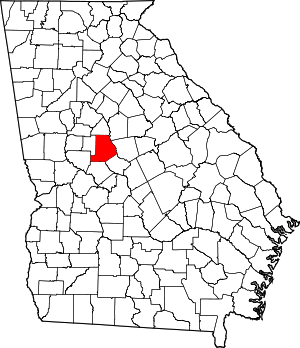 Map of Georgia highlighting Monroe County | |
| Unincorporated communities | ||
| Ghost town | ||
| Principal cities |  | |
|---|---|---|
| Municipalities | ||
| Other communities | ||
| Counties | ||
| CSA components |
| |