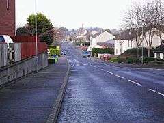
Carryduff
Carryduff (from Irish: Ceathrú Aodha Dhuibh, meaning "Black Hugh's quarter")[1][2][3] is a small town and townland in County Down, Northern Ireland, about 10 kilometres (6.2 mi) south of Belfast city centre. It had a population of 6,961 people in the 2011 Census.[4]
Carryduff
| |
|---|---|
 | |
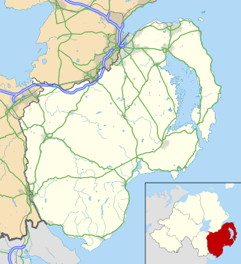 Location within County Down | |
| Population | 6,961 (2011 Census) |
| District |
|
| County | |
| Country | Northern Ireland |
| Sovereign state | United Kingdom |
| Post town | BELFAST |
| Postcode district | BT8 |
| Dialling code | 028 |
| Police | Northern Ireland |
| Fire | Northern Ireland |
| Ambulance | Northern Ireland |
| UK Parliament | |
| NI Assembly |
|
Most of the settlement lies within the townland of Carryduff, although part of it extends into the neighbouring townlands of Killynure and Mealough.
History
One of the earliest references to the settlement dates from 1622, where its anglicised name is written as Carrow-Hugh-Duffe.[3] The original village formed where six roads and a river crossed, and is the site of the ancient Queen's Fort Rath. The road south from Belfast (the A24) climbs out of a gap in the Castlereagh Hills, and splits at Carryduff, one fork (the A7) continuing to Downpatrick (via Saintfield and Crossgar), the other fork (A24) continuing via Ballynahinch to Newcastle towards Kilkeel. In addition, the road from the Ards Peninsula, Newtownards and Comber (the B178) crosses here en route to Hillsborough in the west. All six roads cross the small Carryduff River here (which flows northwards to eventually join the River Lagan at Minnowburn).
The good road connections and proximity to Belfast made the town an ideal site for overspill development from the city in the 1960s. This period saw numerous housing developments, the construction of the Town and Country Shopping Centre, and Carryduff Primary School, leading into the 1970s with the building of the Killynure housing estate by the Northern Ireland Housing Executive. Development along one side of the northbound A24 took place adjacent to the Immaculate Heart of Mary Roman Catholic Church and St Joseph's Primary School, with the Knockbracken Reservoir on the other side.
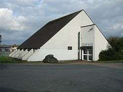
The 1980s saw expansion continue with Carryduff becoming a commuter town for Belfast workers. Developments continued into the 1990s and included Carryduff Library, Carryduff Shopping Centre, including shops such as Wellworths (later SuperValu) and stationery and book shop NPO (later Eason). Numerous further housing developments have been built, as well as the Lough Moss Leisure Centre. These developments saw the Carryduff River placed inside a culvert for much of its journey through the town.
Very little green belt land now remains between Carryduff and the southern border of Belfast, the 1980s having seen the former Matthew Stop Line breached.
The local Carryduff Gaelic Athletic Club is based at Pairc Aodha Dhuibh. Carryduff also has 2 local men's football teams who all play from Lough Moss pitches in the town, they are Carryduff Carryduff Colts F.C. and Carryduff Athletic F.C.
In 2018, the disused Knockbracken reservoir has become Ireland's largest aqua park, offering a range of water based activities.[5]
Demography
The population of Carryduff on Census day (27 March 2011) was 6,961 people.[4] Of these:
- 21.45% were aged under 16 years and 13.92% were aged 65 years and over
- the mean age was 38 years
- 47.55% of the population were male and 52.45% were female
- 49.55% were from a Catholic background and 42.44% were from a Protestant or Other Christian (including Christian related) background
See also
| Wikimedia Commons has media related to Carryduff. |
References
- Placenames Database of Ireland
- "Ainm: Journal of the Ulster Placename Society - County Down". Archived from the original on 14 December 2010. Retrieved 17 February 2010.
- Northern Ireland Placenames Project Archived 17 July 2011 at the Wayback Machine
- "Census 2011 Population Statistics for Carryduff Settlement". Northern Ireland Statistics and Research Agency (NISRA). Retrieved 6 August 2019.
- "Let's Go Hydro". visitbelfast.com. Retrieved 4 September 2018.