Bornesketaig
Bornesketaig, Scottish Gaelic Borgh na Sgiotaig, is a dispersed crofting settlement in Trotternish on the Isle of Skye.[1][2]
Bornesketaig
| |
|---|---|
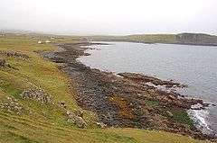 The beach of Camas Mor with some of the houses in Bornesketaig | |
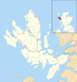 Bornesketaig Location within the Isle of Skye | |
| OS grid reference | NG3771 |
| Council area | |
| Country | Scotland |
| Sovereign state | United Kingdom |
| Postcode district | PH20 1 |
| Police | Scotland |
| Fire | Scottish |
| Ambulance | Scottish |
Broch
A broch once stood nearby, but little remains as the stones have been robbed for other uses. There are a number of caves in the cliffs around Bornesketaig.
References
- Ordnance Survey: Landranger map sheet 23 North Skye (Dunvegan & Portree) (Map). Ordnance Survey. 2011. ISBN 9780319229897.
- "Ordnance Survey: 1:50,000 Scale Gazetteer" (csv (download)). www.ordnancesurvey.co.uk. Ordnance Survey. 1 January 2016. Retrieved 30 January 2016.
| Wikimedia Commons has media related to Bornesketaig. |
This article is issued from Wikipedia. The text is licensed under Creative Commons - Attribution - Sharealike. Additional terms may apply for the media files.