Bhutan–China border
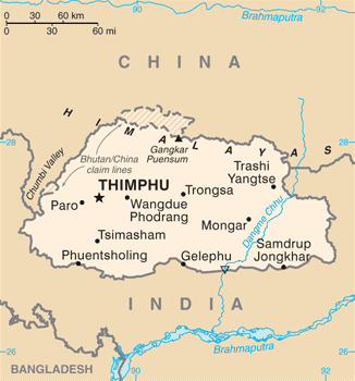
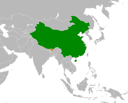
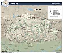
The border between Bhutan and China is a sinuous line of 470 km (290 mi) long, in a north-south-east direction, which separates Bhutan to the south from Tibet, an autonomous region of China, to the north. It lies between two tripoints formed by the two countries with India. It is nearby the parallels 28° and 29° N, in the eastern part of the Himalayas.
History
The Kingdom of Bhutan and the People's Republic of China do not maintain official diplomatic relations, and relations are historically tense.[1][2][3]
Bhutan's border with Tibet has never been officially recognised and demarcated. For a brief period, the Republic of China officially maintained a territorial claim on parts of Bhutan.[4] The territorial claim was maintained by the People's Republic of China after the Chinese Communist Party took control of mainland China in the Chinese Civil War. With the increase in soldiers on the Chinese side of the Sino-Bhutanese border after the 17-point agreement between the local Tibetan government and the central government of the PRC, Bhutan withdrew its representative from Lhasa.[4][5][6]
The 1959 Tibetan Rebellion and the 14th Dalai Lama's arrival in neighbouring ally India made the security of Bhutan's border with China a necessity for Bhutan. An estimated 6,000 Tibetans fled to Bhutan and were granted asylum, although Bhutan subsequently closed its border to China, fearing more refugees to come.[4][7]
In 1998, China and Bhutan signed a bilateral agreement for maintaining peace on the border. In the agreement, China affirmed its respect for Bhutan's sovereignty and territorial integrity and both sides sought to build ties based on the Five Principles of Peaceful Co-existence.[2][3][5][8] However, China's building of roads on what Bhutan asserts to be Bhutanese territory, allegedly in violation of the 1998 agreement, has provoked tensions.[5][6][8] In 2002, however, China presented what it claimed to be 'evidence', asserting its ownership of disputed tracts of land; after negotiations, an interim agreement was reached.[2]
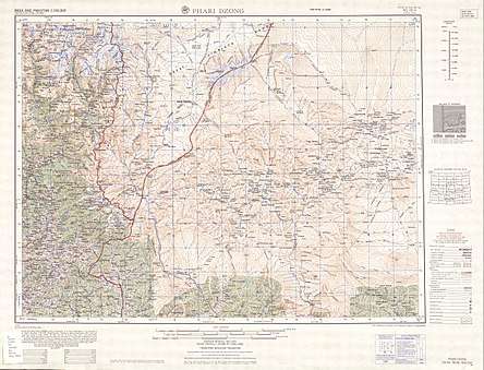
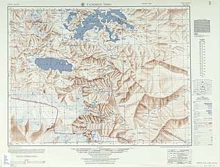
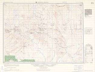
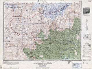
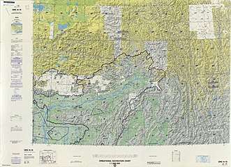
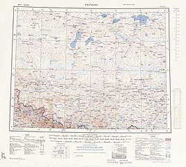
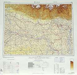
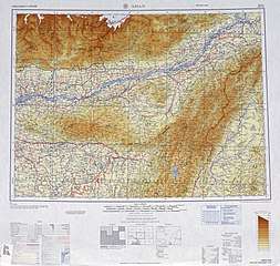
Historical maps
Historical maps of the border area from west to east in the International Map of the World and Operational Navigation Chart, mid-late 20th century:


References
- Sirohi, Seema (14 May 2008). "A New Bhutan Calling". Outlook. Retrieved 30 May 2008.
- Bhutan-China relations (5 July 2004). BhutanNewsOnline.com. Accessed 30 May 2008.
- India and the upcoming Druk democracy Archived 13 January 2008 at the Wayback Machine (May 2007). HimalMag.com. Accessed 30 May 2008.
- Bhutan - China relations Accessed 30 May 2008.
- In Bhutan, China and India collide (12 January 2008). AsiaTimes.com. Accessed 30 May 2008.
- Institute of Peace and Conflict Studies Archived 29 May 2008 at the Wayback Machine (8 April 2008). IPCS.org. Accessed 30 May 2008.
- Bhutan: a land frozen in time (9 February 1998). BBC. Accessed 30 May 2008.
- Bhutan Gazette (7 June 2007). BhutanGazette. Accessed 30 May 2008.
| Wikimedia Commons has media related to Bhutan-China border. |