Arthog
Arthog (![]()
| Arthog | |
|---|---|
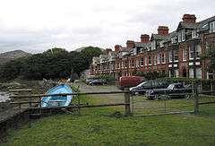 Mawddach Crescent was the first and only phase of an Edwardian holiday resort built by Cardiff entrepreneur, Solomon Andrews, in the early 20th century. | |
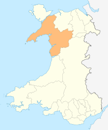
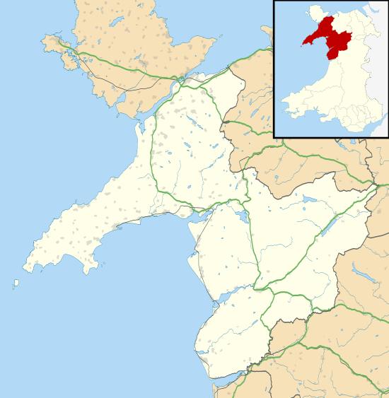 Arthog Location within Gwynedd | |
| Population | 1,031 (2011) |
| OS grid reference | SH642145 |
| Community |
|
| Principal area | |
| Country | Wales |
| Sovereign state | United Kingdom |
| Post town | ARTHOG |
| Postcode district | LL39 |
| Dialling code | 01341 |
| Police | North Wales |
| Fire | North Wales |
| Ambulance | Welsh |
| UK Parliament | |
| Senedd Cymru – Welsh Parliament |
|
It is well known for its outdoor activity centres and the nearby Llynnau Cregennen. The Arthog Outdoor Education Centre is owned by Telford and Wrekin Council and is primarily used in term-time by schools from the Shropshire and Telford & Wrekin Local Education Authorities. The other outdoor activity centre, Min Y Don, has been family owned and run since the 1950s. They too are primarily used in term-time by schools from the Midlands, but are also heavily involved with local community work.
In 1894, Solomon Andrews, a Cardiff entrepreneur, bought land overlooking the Mawddach estuary. On the site he completed Mawddach Crescent in 1902. The row of terraced properties was the start of a purpose-built holiday resort he intended for the area. However the planned development went no further because the surrounding land proved unsuitable for urban planning. During the Second World War, the Royal Marines commandeered Mawddach Crescent. It became known as Iceland Camp. The marines also built huts on nearby Fegla Fawr, the foundation bases can still be seen between the trees above the estuary.
The village was served by Arthog railway station (on the Barmouth - Ruabon line) until the complete closure of the line in 1964. The line is now a footpath known as the Mawddach Trail (Welsh: Llwybr Mawddach), and is popular with both walkers and cyclists.
According to the 2011 census, 28.3% of the community's residents were able to speak Welsh. Consequently, Arthog had the lowest percentage of Welsh speakers of any community in Gwynedd.[3] 70.6% of the community's residents were born outside Wales.[4]
References
- "Office for National Statistics : Census 2001 : Parish Headcounts : Gwynedd". Archived from the original on 22 September 2010. Retrieved 11 August 2009.
- "Community population 2011". Retrieved 17 May 2015.
- "2011 Census results by Community". Welsh Language Commissioner. ONS. 2011. Archived from the original on 14 September 2017. Retrieved 14 November 2016.
- "Map Gwlad Enedigol". Statiaith. ONS. Retrieved 14 November 2016.
- Price, Thomas (1842). "Hanes Cymru, a chenedl y Cymry, o'r cynoesoedd hyd at farwolaeth Llewelyn ap Gruffydd: Ynghyd a rhai cofiaint perthynol i'r amseroedd o'r pryd hynny i waered".
External links
| Wikimedia Commons has media related to Arthog. |