Arkansas Highway 92
Arkansas Highway 92 is a mostly north–south state highway of 60.7 miles (97.7 km) in north-central Arkansas.[1][2][3]
| ||||
|---|---|---|---|---|
 | ||||
| Route information | ||||
| Maintained by ArDOT | ||||
| Length | 60.7 mi[1][2][3] (97.7 km) | |||
| Major junctions | ||||
| West end | ||||
| East end | ||||
| Location | ||||
| Counties | Conway, Van Buren, Cleburne | |||
| Highway system | ||||
| ||||

Route description
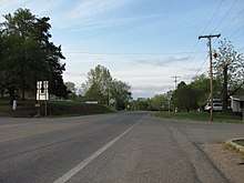
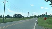
AR 92 begins at US 64 in Plumerville. The route crosses Interstate 40 and continues north through Conway County. A concurrency begins with AR 124 in Springfield and also AR 9 north of Springfield. The AR 9/AR 92/AR 124 concurrency continues north to Center Ridge, when AR 124 turns west, AR 9 heads north, and AR 92 turns east.[1] The highway enters Van Buren County, where it intersects US 65 at Bee Branch and runs near Greers Ferry Lake before entering Cleburne County.[2] The highway continues east to concur with AR 16, cross Greers Ferry Lake, and enter the community of Greers Ferry.[3] Continuing east, AR 92 winds to Drasco, where the route terminates at AR 5/AR 25.
Major intersections
| County | Location | mi[1][2][3] | km | Destinations | Notes |
|---|---|---|---|---|---|
| Conway | Plumerville | 0.0 | 0.0 | Western terminus | |
| 0.2 | 0.32 | I-40 exit 112 | |||
| | 1.6 | 2.6 | Eastern terminus of AR 287 | ||
| Springfield | 10.2 | 16.4 | Western end of concurrency with AR 124 | ||
| | 13.5 | 21.7 | Western end of concurrency with AR 9 | ||
| Center Ridge | 17.7 | 28.5 | Eastern end of concurrency with AR 124 | ||
| 18 | 29 | Eastern end of concurrency with AR 9 | |||
| Van Buren | Rabbit Ridge | 24.3 | 39.1 | Northern terminus of AR 285 | |
| Bee Branch | 31.2 | 50.2 | |||
| | 34 | 55 | Western terminus of AR 356 | ||
| | 43.4 | 69.8 | Eastern terminus of AR 337 | ||
| Cleburne | | 44.7 | 71.9 | Western end of concurrency with AR 16 | |
| | 46.9 | 75.5 | Eastern temrinus of AR 336 | ||
| Greers Ferry | 48.7 | 78.4 | Western terminus of AR 110 | ||
| 49.2 | 79.2 | Eastern end of concurrency with AR 16 | |||
| 52.2 | 84.0 | Southern terminus of AR 225 | |||
| | 54.8 | 88.2 | Southern terminus of AR 263 | ||
| Drasco | 60.7 | 97.7 | Eastern terminus | ||
| 1.000 mi = 1.609 km; 1.000 km = 0.621 mi | |||||
See also
References
- Arkansas State Highway and Transportation Department. AHTD Conway County map Retrieved on June 24, 2010.
- Arkansas State Highway and Transportation Department. AHTD Van Buren County map Retrieved on June 24, 2010.
- Arkansas State Highway and Transportation Department. AHTD Cleburne County map Retrieved on June 24, 2010.
External links
![]()