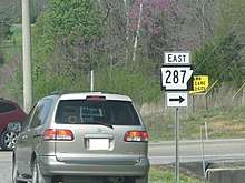
Arkansas Highway 287
Arkansas Highway 287 (AR 287 and Hwy. 287) is a designation for two state highways in Conway County. One segment of 4.84 miles (7.79 km) runs east–west from Arkansas Highway 9 near Morrilton east to Arkansas Highway 92.[2] A second segment of 9.03 miles (14.53 km) runs north–south connecting Highway 9 to Arkansas Highway 95.[3]
| ||||
|---|---|---|---|---|
| Route information | ||||
| Maintained by ArDOT | ||||
| Section 1 | ||||
| Length | 4.84 mi[1] (7.79 km) | |||
| West end | ||||
| East end | ||||
| Section 2 | ||||
| Length | 9.03 mi[1] (14.53 km) | |||
| South end | ||||
| North end | ||||
| Location | ||||
| Counties | Conway | |||
| Highway system | ||||
| ||||

Route description
Morrilton to Highway 92
AR 287 begins at AR 9 just north of Morrilton and an interchange with Interstate 40. The route runs past the Oak Grove Cemetery before terminating at AR 92 north of Plumerville.[3] A second segment of 9.03 miles (14.53 km) runs north–south connecting Highway 9 to Arkansas Highway 95.[3] The road is two–lane undivided for its entire length.[1]
Solgohachia to Highway 95
The highway begins at the unincorporated community of Solgohachia at Highway 9. AR 287 heads north through the communities of McClaren and Lanty before it terminates at AR 95. The road is two–lane undivided for its entire length.[1]
Major intersections
The entire route is in Conway County.
| Location | mi[1] | km | Destinations | Notes | |
|---|---|---|---|---|---|
| | 0.00 | 0.00 | Western terminus | ||
| | 4.84 | 7.79 | Eastern terminus | ||
| AR 287 northern segment begins at AR 9 | |||||
| Solgohachia | 0.00 | 0.00 | Southern terminus | ||
| | 9.03 | 14.53 | Northern terminus | ||
| 1.000 mi = 1.609 km; 1.000 km = 0.621 mi | |||||
See also
- Solgohachia Bridge, bridge listed on the National Register of Historic Places near Solgohachia
References
- Planning and Research Division (2010). "Arkansas Road Log Database". Arkansas State Highway and Transportation Department. Archived from the original (Database) on 23 June 2011. Retrieved June 9, 2011.
- Route and Section Map (PDF) (Map) (Conway County ed.). Arkansas State Highway and Transportation Department. Retrieved August 8, 2011.
- General Highway Map (PDF) (Map) (Conway County ed.). Arkansas State Highway and Transportation Department. Archived (PDF) from the original on 18 July 2011. Retrieved August 8, 2011.