28th Street station (IRT Lexington Avenue Line)
28th Street is a local station on the IRT Lexington Avenue Line of the New York City Subway. Located at Park Avenue South and 28th Street in the Rose Hill neighborhood of Manhattan, it is served by 6 trains at all times, <6> trains during weekdays in the peak direction, and 4 trains during late night hours.
28 Street | |||||||||||
|---|---|---|---|---|---|---|---|---|---|---|---|
 Downtown platform | |||||||||||
| Station statistics | |||||||||||
| Address | East 28th Street & Park Avenue South New York, NY 10016 | ||||||||||
| Borough | Manhattan | ||||||||||
| Locale | Rose Hill, Kips Bay | ||||||||||
| Coordinates | 40.74329°N 73.984165°W | ||||||||||
| Division | A (IRT) | ||||||||||
| Line | IRT Lexington Avenue Line | ||||||||||
| Services | 4 6 | ||||||||||
| Structure | Underground | ||||||||||
| Platforms | 2 side platforms | ||||||||||
| Tracks | 4 | ||||||||||
| Other information | |||||||||||
| Opened | October 27, 1904[1] | ||||||||||
| Closed | July 16, 2018 (reconstruction) | ||||||||||
| Rebuilt | January 14, 2019 | ||||||||||
| Station code | 404[2] | ||||||||||
| Accessible | |||||||||||
| Wireless service | |||||||||||
| Opposite-direction transfer available | No | ||||||||||
| Traffic | |||||||||||
| Passengers (2019) | 5,834,989[5] | ||||||||||
| Rank | 73 out of 424[5] | ||||||||||
| Station succession | |||||||||||
| Next north | 33rd Street: 4 | ||||||||||
| Next | station not accessible northbound Next accessible station northbound: Grand Central–42nd Street: 4 | ||||||||||
| Next south | 23rd Street: 4 | ||||||||||
| Next | 23rd Street (local): 4 | ||||||||||
| |||||||||||
| |||||||||||
| |||||||||||
28th Street Subway Station (IRT) | |||||||||||
| MPS | New York City Subway System MPS | ||||||||||
| NRHP reference No. | 05000230[6] | ||||||||||
| Added to NRHP | March 30, 2005 | ||||||||||
%26groups%3D_618a86c1b43e3114847c6c9f3ab7ba725dc72a6b.svg)
History
Construction started on the first IRT line in 1900.[7] The part of the line from City Hall to just south of 42nd Street was part of the original IRT line, opened on October 27, 1904 including a local station at 28th Street.[1]
On August 6, 1927, bombs exploded at the 28th Street station and at the 28th Street station on the Broadway Line. The perpetrator of the bombings is unknown; they were initially blamed on Galleanists (as Sacco and Vanzetti had been denied appeal three days prior), though police later believed they were unrelated.[8][9][10]
On April 13, 1948, the platform extensions to accommodate ten-car trains at this station along with those at 23rd Street, and 33rd Street were opened for use.[11]
Under the 2015–2019 MTA Capital Plan, the station underwent a complete overhaul as part of the Enhanced Station Initiative and was entirely closed for several months. Updates included cellular service, Wi-Fi, USB charging stations, interactive service advisories and maps.[12][13] In January 2018, the NYCT and Bus Committee recommended that Judlau Contracting receive the $125 million contract for the renovations of 57th and 23rd Streets on the IND Sixth Avenue Line; 28th Street on the IRT Lexington Avenue Line, and 34th Street–Penn Station on the IRT Broadway–Seventh Avenue Line and IND Eighth Avenue Line.[14] However, the MTA Board temporarily deferred the vote for these packages after city representatives refused to vote to award the contracts.[15][16] The contract was put back for a vote in February, where it was ultimately approved.[17] The station was closed for renovations on July 16, 2018, and reopened to the public January 14, 2019,[18] delayed from December 2018.[19]
Station layout
| G | Street level | Entrances/exits |
| P Platform level |
Side platform | |
| Northbound local | ← ← | |
| Northbound express | ← | |
| Southbound express | | |
| Southbound local | | |
| Side platform | ||

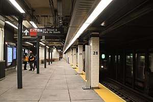
This station contains four tracks and two side platforms. The two middle express tracks run at a lower level than the two outer local ones. The fare control is at platform level and there are no open crossunders or crossovers. However, there is a closed crossunder with railings and a blacked out sign indicating its location. The token booth is unusual in that it is built into the tile wall instead of a standalone structure like most other stations.
Two works of art were installed in this station. The first was a glass block wall artwork at the main fare control entitled Seven Ways 4 Twenty-Eighth. It was installed during station renovations in 1996. The second was Roaming Underfoot, a glass mosaic mural on the platform walls by Nancy Blum. It showcases flora in the Madison Square Park Conservancy's Perennial Collection, and was installed during station renovations in 2018.[20]
The 28th Street station has been listed on the National Register of Historic Places since 2005.[21]
Exits
| Exit location[22] | Number of exits | Platform served |
|---|---|---|
| North side of 28th Street west of Park Avenue S (inside 45 East 28th Street) |
1 | Southbound |
| SW corner of Park Avenue S and 28th Street (inside 50 East 28th Street) |
2 (1 stair, 1 elevator) |
Southbound |
| NE corner of Park Avenue S and 28th Street | 2 | Northbound |
| SE corner of Park Avenue S and 28th Street | 2 | Northbound |
| New York Life Building, between 26th and 27th Streets | 1 | Southbound (open 7am – 7pm weekdays) |
The entrance inside 50 East 28th Street replaced two small staircases that also led to the southwestern corner of 28th Street and Park Avenue South.
Image gallery
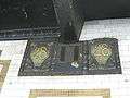 Plaque by Heins & LaFarge / Grueby Faience Company, 1904.
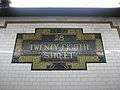 Faience name tablet by Heins & LaFarge / Grueby Faience Company, 1904.
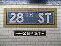 Wall mosaic
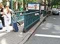 Northbound street stair
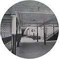 28th Street station in 1904
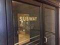 Downtown entrance within the New York Life Building
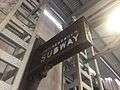 "Interborough Subway" sign outside the New York Life Building
References
- "Our Subway Open: 150,000 Try It; Mayor McClellan Runs the First Official Train". The New York Times. October 28, 1904. p. 1. ISSN 0362-4331. Retrieved April 21, 2020.
- "Station Developers' Information". Metropolitan Transportation Authority. Retrieved June 13, 2017.
- "NYC Subway Wireless – Active Stations". Transit Wireless Wifi. Retrieved November 13, 2019.
- Attached PDF to "Governor Cuomo Announces Wireless Service and New "Transit Wireless WiFi" in Queens and Manhattan Subway Stations", governor.ny.gov
- "Facts and Figures: Annual Subway Ridership 2014–2019". Metropolitan Transportation Authority. 2020. Retrieved May 26, 2020.
- "NPS Focus". National Register of Historic Places. National Park Service. Retrieved December 24, 2011.
- "www.nycsubway.org".
- Joughin, Louis; Morgan, Edmund M. The Legacy of Sacco and Vanzetti. Princeton University Press. p. 273. ISBN 9781400868650 – via Google Books.
- Carroll, Michael P. (Winter 2020). "The Forgotten Story of the Bombings of the Italian Church of Saints Peter and Paul in San Fransisco [sic]". Italian American Review. 10 (1): 36. doi:10.5406/italamerrevi.10.1.0019.
- "Probe of Bombings Turns to Boston". Boston Globe. August 9, 1927. p. 8 – via Newspapers.com

- Report for the three and one-half years ending June 30, 1949. New York City Board of Transportation. 1949. hdl:2027/mdp.39015023094926.
- "MTA Will Completely Close 30 Subway Stations For Months-Long "Revamp"". Gothamist. Archived from the original on August 1, 2016. Retrieved July 18, 2016.
- "MTAStations" (PDF). governor.ny.gov. Government of the State of New York. Retrieved July 18, 2016.
- Metropolitan Transportation Authority (January 22, 2018). "NYCT/Bus Committee Meeting" (PDF). p. 135. Archived from the original (PDF) on January 27, 2018. Retrieved January 19, 2018.
- Barone, Vincent (January 24, 2018). "Controversial cosmetic subway improvement plan falters". am New York. Retrieved 2018-01-25.
- Siff, Andrew (January 24, 2018). "MTA Shelves Plan to Modernize Subway Stations Amid Criticism". NBC New York. Retrieved 2018-01-25.
- "Foes Hit Gov's Station Fix Plan". NY Daily News. 2018-02-13. Retrieved 2018-02-23.
- "Planned Service Changes for: Monday, January 14, 2019". mta.info. Metropolitan Transportation Authority. January 14, 2019. Archived from the original on January 14, 2019. Retrieved December 20, 2018.
- "Repairs and Improvements Coming to Three Manhattan 6FM Subway Stations". www.mta.info. Metropolitan Transportation Authority. June 15, 2018. Retrieved June 18, 2018.
- "Arts & Design - NYCT Permanent Art". MTA. Retrieved January 18, 2019.
- New York County Listings at the National Register of Historic Places(Structure - #05000230)
- "MTA Neighborhood Maps: Union Square / Gramercy" (PDF). Metropolitan Transportation Authority. 2015. Retrieved August 6, 2015.
Further reading
- Stookey, Lee (1994). Subway ceramics : a history and iconography of mosaic and bas relief signs and plaques in the New York City subway system. Brattleboro, Vt: L. Stookey. ISBN 978-0-9635486-1-0. OCLC 31901471.
External links
| Wikimedia Commons has media related to 28th Street (IRT Lexington Avenue Line). |
- nycsubway.org – IRT East Side Line: 28th Street
- nycsubway.org – 7 waves 4 twenty eight Artwork by Gerald Marks (1996)
- Forgotten NY – Original 28 - NYC's First 28 Subway Stations
- 28th Street entrance from Google Maps Street View
- 26th-27th Streets entrance from Google Maps Street View
- Platforms from Google Maps Street View
| Lexington Ave. Line |
|
|---|---|
| |
| Topics |  | |
|---|---|---|
| Lists by county |
| |
| Lists by city | ||
| Other lists | ||
| ||