59th Street (Manhattan)
59th Street is a crosstown street in the New York City borough of Manhattan, running from York Avenue/Sutton Place to the West Side Highway, with a discontinuity between Ninth Avenue/Columbus Avenue and Eighth Avenue/Central Park West where the Time Warner Center is located. At Second Avenue, 59th Street branches off onto the Ed Koch Queensboro Bridge, which is often referred to as the 59th Street Bridge,[1] even though 59th Street continues east to York Avenue/Sutton Place.
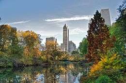
 Looking west along Central Park South | |
| West end | Twelfth Avenue |
|---|---|
| Major junctions | Grand Army Plaza, Columbus Circle |
| East end | Sutton Place |
The portion of the street forming the southern boundary of Central Park from Columbus Circle at Eighth Avenue/Central Park West on the west to Grand Army Plaza at Fifth Avenue on the east is known as Central Park South. Entry into Central Park can be made at the Scholars' Gate at Fifth Avenue, the Artists' Gate at Sixth Avenue, the Artisans' Gate at Seventh Avenue, and the Merchants' Gate at Columbus Circle. Central Park South contains four famous upscale hotels: the Plaza Hotel, the Ritz-Carlton, which is the flagship of the Ritz-Carlton chain, the Park Lane, and JW Marriott Essex House, and a notable residential building, the Gainsborough Studios.
While Central Park South is bi-directional, the section of 59th Street between Ninth and Eleventh Avenue/West End Avenue is one-way westbound, and the section between Fifth Avenue and Second Avenue is one-way eastbound.
59th Street forms the border between Midtown Manhattan and Uptown Manhattan. North of 59th Street, the Manhattan neighborhoods of the Upper West Side and Upper East Side continue on either side of Central Park. On the West Side, Manhattan's numbered avenues are renamed north of 59th Street: Eighth Avenue becomes Central Park West; Ninth Avenue is renamed Columbus Avenue; Tenth Avenue is renamed Amsterdam Avenue; and Eleventh Avenue becomes West End Avenue.
Transportation
59th Street is served by the following New York City Subway stations:
- 59th Street–Columbus Circle (1, A, B, C, and D trains)[2]
- Fifth Avenue–59th Street (N, R, and W trains)
- Lexington Avenue/59th Street (4, 5, 6, <6>, N, R, and W trains)
The Roosevelt Island Tramway terminates at Second Avenue near 59th Street and extends eastward to Roosevelt Island.
The New York Central Railroad's 59th Street station, a never-opened railroad station, exists on Park Avenue, which now carries the Park Avenue main line of the Metro-North Railroad.[3] Currently, the station is used as an emergency exit for the Metro-North Railroad in the Park Avenue Tunnel.[4]
Landmarks

- Bloomingdale's Department Store at Lexington Avenue
- Bloomberg World Headquarters between Third and Lexington Avenues
- 59E59 Theaters an Off-Broadway theater complex between Park and Madison Avenues
- General Motors Building at Fifth Avenue
- Hampshire House
- Trump Parc
- Grand Army Plaza
- Plaza Hotel at Fifth Avenue
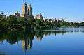
- Central Park
- New York Athletic Club and 200 Central Park South at SE and SW corners of Seventh Avenue
- Gainsborough Studios, 222 Central Park South
- 2 Columbus Circle
- Time Warner Center at Columbus Circle
- Mount Sinai West at 10th Avenue
- IRT Powerhouse fills the entire block between 58th to 59th Street, and from 11th to 12th Avenues.
- Hudson River Park extends along the Hudson River from Battery Park to 59th Street.
See also
References
Notes
- 59th Street:A New York Songline- Virtual walking tour
- "Subway Map" (PDF). Metropolitan Transportation Authority. October 21, 2019. Retrieved January 18, 2018.
- Scientific American (1875). "THE UNDERGROUND RAILWAY, NEW YORK CITY". www.columbia.edu. Archived from the original on May 4, 2009. Retrieved September 17, 2018.
- Hudson, Edward (February 23, 1984). "FIRE POSTSCRIPT: 2,000 STUCK IN TUNNEL". The New York Times. Retrieved June 19, 2018.
.jpg)