Muotkatunturit Wilderness Area
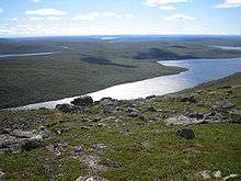
Muotkatunturit (Sami: Muotkkeduoddara meahcceguovlu) is a wilderness area in Inari and Utsjoki in northern Finnish Lapland, where one can enjoy silence and be alone with the nature. The northern part is a rolling fell plateau crossed by river valleys, the south consists of fell birch forests, bogs and old pine forests. There are no marked trails in the area and only a few wilderness huts. Somebody in the company should have sufficient experience of hiking.
Understand
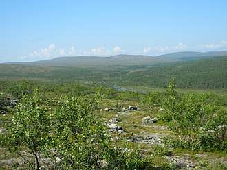
Muotkatunturit is a true wilderness area, where you have to get along by yourself. The terrain is quite easy, but the treeless areas offer little shelter and there are many areas without mobile phone coverage. The area covers 1,570 km².
Consider observing leave-no-trace camping principles. There are waste bins at the wilderness huts, but emptying them is costly, so avoid using them.
Inari and Utsjoki both belong to the Sami native region, with about half the population in Utsjoki being Sami. Names on the map are mostly in Northern Sami and Inari Sami, sometimes in Finnish.
History
Muotkatunturit has long been an important reindeer husbandry area, the fells in summer, the forests in winter. There are also stone age findings by lake Peltojärvi.
The wilderness areas were established 1991 to protect the wilderness character of these areas, secure the Sami culture and develop usage of the nature, including reindeer herding, fishing and hunting. There are severe restrictions on building any infrastructure, but the status has little direct influence on the hiker. Most of the area is state owned and administered by Metsähallitus.
Landscape
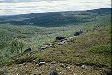
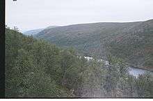
The southern part of the area is lowland dominated by fell birch, with bogs, some old pine woods and some of the fells extending above the tree line. Going to the north the terrain gets higher and even the fell birch has to seek shelter in valleys. The open rolling fell landscape of the central and north parts of the area is what most hikers come here to enjoy. The highest peak, Kuárvikozzâ, reaches a modest 590 metres, 250 metres above its surroundings.
There are many quick streams between the fells, and a canyon, Stuorraávži or Stuorrâävži, in the fell plateau. In the east there is the lake Peltojärvi (Bealdojávri, Piäldujävri), with Peltotunturi (Bealdoaivi, Piälduáivi) reaching 567 meters.
Flora and fauna
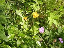
The fell plateau is dominated by fell heaths, with fell birch in the valleys. Alpine bearberry (rievssatmuorji, Arctostaphylos alpinus) give the heaths a distinct red colour in the fall, at ruska.
There is a strong golden eagle population in the area and several of the seriously threatened wolverine. More common animals include rough-legged buzzard, grey-headed chickadee, willow ptarmigan and Siberian jay.
Climate
The wilderness area is in inland Lapland, far north of the Arctic circle, to a large part above the tree line. This means advice on cold weather applies in full in winter. Do not come without sufficient experience or experienced company. The lasting snow comes in October–November, but thicker snow usually only around New year. As in most of Lapland, early spring is the best time for skiing.
Later in the spring melting snow means high waters. Use your judgement when fording. Experience is needed.
The mosquito season starts in late June and continues to the first freezing nights in August–September. They are less of a problem above the tree line.
Ruska, the beautiful time of red leaves, is in early to mid September.
Summer day temperatures are usually 15–20°C, but lower temperatures are possible, emphasized if there is wind and rain.
Get in
The Sami museum and nature centre Siida in Inari acts as visitor centre for Muotkatunturit. Inari is easily reachable by car (E75), coach or plane (via Ivalo airport). Here you can get maps, advice and fishing and hunting permits. There are nature trails nearby. There is an entrance fee (€10/8/5) to the exhibitions; guided tours should be reserved in advance.
- Siida, ☎ +358 20-564-7740, e-mail: siida(at)metsa.fi.
There are no public roads into the Muotkatunturit area, but roads near it (1–14 km) on each side: E75/national road 4 (Rovaniemi–Ivalo–Inari–Utsjoki) to the east, road 92 (Kaamanen–Karigasniemi) to the north and north-east and local road 9553 (Inari–🌍 Angeli) to the south and by the Norwegian border (Karigasniemi–Angeli) to the west.
There is a weekly taxi/minibus connection between Inari and Angeli, which can be used to reach the area from the south. The road runs 1–3 km from the area, on the other side of the river Vaskojoki (check how/where to cross it). An ordinary taxi ride from Inari to 🌍 Tirro (20 km) would cost about 30–50 euro.
The eastern and northern parts of the area are easily reached by coaches from Ivalo via Inari to Karigasniemi (either local bus or Rovaniemi–Karasjok/Nordkap). If coming from the north (Tana bru, Utsjoki), transfer at Kaamanen. From the Karigasniemi road the fell plateau is easily reachable, which allows shorter return trips, even day trips (but the climb to the fells is considerable).
There is a snowmobile route from Inari via Tirro and Peltojärvi to Muotkan Ruoktu and further to Utsjoki or to Karigasniemi by the road.
There is also the former post route from Tirro to Karigasniemi, a trail not marked in the terrain and sometimes difficult to follow, but marked on the map at least most of the way.
Popular starting points in the north include Muotkan Ruoktu, with a trail to Peltojärvi, Kiellatupa (Giellájohka lomakylä) by Kielajoki river and the village Karigasniemi by the Norwegian border.
The river valley of Inarinjoki by the Norwegian border is steep, but there are several places suitable for starting a hike. As there is no public transport here, you might want to start from a cottage where you have been staying. The Ranttila house is by this road.
Fees and permits
There are no entrance or hiking fees. The right to access is valid in the area and permits roaming, temporary camping and picking berries and mushroom. Using small branches for fire and lodging in the open wilderness huts is also free (note the terms).
Fishing permits can be bought from the nature centre or from local businesses. Check what permits are relevant for the areas you are going to visit. Angling and ice fishing in still waters is included in the right to access, but there are annually varying restrictions in the area. For lure fishing you need a permit, mostly the "Utsjoki 1574" one. The national fishing permit in itself covers only some waters but is needed for most fishing.
Hunting permits are sold for the publicly owned area and some tourist businesses arrange hunting excursions. Typical game is willow ptarmigan, waterfowl and mountain hare. Hunting has to be coordinated with the reindeer husbandry.
Get around
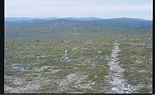
There are no public roads in the area, nor marked trails. There are some roads leading into the area, used by locals, but they are not suitable for ordinary cars and may be closed for traffic.
In summer you will be walking. In the winter you will be skiing, unless you opt for the snowmobile route. A good map, a compass and the skill to use them are needed, as is skill to cope with harsh weather, minor bogs and minor rivers (there are no bridges).
There is an outdoor map for the area, 1:50 000. You can also use the ordinary topographical maps (W433, W434 and W443; 1:50 000), but on these the wilderness huts are not easily found.
Most people coming here walk their own paths. The established routes are the one from Muotkan Ruoktu to Peltojärvi (14 km) and the former post route from Tirro to Karigasniemi through all the wilderness area (often used for only part of the trek).
There are reindeer fences, with few gates.
See
Do
- Hiking
- Cross-country skiing
- Fishing
- Hunting
Buy
There are shops at least in Inari, Ivalo and Karigasniemi and some service in Kaamanen. There are souvenir shops and service for tourists also at other places along the road.
For any handicraft, check they are "Sami duodji" and not cheap import. You might want to check beforehand what local craftsmen there are, and where to get their products – the souvenir shops have limited assortments.
Eat
There are several tourist businesses by the roads, most of which can serve you (and probably also pack) meals.
There are stoves in the wilderness huts, in Stuorraäytsi a separate gas stove for cooking.
Making fire is allowed on state owned land in the area (i.e. nearly everywhere), given due care and that there is no wildfire warning in effect. Small branches and sticks from the ground may be used without further permits. Use existing fireplaces if possible. You should still bring a camping stove for most cooking.
Berries and edible mushrooms can be picked thanks to the right to access. You can also use common wild herbs. For fishing you need to check current restrictions, disinfect your equipment (if coming from certain waters) and (except for angling without reel in still water) buy permits.
Drink
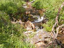
The water in the area is mostly potable, especially water from rivers and streams. In warm periods in the summer boiling the water is recommended. Use your judgement. On the fell heath itself water is scarce, but valleys with water are not far away.
After the reindeer round-up (usually in June) water in the area where large reindeer herds have got dirt in the water is unsafe for a few weeks.
Sleep
A suitable tent, camping mattresses and sleeping bags are needed if you stay overnight in the wilderness area. There are no mattresses, blankets or pillows in the open wilderness huts and you should not count on being able to sleep indoors.
Lodging
Metsähallitus maintains two open wilderness huts in the area, the 🌍 Stuorraäytsi hut. (7 persons) in the western end of the canyon and the 🌍 Kurtojoki hut (6 persons) at the northern shore of Kurtojohka, south of Jorba-Kaisavarri, in the south-west part of the area. Note that latecomers have an absolute right to the facilities. Dogs are allowed if others in the hut agree. There are a few wilderness huts maintained by others, such as the minimal 🌍 Lahtisen kämppä (about two by two metres!) some 10 km upstream from Muotkan Ruoktu. As you use facilities of other people, make sure to leave the hut at least as tidy as when you came, check the stove before using it, and make sure there is dry firewood for the party coming next.
There are many commercial lodging facilities outside the area, including cottages for rent, rooms and a hotel in Inari.
- 🌍 Muotkan Ruoktu, Karigasniementie 2281 (at Peltojoki by the Karigasniemi road, 23km from the Kaamanen crossroads, 45km from Karigasniemi), ☎ +358 400-860-668, fax: +358 16 672-845, e-mail: muotkanruoktun@gmail.com. Campsite, rooms, cottages. Café-restaurant. With a trail to Peltojärvi and several shorter trails. Open 1 March–30 September, some of the cottages are available also off season. Cottages from €32/day (2 persons, linen included); caravan €20 + electricity €8; camping €15/tent; board €45/day/pers+lodging; sauna €20/hour, included in board.
- 🌍 Kiellatupa, Karigasniementie 2920 (at Giellájohka by the Karigasniemi road, 30 km from the Kaamanen crossroads, 37km from Karigasniemi), ☎ +358 50-320-3946, e-mail: info@giellajohka.fi. Hostel and summer cabin. Café-restaurant. Rooms from €63/day (linen included); caravan €15 + electricity €5 + €2/1 per person.
- 🌍 Ranttila (at Inarijoki, 36 km from Karigasniemi towards Angeli), ☎ +358 400-860-668. Former private house with lodging for 20 (three bedrooms), by the Muotkan Ruoktu owner. €180/day.
Camping
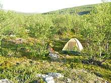
Camping by caravan is possible at least in Karigasniemi and at Muotkan Ruoktu and Kiellatupa. Parking lots maintained by the road administration can also be used, such as at the trailhead of the Kevo trail (see below). There are no camp sites in the wilderness area.
Backcountry
Camping is allowed nearly everywhere, according to the right to access. Using the grounds of wilderness huts or commonly used places is recommended, though, to minimize wearing of the ground.
Stay safe
Tell somebody about your plans, including alternative route and timetables, so that they can start a rescue operation if you do not return on time. You can use Siida for this, but do not forget to tell when you do return, or if you are delayed without an emergency. You can use the emergency number 112 (which can use coverage by any provider) also to tell you are safe.
Proper clothes, equipment and sufficient food supplies are a must, as is sufficient experience. You will have to get by on your own for quite some time in an emergency, and even calling the rescue service requires getting to a place with phone coverage (or to the road, if your phone got wet or out of battery power).
Go next
- The Kevo route (64/78 km), through an impressing canyon to Utsjoki, with starting point at 🌍 Sulaoja (Suttesája) by the Kaamanen–Karigasniemi road, or the 2km nature trail by Sulaoja. Kevo is a nature reserve, check restrictions for the intended season if you want to see it (the nature trail and the Paistunturi wilderness area around the Kevo canyon have few restrictions).