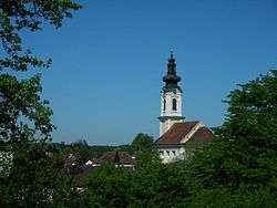
Zell an der Pram
Zell an der Pram is a town and a municipality in the district of Schärding in the Austrian state of Upper Austria.
Zell an der Pram | |
|---|---|
 | |
 Coat of arms | |
 Zell an der Pram Location within Austria | |
| Coordinates: 48°19′00″N 13°38′00″E | |
| Country | Austria |
| State | Upper Austria |
| District | Schärding |
| Government | |
| • Mayor | Matthias Bauer (ÖVP) |
| Area | |
| • Total | 23.37 km2 (9.02 sq mi) |
| Elevation | 367 m (1,204 ft) |
| Population (2018-01-01)[2] | |
| • Total | 2,021 |
| • Density | 86/km2 (220/sq mi) |
| Time zone | UTC+1 (CET) |
| • Summer (DST) | UTC+2 (CEST) |
| Postal code | 4755 |
| Area code | 07764 |
| Vehicle registration | SD |
| Website | www.zell-pram.ooe.gv.at |
Geography
Zell lies in the Innviertel. About 14 percent of the municipality is forest, and 76 percent is farmland.
The municipality includes the following populated places (Ortschaften)[3]
|
|
|
|
gollark: 🌵 💴 ❕
gollark: 🌕 🌵 📡 ❕
gollark: 🌵 🌵 🌵 <:ack:436278437225955330> ❕
gollark: 🌵❕
gollark: 🌵coin!
References
- "Dauersiedlungsraum der Gemeinden Politischen Bezirke und Bundesländer - Gebietsstand 1.1.2018". Statistics Austria. Retrieved 10 March 2019.
- "Einwohnerzahl 1.1.2018 nach Gemeinden mit Status, Gebietsstand 1.1.2018". Statistics Austria. Retrieved 9 March 2019.
- "Bevölkerung am 1.1.2018 nach Ortschaften (Gebietsstand 1.1.2018)" (in German). Bundesanstalt Statistik Österreich.
| Wikimedia Commons has media related to Zell an der Pram. |
| Authority control |
|
|---|
This article is issued from Wikipedia. The text is licensed under Creative Commons - Attribution - Sharealike. Additional terms may apply for the media files.