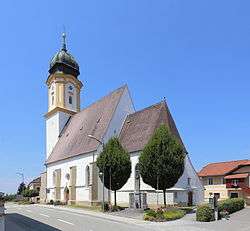
Sankt Willibald
Sankt Willibald, officially St. Willibald, is a municipality in the district of Schärding in the Austrian state of Upper Austria.
Sankt Willibald | |
|---|---|
 | |
 Coat of arms | |
 Sankt Willibald Location within Austria | |
| Coordinates: 48°22′00″N 13°41′00″E | |
| Country | Austria |
| State | Upper Austria |
| District | Schärding |
| Government | |
| • Mayor | Josef Jobst (ÖVP) |
| Area | |
| • Total | 14.51 km2 (5.60 sq mi) |
| Elevation | 455 m (1,493 ft) |
| Population (2018-01-01)[2] | |
| • Total | 1,100 |
| • Density | 76/km2 (200/sq mi) |
| Time zone | UTC+1 (CET) |
| • Summer (DST) | UTC+2 (CEST) |
| Postal code | 4762 |
| Area code | 07762 |
| Vehicle registration | SD |
| Website | www.oberoesterreich. at/st.willibald |
Geography
Sankt Willibald lies in the Innviertel. About 28 percent of the municipality is forest, and 63 percent is farmland.
gollark: Is this related to this?
gollark: No.
gollark: You should consider it. It's quite cool.
gollark: Consider GPT-3, however.
gollark: And deconstructing it probably would have been better, yes, but for whatever reason I didn't.
References
- "Dauersiedlungsraum der Gemeinden Politischen Bezirke und Bundesländer - Gebietsstand 1.1.2018". Statistics Austria. Retrieved 10 March 2019.
- "Einwohnerzahl 1.1.2018 nach Gemeinden mit Status, Gebietsstand 1.1.2018". Statistics Austria. Retrieved 9 March 2019.
| Wikimedia Commons has media related to Sankt Willibald. |
This article is issued from Wikipedia. The text is licensed under Creative Commons - Attribution - Sharealike. Additional terms may apply for the media files.