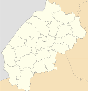
Zadilske
Zadilske (Ukrainian: Заді́льське) – remote selo (village) in Skole Raion, Lviv Oblast, of western Ukraine. [1] Local government is administered by Zadilska village council.[2]
Zadilske Задільське | |
|---|---|
 Zadilske | |
| Coordinates: 48°59′31″N 23°08′05″E | |
| Country | |
| Province | |
| District | Skole Raion |
| Established | 1537 |
| Area | |
| • Total | 2,65 km2 (102 sq mi) |
| Elevation /(average value of) | 716 m (2,349 ft) |
| Population | |
| • Total | 662 |
| • Density | 249,81/km2 (64,700/sq mi) |
| Time zone | UTC+2 (EET) |
| • Summer (DST) | UTC+3 (EEST) |
| Postal code | 82621 |
| Area code | +380 3251 |
| Website | село Задільське (райцентр Сколе, облцентр Львів) (Ukrainian) |
Geography
The village is situated in the Carpathian Mountains on the border district of Skole and Turka Raion. Distance from the regional center Lviv is 160 kilometres (99 mi) , 52 kilometres (32 mi) from the district center Skole, and 129 kilometres (80 mi) from Uzhhorod.
Religious structures
The village has an architectural monument of local importance of Skole Raion – Church of St. Demetrios (wooden) 19th century (1495-M)[3]
gollark: "Good" and "evil" affect your emotional state through something something bits of the nervous system and are thus drugs.
gollark: Actually, it changes your emotional state. So it is.
gollark: Greetings³boi.
gollark: Water isn't a drug due to being present in some drug things. Thus, apiologically, glucose cannot be food due to being part of food.
gollark: Irrelevant. Otherwise-illegal drugs are contained within ADHD medications, which are permitted.
References
- "Zadilske village (Lviv region): street map". drymba.net. Retrieved 20 March 2015.
- "Інформація про : Опис, Зміни, Фото, Карта, Географія". gki.com.ua. Retrieved 20 March 2015.
- Пам'ятки архітектури Сколівського району (in Ukrainian)
This article is issued from Wikipedia. The text is licensed under Creative Commons - Attribution - Sharealike. Additional terms may apply for the media files.