Zacoalco de Torres
Zacoalco de Torres, formerly Zacoalco (Nahuatl languages: Tzacoalco; "place of closed water"), is a town and municipality in Jalisco, Mexico. The municipality covers an area of 491.27 km². It is the primary production region of the equipal-style wood and pigskin furniture.
Zacoalco de Torres | |
|---|---|
City and Municipality | |
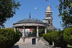 Kiosk in the town square with the tower of the San Francisco Parish visible | |
 Coat of arms | |
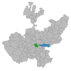 Location of the municipality in the state of Jalisco | |
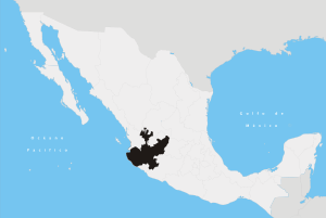
Zacoalco de Torres Location in Mexico | |
| Coordinates: 20°14′N 103°35′W | |
| Country | |
| State | |
| Region | Sur |
| Settled | 1264 |
| Area | |
| • Total | 491.27 km2 (189.68 sq mi) |
| Population (2010) | |
| • Total | 27,901 |
| Time zone | UTC-6 (Central Standard Time) |
| • Summer (DST) | UTC-5 (Central Daylight Time) |
| Area code(s) | 33 |
| Website | zacoalcodetorres.gob.mx |
As of 2005, the municipality had a total population of 30,528.[1]
To the east lies the largest lake in Mexico, La Playita.
Climate
| Climate data for Zacoalco de Torres | |||||||||||||
|---|---|---|---|---|---|---|---|---|---|---|---|---|---|
| Month | Jan | Feb | Mar | Apr | May | Jun | Jul | Aug | Sep | Oct | Nov | Dec | Year |
| Average high °C (°F) | 26.4 (79.5) |
28.4 (83.1) |
31.0 (87.8) |
33.0 (91.4) |
33.8 (92.8) |
31.6 (88.9) |
28.7 (83.7) |
28.5 (83.3) |
28.1 (82.6) |
28.1 (82.6) |
28 (82) |
26.3 (79.3) |
29.3 (84.7) |
| Average low °C (°F) | 9.2 (48.6) |
9.8 (49.6) |
11.7 (53.1) |
13.8 (56.8) |
16.0 (60.8) |
17.6 (63.7) |
17 (63) |
17.3 (63.1) |
17.1 (62.8) |
15.5 (59.9) |
11.9 (53.4) |
9.8 (49.6) |
14 (57) |
| Average precipitation mm (inches) | 10 (0.4) |
2.5 (0.1) |
0 (0) |
2.5 (0.1) |
10 (0.4) |
94 (3.7) |
130 (5.1) |
84 (3.3) |
94 (3.7) |
30 (1.2) |
5.1 (0.2) |
5.1 (0.2) |
470 (18.4) |
| Source: Weatherbase [2] | |||||||||||||
gollark: Also not-very-expressiveness.
gollark: Unsafety, that's basically it.
gollark: But it's okay, and at least it's not C or something!
gollark: It's unfortunate that we got THIS as the way to develop basically everything for the interweb™.
gollark: More so than JS, arguably.
References
- "Zacoalco de Torres". Enciclopedia de los Municipios de México. Instituto Nacional para el Federalismo y el Desarrollo Municipal. Retrieved April 20, 2009.
- "Weatherbase: Historical Weather for Zacoalco de Torres, Jalisco". Weatherbase. 2011. Retrieved on November 24, 2011.
This article is issued from Wikipedia. The text is licensed under Creative Commons - Attribution - Sharealike. Additional terms may apply for the media files.