Yellow River (Pensacola Bay)
The Yellow River (historically known as the Chester River)[2] is a 118-mile-long (190 km)[3] river in the southern United States which runs through Alabama and Florida. It empties into Blackwater Bay, an arm of Pensacola Bay.
| Yellow River Chester River | |
|---|---|
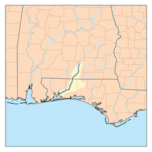 Map of the Yellow River | |
| Location | |
| Country | United States |
| State | Alabama and Florida |
| Physical characteristics | |
| Source | |
| • location | Covington County, Alabama[1] |
| • coordinates | 31.45655°N 86.33467°W |
| Mouth | |
• location | Santa Rosa County, Florida[1] |
• coordinates | 30.55741°N 86.99524°W |
| Length | 118 miles (190 km) |
References
- U.S. Geological Survey Geographic Names Information System: Yellow River (Pensacola Bay)
- "The Coast of West Florida and Louisiana. - David Rumsey Historical Map Collection". www.davidrumsey.com. Retrieved 2020-06-16.
- U.S. Geological Survey. National Hydrography Dataset high-resolution flowline data. The National Map, accessed April 15, 2011
| Authority control |
|
|---|
This article is issued from Wikipedia. The text is licensed under Creative Commons - Attribution - Sharealike. Additional terms may apply for the media files.