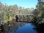
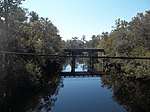
Sopchoppy River
The Sopchoppy River is a minor river in the Florida Big Bend. A tributary of the Ochlockonee River, it is approximately 46 miles (74 km) in length[1] and nearly entirely within Wakulla County, with only a small part of its East Branch entering Leon County.
| Sopchoppy River | |
|---|---|
| Location | |
| Country | United States |
| State | Florida |
| Counties | Leon, Wakulla |
| District | NWFWMD |
| Physical characteristics | |
| Source | East Branch |
| • location | Apalachicola National Forest, Leon County, Florida |
| • coordinates | 30°18′29″N 84°34′38″W |
| Mouth | Ochlockonee Bay |
• location | Surf, Wakulla County, Florida |
• coordinates | 29°59′23″N 84°25′56″W |
| Length | 46 mi (74 km) |
| Basin size | 330 sq mi (850 km2) |
| Discharge | |
| • location | Sopchoppy, Florida |
| • average | 5.6 m3/s (200 cu ft/s) |
| • minimum | 1.8 m3/s (64 cu ft/s) |
| • maximum | 8.9 m3/s (310 cu ft/s) |
| Basin features | |
| Tributaries | |
| • left | Buckhorn Creek |
| • right | Monkey Creek |
The river flows through the Apalachicola National Forest and the Bradwell Bay Wilderness, in addition to through the town of Sopchoppy, and a canoe trail 15 miles (24 km) in length is designated along its length from the Oak Park Cemetery Bridge to US 319.
List of crossings
| Crossing | Carries | Image | Location | Coordinates |
|---|---|---|---|---|
| Forest Road 306 | (East Branch) | 30°17′58″N 84°34′50″W | ||
| Forest Road 344 | (West Branch) | 30°15′56″N 84°37′07″W | ||
| Forest Road 309 | (West Branch) (East Branch) |
30°15′32″N 84°35′52″W 30°15′19″N 84°35′23″W | ||
| Convergence of East and West Branches | ||||
| Forest Highway 13 | 30°13′50″N 84°32′17″W | |||
| Forest Road 329 | 30°10′13″N 84°29′54″W | |||
| Oak Park Cemetery Bridge | Forest Road 346 | 30°07′47″N 84°29′37″W | ||
| Mount Beasor Road | 30°05′52″N 84°31′09″W | |||
Smith Creek Road |
 |
Sopchoppy | 30°03′49″N 84°30′02″W | |
| CR 22 Rose Street |
 |
Sopchoppy | 30°03′46″N 84°30′03″W | |
Sopchoppy Highway |
Sopchoppy | 30°01′20″N 84°25′59″W | ||
gollark: Seems like it's still loading then, possibly?
gollark: Please check the "network" tab.
gollark: It doesn't do that for me. Maybe your connection is [REDACTED].
gollark: Please ensure a sensibly configured volume setting.
gollark: https://radio.osmarks.net/
References
- Boning, Charles R. 2007. Florida's Rivers. Sarasota, Florida: Pineapple Press, Inc. ISBN 978-1-56164-400-1
- Northwest Florida Water Management District: Major Water Bodies
- USGS: Sopchoppy River near Sopchoppy, Florida (Station 02327100)
- Sopchoppy River by Frank Howard
- DEP: Sopchoppy River Canoe Trail
This article is issued from Wikipedia. The text is licensed under Creative Commons - Attribution - Sharealike. Additional terms may apply for the media files.