Yellepit, Washington
Yellepit was an unincorporated community in Benton County, Washington, United States, located approximately three miles southwest of Wallula on the west bank of the Columbia River.
Yellepit, Washington | |
|---|---|
Former unincorporated community | |
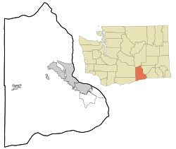 Yellepit, Washington Location of Yellepit, Washington | |
| Coordinates: 46°03′39″N 118°57′05″W[1] | |
| Country | United States |
| State | Washington |
| County | Benton |
| Elevation | 341 ft (104 m) |
| Time zone | UTC-8 (Pacific (PST)) |
| • Summer (DST) | UTC-7 (PDT) |
| ZIP code | 99337 |
| Area code(s) | 509 |
| GNIS feature ID | 1511443[2] |
History
The community was named Yellepit in honor of a chief of the Walla Walla tribe who was encountered by the Lewis and Clark Expedition.[3] The community once had a large train depot, water tank and other buildings. In 1953 the community site was inundated by the waters of Lake Wallula.[4]
gollark: However, deleting the registry will not *actually* break anything.
gollark: That won't actually happen. Which is a bit of an oversight, I must admit.
gollark: ...
gollark: I doubt it, but go on.
gollark: This isn't exactly addressing that, but basically for obvious security reasons all user-controlled things must run in the sandbox.
References
- "Yellepit". Geographic Names Information System. United States Geological Survey. Retrieved 2012-10-28.
- "US Board on Geographic Names". United States Geological Survey. 2007-10-25. Retrieved 2008-01-31.
- "Station Roster Master List: Yellepit". Northern Pacific Railway Historical Association. Retrieved October 30, 2012.
- "Washington Place Names database". Tacoma Public Library. Retrieved October 30, 2012.
External links
Municipalities and communities of Benton County, Washington, United States | ||
|---|---|---|
| Cities | 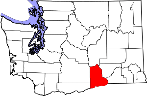 Map of Washington highlighting Benton County | |
| CDPs | ||
| Unincorporated communities | ||
| Ghost towns | ||

This article is issued from Wikipedia. The text is licensed under Creative Commons - Attribution - Sharealike. Additional terms may apply for the media files.