Wolcott, Colorado
Wolcott is a census-designated place (CDP) and a U.S. Post Office located in Eagle County, Colorado, United States. The population as of the 2010 census was 15.[3] The Wolcott Post Office has the ZIP Code 81655.[2]
Wolcott, Colorado | |
|---|---|
Bridge over Eagle River in Wolcott | |
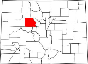
 Wolcott Location in Eagle County and the state of Colorado | |
| Coordinates: 39°42′10″N 106°40′42″W | |
| Country | |
| State | |
| County | Eagle County[1] |
| Area | |
| • Total | 0.39 sq mi (1.00 km2) |
| • Land | 0.37 sq mi (0.96 km2) |
| • Water | 0.02 sq mi (0.04 km2) |
| Elevation | 6,990 ft (2,130 m) |
| Population (2010) | |
| • Total | 15 |
| • Density | 40/sq mi (15.6/km2) |
| Time zone | UTC-7 (MST) |
| • Summer (DST) | UTC-6 (MDT) |
| ZIP code[2] | 81655 |
| GNIS feature ID | 0204665 |
| FIPS code | 08-85760 |
A post office called Wolcott has been in operation since 1889.[4] The community was named after Edward O. Wolcott, a United States Senator from Colorado.[5]
Geography
Wolcott is located in central Eagle County at 39°42′10″N 106°40′42″W (39.702696,-106.678448), in the valley of the Eagle River, a west-flowing tributary of the Colorado River. U.S. Route 6 passes through the community, following the river, while Interstate 70 forms the southern edge of the CDP, with access from Exit 157. I-70 and US-6 each lead 7 miles (11 km) east to Edwards and west 10 miles (16 km) to Eagle, the county seat. Colorado State Highway 131 intersects I-70 at Exit 157, passes through the center of Wolcott, and leads north 72 miles (116 km) to Steamboat Springs.
Demographics
| Historical population | |||
|---|---|---|---|
| Census | Pop. | %± | |
| U.S. Decennial Census[6] | |||
See also
- Outline of Colorado
- State of Colorado
- Colorado cities and towns
- Colorado census designated places
- Colorado counties
- Colorado metropolitan areas
- Colorado cities and towns
- List of cities and towns in Colorado
- Eagle County, Colorado
References
- "US Board on Geographic Names". United States Geological Survey. 2007-10-25. Retrieved 2008-01-31.
- "ZIP Code Lookup" (JavaScript/HTML). United States Postal Service. January 3, 2007. Retrieved January 3, 2007.
- Colorado Trend Report 2: State and Complete Places (Sub-state 2010 Census Data). Missouri Census Data Center. Accessed 2011-02-25.
- "Post offices". Jim Forte Postal History. Retrieved 11 July 2016.
- Dawson, John Frank. Place names in Colorado: why 700 communities were so named, 150 of Spanish or Indian origin. Denver, CO: The J. Frank Dawson Publishing Co. p. 52.
- "Census of Population and Housing". Census.gov. Retrieved June 4, 2016.
