Winnipeg Route 25
Route 25 is a city route in the Canadian city of Winnipeg, Manitoba. It follows Inkster Boulevard from Route 90 (Brookside Boulevard) to Route 180 (McPhillips Street). West of Route 90, Inkster Boulevard becomes PTH 190 (CentrePort Canada Way) as it leaves Winnipeg and enters the Rural Municipality of Rosser.[2] East of McPhillips, Inkster continues to Route 52 (Main Street), but this is not part of Route 25.
| ||||
|---|---|---|---|---|
| Inkster Boulevard | ||||
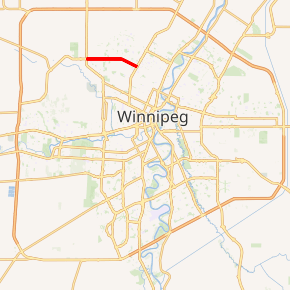
Route 25 highlighted in red | ||||
| Route information | ||||
| Maintained by City of Winnipeg | ||||
| Length | 5.8 km[1] (3.6 mi) | |||
| Existed | 1966–present | |||
| Major junctions | ||||
| West end | Route 90 (Brookside Blvd) / PTH 190 west (CentrePort Canada Way) | |||
| East end | Route 180 (McPhillips St) | |||
| Highway system | ||||
| Manitoba provincial highways Winnipeg City Routes
| ||||

The route is a major road running through residential and industrial areas.[2] The speed limit between Keewatin Street and Route 180 is 60 km/h (35 mph) while the speed limit between Route 90 and Keewatin Street is 70 km/h (45 mph).
Major intersections
The entire route is in Winnipeg.
| km[1] | mi | Destinations | Notes | ||
|---|---|---|---|---|---|
| 0.0 | 0.0 | Route 25 western terminus; continues as PTH 190 | |||
| 3.2 | 2.0 | Keewatin Street | |||
| 5.8 | 3.6 | Route 25 eastern terminus | |||
| 7.6 | 4.7 | McGregor Street | |||
| 8.7 | 5.4 | ||||
| 9.6 | 6.0 | Scotia Street | Inkster Blvd eastern terminus | ||
1.000 mi = 1.609 km; 1.000 km = 0.621 mi
| |||||
gollark: Yes, you can DEFINITELY accurately predict that far into the future.
gollark: I can be supreme eternal world dictator for life, and a hypothetical governance AI *vice* supreme eternal world dictator for life.
gollark: Also, you could not actually trust it.
gollark: AI is simply not good enough yet. The only solution is me as supreme eternal world dictator for life.
gollark: I see.
References
- Google (January 14, 2019). "Route 25 in Winnipeg, MB" (Map). Google Maps. Google. Retrieved January 14, 2019.
- "CentrePort Canada Way - Trade Route Investments - $292.6 million". Government of Manitoba. Retrieved October 25, 2014.
This article is issued from Wikipedia. The text is licensed under Creative Commons - Attribution - Sharealike. Additional terms may apply for the media files.