Wigginton, North Yorkshire
Wigginton is a village and civil parish in the unitary authority of the City of York in North Yorkshire, England. It is situated 4 miles (6.4 km) north of York. According to the 2001 census the parish had a population of 3,714, reducing to 3,610 at the 2011 Census.[1] Prior to 1996 it had been part of the Ryedale district.
| Wigginton | |
|---|---|
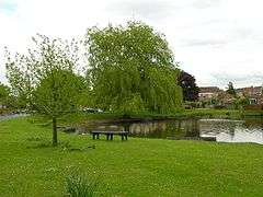 The village pond | |
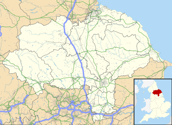 Wigginton Location within North Yorkshire | |
| Population | 3,610 (2011) |
| OS grid reference | SE594585 |
| Civil parish |
|
| Unitary authority |
|
| Ceremonial county | |
| Region | |
| Country | England |
| Sovereign state | United Kingdom |
| Post town | YORK |
| Postcode district | YO32 |
| Police | North Yorkshire |
| Fire | North Yorkshire |
| Ambulance | Yorkshire |
| UK Parliament | |
Wigginton is bordered on the east by the township of Haxby, the A1237 York Outer ring Road to the south, the B1363 to the west and open farmland to the north.
History
The village name derives from the Old English pre-7th century personal name "Wicga", meaning "a beetle", plus the Old English suffix, "-tun", meaning a "settlement or enclosure, hence "Wigca's settlement".[2]
The village was named in the Domesday Book and noted as belonging to the cathedral church of St Peter in York. The name of the village has been recorded as Wichestun in the 11th century and Wygynton in the 13th century. The first recorded owners of the manor were the Askebys, who may have been connected with the neighbouring village of Haxby, and of Roger de Haxbey, who owned nearby land during the reign of Edward I. Hugh de Moresby, Lord of Moresby in Cumberland, was in possession of the manor of Wigginton in 1337. Through inheritance and marriage the manor passed to Anne Pickering and her second husband, Sir Henry Knyvett. She sold the manor with others in 1541 to Henry VIII, but his heir, Edward VI, granted them back to Anne and Henry in 1548.[3]
Governance
Wigginton was in the Vale of York parliamentary constituency until the 2010 general election when it was transferred to the newly created constituency of York Outer. In that election the Conservative Party candidate, Julian Sturdy, was elected having received 43% of the vote and a majority of 3,688 over the Liberal Democrat candidate.[4]
The town is located within the Haxby and Wigginton Ward of the York Unitary Authority. As of May 2019 it is represented by Councillors Andrew Hollyer (Liberal Democrat), Edward Pearson (Liberal Democrat) and Ian Cuthbertson (Liberal Democrat).[5]
Demography
In 1872 the population was recorded as 349.[6] In the National Census of 1881 the population had risen to 399.[7] According to the 2001 census the parish had a population of 3,714.
Geography
The town sits on flat ground consisting mostly of clay with soil that is sand and alluvium.[7] To the west of the village is Westfield Beck. The nearby town of Haxby now merges with Wigginton though the old Parish Boundary map still shows the dividing line. This runs east to west along the back of the houses on Wheatfield Drive on its southern edge as far as Barley Drive. Here it turns northward cutting across Greenshaw Drive until it reaches the road known The Village. The boundary follows this road until it turns west. The boundary at this point continues northward cutting across Windsor Drive near Ripley Grove and then out into the countryside.
Economy
Wigginton has expanded from a mainly agricultural origin to become mostly a commuter village for York. Wigginton has a number of businesses, a garden centre, two farm shops, hairdressers and chiropodists, a nursing home, a village store and three public houses. Also a small arcade of shops are on Sutton Road.
Transport
As of 2019 First York operate a bus service in the town as part of the Chapelfields to Wigginton route. The Acomb Park to Haxby route is operated by ConneXionsbuses.[8] Yorkshire Coastliner operate the Rawcliffe to Monks Cross and Osbaldwick bus service which stops in the town.[9] Reliance Motor Services operate a service that stops in the village on the B1363 as part of its York to Easingwold route.[10]
Education
Primary education is catered for at Wigginton Primary School.[11] As of 2018, the town is within the catchment area of Joseph Rowntree Secondary School.[12]
Religious sites
The present parish church is dedicated to St Nicholas. The first specific mention of a church building was in 1424 and of a chapel at Wigginton in the middle of the 13th century. The present church of St Nicholas was rededicated in 2008 having previously been known as St Mary & St Nicholas. It had been rebuilt in 1860.[13]
Sport
As of 2010, Wigginton Grasshoppers F.C.82 football club 1st XI play in the York and District Premier Division and the Reserve Team play in the Reserve Division A. They also provide teams across the full age range to various local weekend leagues.[14]
The town is also the home of Wigginton Squash and Racketball Club, a thriving and friendly 3 court Squash & Racketball Club, with bar, lounge and function facility. The club has been men’s Yorkshire League Champions on 3 occasions, and supports the local York & District Squash leagues with 6 men’s & 2 ladies teams. Juniors also play league squash for the club. The club currently have one Yorkshire League team.
Bibliography
A Hundred Years at Sunnyside (in the village of Wigginton near York), written by John Edwin Gates and published by blurb.com, is an account of life in Wigginton from 1912 to 2011. Stephen Lewis of the York Press wrote: "A Hundred Years at Sunnyside gives some delightful glimpses into the life of a York Butcher 100 years ago... an affectionate tribute to the family and the childhood home John left behind in York, as well as to a way of life sadly now long vanished".[15]
Gallery
.jpg) St Nicholas church
St Nicholas church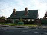 Wigginton Old School building
 Wigginton Black Horse public house
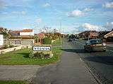 Wigginton
References
- "Civil Parish population 2011". Neighbourhood Statistics. Office for National Statistics. Retrieved 20 February 2016.
- "Village name". Retrieved 4 December 2010.
- "Church". Retrieved 4 December 2010.
- "Election result". BBC News. Retrieved 20 November 2010.
- "Councillor details - Councillor Ian Cuthbertson". Retrieved 18 June 2017.
- "Population". Retrieved 4 December 2010.
- Bulmer's Topography, History and Directory (Private and Commercial) of North Yorkshire 1890. S&N Publishing. 1890. p. 850. ISBN 1-86150-299-0.
- "Bus Services". Retrieved 20 November 2010.
- "Bus Services". Archived from the original on 19 August 2010. Retrieved 20 November 2010.
- "Reliance Bus Route". Retrieved 4 December 2010.
- "Primary School". Retrieved 4 December 2010.
- "Guide to School Catchment Areas" (PDF). york.gov.uk. p. 59. Retrieved 6 August 2018.
- "St Nicholas Church". Retrieved 4 December 2010.
- "Wigginton Grasshoppers". Retrieved 4 December 2010.
- Lewis, Stephen (21 November 2011). "Book reveals history of Wigginton house". York Press. Retrieved 4 November 2017.
External links
![]()