West Boone Township, Bates County, Missouri
West Boone Township is one of twenty-four townships in Bates County, Missouri, and is part of the Kansas City metropolitan area within the USA. As of the 2000 census, its population was 582.[1]
West Boone Township | |
|---|---|
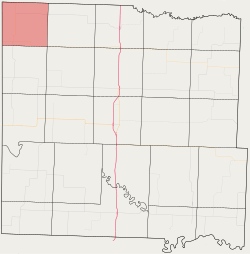 Location in Bates County | |
| Coordinates: 38°23′55″N 94°32′28″W | |
| Country | |
| State | |
| County | Bates |
| Area | |
| • Total | 30.24 sq mi (78.33 km2) |
| • Land | 30.06 sq mi (77.86 km2) |
| • Water | 0.18 sq mi (0.47 km2) 0.6% |
| Elevation | 892 ft (272 m) |
| Population (2000) | |
| • Total | 582 |
| • Density | 19.4/sq mi (7.5/km2) |
| Time zone | UTC-6 (CST) |
| • Summer (DST) | UTC-5 (CDT) |
| ZIP codes | 64723, 64742 |
| GNIS feature ID | 0766311 |
West Boone Township derives its name from the pioneer Daniel Boone.[2]
Geography
According to the United States Census Bureau, West Boone Township covers an area of 30.24 square miles (78.33 square kilometers); of this, 30.06 square miles (77.86 square kilometers, 99.4 percent) is land and 0.18 square miles (0.47 square kilometers, 0.6 percent) is water.
Unincorporated towns
- South Drexel at 38.476404°N 94.608844°W
(This list is based on USGS data and may include former settlements.)
Adjacent townships
- Coldwater Township, Cass County (north)
- Everett Township, Cass County (northeast)
- East Boone Township (east)
- Elkhart Township (southeast)
- West Point Township (south)
- Sugar Creek Township, Miami County, Kansas (west)
Cemeteries
The township contains Edgewood Cemetery.
Airports and landing strips
- Arvin Ranch Airport
School districts
- Drexel R-IV
- Miami R-I
Political districts
- Missouri's 4th congressional district
- State House District 120
- State House District 125
- State Senate District 31
gollark: It's highly advanced.
gollark: It has an actual E2EE option.
gollark: Maybe Discord has a backup internal IRC server for when Discord goes down.
gollark: What LyricLy doesn't know is that they are technically being simulated on a highly advanced virtual osmarkscomputer™ run using quirks in the IRC protocol on our arbitrarily powerful IRC servers.
gollark: I mean, technically, yes.
References
- United States Census Bureau 2008 TIGER/Line Shapefiles
- United States Board on Geographic Names (GNIS)
- United States National Atlas
- "U.S. Census website". Retrieved 2009-05-17.
- "Bates County Place Names, 1928-1945 (archived)". The State Historical Society of Missouri. Archived from the original on 24 June 2016. Retrieved 1 September 2016.
External links
Places adjacent to West Boone Township, Bates County, Missouri | ||||||||||
|---|---|---|---|---|---|---|---|---|---|---|
| ||||||||||
Municipalities and communities of Bates County, Missouri, United States | ||
|---|---|---|
| Cities | 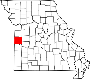 Map of Missouri highlighting Bates County | |
| Villages | ||
| Townships | ||
| Unincorporated communities | ||
| Ghost towns | ||
| Footnotes | ‡This populated place also has portions in an adjacent county or counties | |
This article is issued from Wikipedia. The text is licensed under Creative Commons - Attribution - Sharealike. Additional terms may apply for the media files.