Mount Pleasant Township, Bates County, Missouri
Mount Pleasant Township is one of twenty-four townships in Bates County, Missouri, and is part of the Kansas City metropolitan area within the USA. As of the 2000 census, its population was 5,060.[1]
Mount Pleasant Township | |
|---|---|
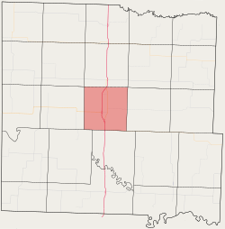 Location in Bates County | |
| Coordinates: 38°15′26″N 94°20′39″W | |
| Country | |
| State | |
| County | Bates |
| Area | |
| • Total | 35.95 sq mi (93.11 km2) |
| • Land | 35.79 sq mi (92.71 km2) |
| • Water | 0.16 sq mi (0.41 km2) 0.44% |
| Elevation | 837 ft (255 m) |
| Population (2000) | |
| • Total | 5,060 |
| • Density | 141.4/sq mi (54.6/km2) |
| Time zone | UTC-6 (CST) |
| • Summer (DST) | UTC-5 (CDT) |
| ZIP code | 64730 |
| GNIS feature ID | 0766301 |
The township was descriptively named.[2]
Geography
According to the United States Census Bureau, Mount Pleasant Township covers an area of 35.95 square miles (93.11 square kilometers); of this, 35.79 square miles (92.71 square kilometers, 99.57 percent) is land and 0.16 square miles (0.41 square kilometers, 0.44 percent) is water.
Cities, towns, villages
Adjacent townships
- Mound Township (north)
- Shawnee Township (northeast)
- Summit Township (east)
- Lone Oak Township (south)
- New Home Township (southwest)
- Charlotte Township (west)
- Elkhart Township (northwest)
Cemeteries
The township contains these two cemeteries: Morris and Oak Hill.
Major highways
Airports and landing strips
- Bates County Hospital Heliport
- Butler Memorial Airport
Lakes
- Butler Recreational Lake
- Kennedy Lake
Landmarks
- Butler Country Club Golf Course
- Butler Golf Course
School districts
- Butler R-V School District
Political districts
- Missouri's 4th congressional district
- State House District 125
- State Senate District 31
gollark: Surely this could be automated via figlet?
gollark: Great.
gollark: I see Robot Uprising is pontificating heavily on smooth infinitesimal analysis.
gollark: https://en.wikipedia.org/wiki/Smooth_infinitesimal_analysis
gollark: Factually incorrect.
References
- United States Census Bureau 2008 TIGER/Line Shapefiles
- United States Board on Geographic Names (GNIS)
- United States National Atlas
- "U.S. Census website". Retrieved 2009-05-17.
- "Bates County Place Names, 1928-1945 (archived)". The State Historical Society of Missouri. Archived from the original on 24 June 2016. Retrieved 1 September 2016.CS1 maint: BOT: original-url status unknown (link)
External links
Places adjacent to Mount Pleasant Township, Bates County, Missouri | ||||||||||
|---|---|---|---|---|---|---|---|---|---|---|
| ||||||||||
Municipalities and communities of Bates County, Missouri, United States | ||
|---|---|---|
| Cities | 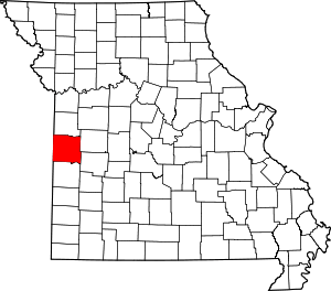 Map of Missouri highlighting Bates County | |
| Villages | ||
| Townships | ||
| Unincorporated communities | ||
| Ghost towns | ||
| Footnotes | ‡This populated place also has portions in an adjacent county or counties | |
This article is issued from Wikipedia. The text is licensed under Creative Commons - Attribution - Sharealike. Additional terms may apply for the media files.