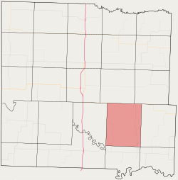
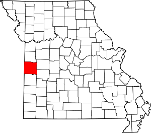
Pleasant Gap Township, Bates County, Missouri
Pleasant Gap Township is one of twenty-four townships in Bates County, Missouri, and is part of the Kansas City metropolitan area within the USA. As of the 2000 census, its population was 264.[1]
Pleasant Gap Township | |
|---|---|
 Location in Bates County | |
| Coordinates: 38°09′28″N 94°13′09″W | |
| Country | |
| State | |
| County | Bates |
| Area | |
| • Total | 45.64 sq mi (118.22 km2) |
| • Land | 45.61 sq mi (118.12 km2) |
| • Water | 0.04 sq mi (0.1 km2) 0.08% |
| Elevation | 820 ft (250 m) |
| Population (2000) | |
| • Total | 264 |
| • Density | 5.8/sq mi (2.2/km2) |
| Time zone | UTC-6 (CST) |
| • Summer (DST) | UTC-5 (CDT) |
| ZIP codes | 64724, 64730, 64779 |
| GNIS feature ID | 0766304 |
The township took its name from the community of Pleasant Gap, Missouri.[2]
Geography
According to the United States Census Bureau, Pleasant Gap Township covers an area of 45.64 square miles (118.22 square kilometers); of this, 45.61 square miles (118.12 square kilometers, 99.92 percent) is land and 0.04 square miles (0.1 square kilometers, 0.08 percent) is water.
Unincorporated towns
(This list is based on USGS data and may include former settlements.)
Adjacent townships
- Summit Township (north)
- Deepwater Township (northeast)
- Hudson Township (east)
- Rockville Township (southeast)
- Prairie Township (south)
- Lone Oak Township (west)
Cemeteries
The township contains Rogers Cemetery.
Major highways
Airports and landing strips
- Bauer PGI Airport
School districts
- Butler R-V School District
- Rich Hill R-IV
Political districts
- Missouri's 4th congressional district
- State House District 120
- State House District 125
- State Senate District 31
gollark: Detector rails? I guess so.
gollark: Redstone can't sense where the minecarts are and what direction they're moving, and it would be possible but really really hard to implement A* in it for the routing.
gollark: I'm pretty sure that's impossible.
gollark: No.
gollark: It's a server called SwitchCraft. There's basically just ComputerCraft and accessory mods.
References
- United States Census Bureau 2008 TIGER/Line Shapefiles
- United States Board on Geographic Names (GNIS)
- United States National Atlas
- "U.S. Census website". Retrieved 2009-05-17.
- "Bates County Place Names, 1928-1945 (archived)". The State Historical Society of Missouri. Archived from the original on 24 June 2016. Retrieved 1 September 2016.CS1 maint: BOT: original-url status unknown (link)
External links
This article is issued from Wikipedia. The text is licensed under Creative Commons - Attribution - Sharealike. Additional terms may apply for the media files.
