Washington Township, Brown County, Indiana
Washington Township is one of four townships in Brown County, Indiana. As of the 2010 census, its population was 4,896 and it contained 2,519 housing units.[3] The township includes the northern portion of Brown County State Park.
Washington Township | |
|---|---|
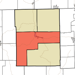 Location of Washington Township in Brown County | |
| Coordinates: 39°10′03″N 86°15′48″W | |
| Country | United States |
| State | Indiana |
| County | Brown |
| Government | |
| • Type | Indiana township |
| Area | |
| • Total | 102 sq mi (260 km2) |
| • Land | 99.42 sq mi (257.5 km2) |
| • Water | 2.58 sq mi (6.7 km2) |
| Elevation | 755 ft (230 m) |
| Population (2010) | |
| • Total | 4,896 |
| • Density | 49.2/sq mi (19.0/km2) |
| FIPS code | 18-80396[2] |
| GNIS feature ID | 453984 |
History
Washington Township was established in 1836.[4]
The Brown County Bridge No. 36 and Theodore Clement Steele House and Studio are listed on the National Register of Historic Places.[5]
Geography
According to the 2010 census, the township has a total area of 102 square miles (260 km2), of which 99.42 square miles (257.5 km2) (or 97.47%) is land and 2.58 square miles (6.7 km2) (or 2.53%) is water.[3] Axsom Branch Pond and Terrill Ridge Pond are in this township.
Cities and towns
Unincorporated towns
- Annandale Estates
- Belmont
- Camp Roberts
- Clarksdale
- Gnaw Bone
- Mount Liberty
- Town Hill
- West Overlook
(This list is based on USGS data and may include former settlements.)
Adjacent townships
- Hamblen (northeast)
- Jackson (north)
- Van Buren (southeast)
- Benton Township, Monroe County (northwest)
- Camp Atterbury (northeast)
- Harrison Township, Bartholomew County (east)
- Polk Township, Monroe County (southwest)
- Salt Creek Township, Jackson County (south)
- Salt Creek Township, Monroe County (west)
Major highways
Cemeteries
The township contains eight cemeteries: Clark, Crouch, David, Dobbs, Hickory Hill, Marlett, Pittman, South View, and Terrill.
References
- "US Board on Geographic Names". United States Geological Survey. 2007-10-25. Retrieved 2008-01-31.
- "U.S. Census website". United States Census Bureau. Retrieved 2008-01-31.
- "Population, Housing Units, Area, and Density: 2010 - County -- County Subdivision and Place -- 2010 Census Summary File 1". United States Census. Archived from the original on 2020-02-12. Retrieved 2013-05-10.
- Blanchard, Charles (1884). Counties of Morgan, Monroe and Brown, Indiana: Historical and Biographical. F.A. Battey & Company. pp. 683.
- "National Register Information System". National Register of Historic Places. National Park Service. July 9, 2010.
External links
- Foxfire Park Located downtown Nashville, Foxfire Park is home to Festivals, Arts and Crafts Fairs, Car Shows, and home to the annual Fall Fine Arts Festival which showcases over 200 Artists from around the Midwest.
- Indiana Township Association
- United Township Association of Indiana
- Town of Nashville
Municipalities and communities of Brown County, Indiana, United States | ||
|---|---|---|
| Town | Map of Indiana highlighting Brown County | |
| Townships | ||
| CDP | ||
| Other unincorporated communities |
| |
| Footnotes | ‡This populated place also has portions in an adjacent county or counties | |
| Authority control |
|
|---|