Clarksdale, Indiana
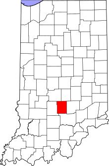
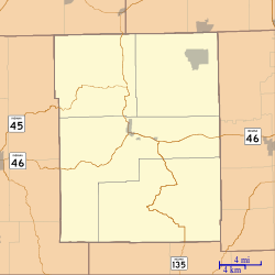
Clarksdale is an unincorporated community in Washington Township, Brown County, in the U.S. state of Indiana.[3][4]
Clarksdale, Indiana | |
|---|---|
 Brown County's location in Indiana | |
 Clarksdale Location in Brown County | |
| Coordinates: 39°12′00″N 86°07′34″W | |
| Country | United States |
| State | Indiana |
| County | Brown |
| Township | Washington |
| Elevation | 679 ft (207 m) |
| Time zone | UTC-5 (Eastern (EST)) |
| • Summer (DST) | UTC-4 (EDT) |
| ZIP code | 47448 |
| Area code(s) | 812 & 930 |
| FIPS code | 18-12890[2] |
| GNIS feature ID | 432574 |
The community was named in honor of George Rogers Clark.
Geography
Clarksdale is located at 39°12′00″N 86°07′34″W.
gollark: What's a "closed form"?
gollark: You missed sqrt(sqrt(2)) + n.
gollark: Just delete them with orbital bee strikes.
gollark: I mean, that at least has a competent-ish FPU.
gollark: My brain has even less capacity, defined some ways, than osmarks.tk's ternary server.
References
- "US Board on Geographic Names". United States Geological Survey. 2007-10-25. Retrieved 2008-01-31.
- "U.S. Census website". United States Census Bureau. Retrieved 2008-01-31.
- "Clarksdale, Indiana". Geographic Names Information System. United States Geological Survey. Retrieved March 8, 2020.
- Clarksdale Topo Zone in Brown County IN
- Inman, N. Carol (1991). The Origins of 1001 Towns In Indiana. Indiana State Historical Association.
This article is issued from Wikipedia. The text is licensed under Creative Commons - Attribution - Sharealike. Additional terms may apply for the media files.