Fruitdale, Indiana
Fruitdale is an unincorporated community in Jackson Township, Brown County, in the U.S. state of Indiana.[3]
Fruitdale, Indiana | |
|---|---|
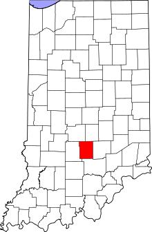
 Brown County's location in Indiana | |
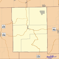
 Fruitdale Location in Brown County | |
| Coordinates: 39°19′19″N 86°15′28″W | |
| Country | United States |
| State | Indiana |
| County | Brown |
| Township | Jackson |
| Elevation | 843 ft (257 m) |
| Time zone | UTC-5 (Eastern (EST)) |
| • Summer (DST) | UTC-4 (EDT) |
| ZIP code | 46160 |
| Area code(s) | 812 & 930 |
| FIPS code | 18-26080[2] |
| GNIS feature ID | 434882 |
History
A post office was established at Fruitdale in 1909, and remained in operation until 1937.[4] The community was likely named from fruit orchards nearby.[5]
Geography
Fruitdale is located at 39°19′19″N 86°15′28″W.
gollark: Try and avoid attracting the attention of the Authority Figures™!
gollark: Oh, alternative gulag game idea: it's a regular forum, except some people are randomly selected as Authority Figures™ and can click a button to gulag someone.
gollark: It has a list of users and you can click a button to gulag them, and then you see how long it takes for everyone to be gulaged.
gollark: Well, with a bunch of backend logic, I could probably have a gulag game.
gollark: Game idea: you click the button and it permanently adds random nuclear impact craters to pages on osmarks.tk.
References
- "US Board on Geographic Names". United States Geological Survey. 2007-10-25. Retrieved 2008-01-31.
- "U.S. Census website". United States Census Bureau. Retrieved 2008-01-31.
- "Fruitdale, Indiana". Geographic Names Information System. United States Geological Survey. Retrieved March 7, 2020.
- "Brown County". Jim Forte Postal History. Archived from the original on 3 September 2014. Retrieved 28 August 2014.
- Baker, Ronald L. (October 1995). From Needmore to Prosperity: Hoosier Place Names in Folklore and History. Indiana University Press. p. 140. ISBN 978-0-253-32866-3.
...it is generally believed that it comes from the location of the village, in the fruit belt.
This article is issued from Wikipedia. The text is licensed under Creative Commons - Attribution - Sharealike. Additional terms may apply for the media files.