Washburn (CDP), Maine
Washburn is a census-designated place (CDP) comprising the main village within the town of Washburn in Aroostook County, Maine, United States. The population of the CDP was 997 at the 2010 census,[1] out of a population of 1,687 for the entire town.
Washburn, Maine | |
|---|---|
 Washburn Location within the state of Maine | |
| Coordinates: 46°47′17″N 68°9′24″W | |
| Country | United States |
| State | Maine |
| County | Aroostook |
| Town | Washburn |
| Area | |
| • Total | 4.5 sq mi (11.7 km2) |
| • Land | 4.5 sq mi (11.6 km2) |
| • Water | 0.08 sq mi (0.2 km2) |
| Elevation | 500 ft (200 m) |
| Population (2010) | |
| • Total | 997 |
| • Density | 223/sq mi (86.2/km2) |
| Time zone | UTC-5 (Eastern (EST)) |
| • Summer (DST) | UTC-4 (EDT) |
| ZIP code | 04786 |
| Area code(s) | 207 |
| FIPS code | 23-80250 |
| GNIS feature ID | 577855 |
Geography
The Washburn CDP is located in the western part of the town of Washburn, at the junction of Maine State Routes 164 and 228. It is 10 miles (16 km) northeast to Caribou along Route 164.
According to the United States Census Bureau, the CDP has a total area of 4.5 square miles (11.7 km2), of which 4.5 square miles (11.6 km2) is land and 0.077 square miles (0.2 km2), or 1.33%, is water.[1]
gollark: The proposal should declare what each operation should do on integers.
gollark: Are they IEEE 754 fløæts or what?
gollark: Also, this doesn't provide any operations.
gollark: > There is currently no way to create a Float literal; they should be generated from operations on Integers.
gollark: You should call then NAP Augmentation Proposals, though, or NAPs for short.
References
- "Geographic Identifiers: 2010 Demographic Profile Data (G001): Washburn CDP, Maine". U.S. Census Bureau, American Factfinder. Archived from the original on February 12, 2020. Retrieved May 22, 2013.
Municipalities and communities of Aroostook County, Maine, United States | ||
|---|---|---|
| Cities | 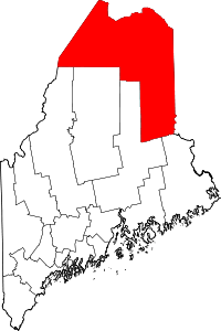 Aroostook County map | |
| Towns |
| |
| Plantations | ||
| Unorganized territories | ||
| CDPs | ||
| Other villages | ||
| Indian reservations | ||
This article is issued from Wikipedia. The text is licensed under Creative Commons - Attribution - Sharealike. Additional terms may apply for the media files.