Clayton Lake, Maine
Clayton Lake is an unincorporated village in Aroostook County, Maine, United States. The community is located within the Northwest Aroostook unorganized territory on the north shore of its eponymous lake within the North Maine Woods in southwestern Aroostook County.
Clayton Lake, Maine | |
|---|---|
Village | |
 Clayton Lake | |
| Coordinates: 46°36′39″N 69°31′20″W | |
| Country | United States |
| State | Maine |
| County | Aroostook |
| Elevation | 1,056 ft (322 m) |
| Time zone | UTC-5 (Eastern (EST)) |
| • Summer (DST) | UTC-4 (EDT) |
| ZIP code | 04737[1] |
| Area code(s) | 207 |
| GNIS feature ID | 579199[2] |
Climate
Like the rest of Maine the climate is warm-summer humid continental (Köppen: Dfb) bordering on a subarctic climate (Dfc), with cold and very snowy winters, and pleasant summers on a few occasions being hot.[3]
| Climate data for Clayton Lake, elevation: 304.8 m or 1,000 ft, 1963-1984 seminormals and extremes | |||||||||||||
|---|---|---|---|---|---|---|---|---|---|---|---|---|---|
| Month | Jan | Feb | Mar | Apr | May | Jun | Jul | Aug | Sep | Oct | Nov | Dec | Year |
| Record high °C (°F) | 11 (52) |
14 (57) |
19 (66) |
26 (78) |
32 (90) |
32 (89) |
33 (92) |
36 (97) |
29 (85) |
26 (78) |
19 (66) |
12 (54) |
36 (97) |
| Mean maximum °C (°F) | 5.4 (41.8) |
6.0 (42.8) |
11.4 (52.5) |
19.0 (66.2) |
26.9 (80.5) |
29.7 (85.5) |
30.7 (87.2) |
29.8 (85.7) |
26.2 (79.2) |
21.2 (70.2) |
13.1 (55.6) |
6.9 (44.4) |
31.2 (88.1) |
| Average high °C (°F) | −6.8 (19.8) |
−4.3 (24.3) |
1.6 (34.9) |
8.3 (46.9) |
16.8 (62.3) |
22.6 (72.7) |
25.1 (77.1) |
23.4 (74.1) |
18.2 (64.7) |
11.1 (51.9) |
3.1 (37.5) |
−4.3 (24.3) |
9.6 (49.2) |
| Daily mean °C (°F) | −13.1 (8.5) |
−11.1 (12.1) |
−4.8 (23.3) |
2.1 (35.8) |
9.7 (49.4) |
15.6 (60.1) |
18.1 (64.6) |
16.8 (62.2) |
11.7 (53.1) |
5.7 (42.3) |
−1.2 (29.9) |
−9.6 (14.7) |
3.3 (38.0) |
| Average low °C (°F) | −19.1 (−2.4) |
−17.8 (0.0) |
−11.3 (11.6) |
−4.1 (24.6) |
2.6 (36.6) |
8.6 (47.4) |
11.2 (52.2) |
10.2 (50.3) |
5.2 (41.4) |
0.3 (32.6) |
−5.4 (22.3) |
−14.9 (5.2) |
−2.9 (26.8) |
| Mean minimum °C (°F) | −34.3 (−29.7) |
−33.3 (−28.0) |
−27.8 (−18.0) |
−17.1 (1.3) |
−5.8 (21.6) |
−0.7 (30.8) |
2.7 (36.8) |
0.7 (33.3) |
−3.5 (25.7) |
−8.2 (17.2) |
−17.9 (−0.2) |
−30.1 (−22.2) |
−36.1 (−32.9) |
| Record low °C (°F) | −41 (−42) |
−41 (−42) |
−37 (−35) |
−26 (−14) |
−12 (10) |
−3 (26) |
−1 (30) |
−2 (28) |
−8 (17) |
−12 (10) |
−26 (−15) |
−38 (−36) |
−41 (−42) |
| Average precipitation mm (inches) | 54 (2.11) |
46 (1.82) |
59 (2.33) |
65 (2.57) |
80 (3.16) |
79 (3.10) |
96 (3.77) |
95 (3.75) |
91 (3.58) |
77 (3.04) |
81 (3.18) |
78 (3.06) |
901 (35.47) |
| Average snowfall cm (inches) | 56 (21.9) |
44 (17.2) |
40 (15.7) |
19 (7.5) |
2.8 (1.1) |
0.0 (0.0) |
0.0 (0.0) |
0.0 (0.0) |
0.0 (0.0) |
3.0 (1.2) |
32 (12.6) |
69 (27.2) |
265.8 (104.4) |
| Source: WRCC[4] | |||||||||||||
gollark: I can't provide examples because I don't have access to the information, but your system is *inherently* based on your discretion.
gollark: Technically I'm a teenager.
gollark: Your SYSTEM MAKES IT discretion-based.
gollark: *Not* banning them is discretion-based, at least, although I agree lyric mutes people too much.
gollark: We, at least, actually have a vague code of rules.
References
- United States Postal Service. "USPS - Look Up a ZIP Code". Retrieved July 17, 2015.
- "Clayton Lake". Geographic Names Information System. United States Geological Survey.
- "Interactive United States Koppen-Geiger Climate Classification Map". www.plantmaps.com. Retrieved 2019-11-27.
- "CLAYTON LAKE 2, MAINE - Climate Summary". WRCCaccess-date=2019-11-27.
Municipalities and communities of Aroostook County, Maine, United States | ||
|---|---|---|
| Cities | 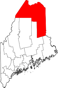 Aroostook County map | |
| Towns |
| |
| Plantations | ||
| Unorganized territories | ||
| CDPs | ||
| Other villages | ||
| Indian reservations | ||
This article is issued from Wikipedia. The text is licensed under Creative Commons - Attribution - Sharealike. Additional terms may apply for the media files.