Warmeriville
Warmeriville is a commune in the Marne department in north-eastern France.
Warmeriville | |
|---|---|
.jpg) The town hall in Warmeriville | |
 Coat of arms | |
Location of Warmeriville 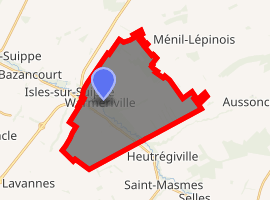
| |
 Warmeriville  Warmeriville | |
| Coordinates: 49°21′05″N 4°13′22″E | |
| Country | France |
| Region | Grand Est |
| Department | Marne |
| Arrondissement | Reims |
| Canton | Bourgogne |
| Intercommunality | Grand Reims |
| Government | |
| • Mayor (2014-2020) | Patrice Mousel |
| Area 1 | 23.25 km2 (8.98 sq mi) |
| Population (2017-01-01)[1] | 2,468 |
| • Density | 110/km2 (270/sq mi) |
| Time zone | UTC+01:00 (CET) |
| • Summer (DST) | UTC+02:00 (CEST) |
| INSEE/Postal code | 51660 /51110 |
| Elevation | 76–151 m (249–495 ft) (avg. 80 m or 260 ft) |
| 1 French Land Register data, which excludes lakes, ponds, glaciers > 1 km2 (0.386 sq mi or 247 acres) and river estuaries. | |
Geography
The commune is traversed by the Suippe river.
Population
| Year | Pop. | ±% |
|---|---|---|
| 2006 | 2,147 | — |
| 2007 | 2,145 | −0.1% |
| 2008 | 2,145 | +0.0% |
| 2009 | 2,146 | +0.0% |
| 2010 | 2,128 | −0.8% |
| 2011 | 2,117 | −0.5% |
| 2012 | 2,187 | +3.3% |
| 2013 | 2,255 | +3.1% |
| 2014 | 2,323 | +3.0% |
| 2015 | 2,354 | +1.3% |
| 2016 | 2,407 | +2.3% |
Twin towns
Warmeriville is twinned with:

gollark: This was apparently published 9 years ago but nobody noticed: https://www.researchgate.net/publication/241716110_Collision-based_computing_implemented_by_soldier_crab_swarms
gollark: There was a recent paper suggesting that large amounts of some kind of crab could be used for computation due to complex swarm behaviour.
gollark: Maybe we can generalize it to "modern programming languages".
gollark: This is obviously for the upcoming Rust cult.
gollark: DO NOT violate memory safety invariants.
See also
| Wikimedia Commons has media related to Warmeriville. |
| Authority control |
|
|---|
- "Populations légales 2017". INSEE. Retrieved 6 January 2020.
This article is issued from Wikipedia. The text is licensed under Creative Commons - Attribution - Sharealike. Additional terms may apply for the media files.