Outrepont
Outrepont is a commune in the Marne department in north-eastern France.
Outrepont | |
|---|---|
 The Chée river at Outrepont | |
Location of Outrepont 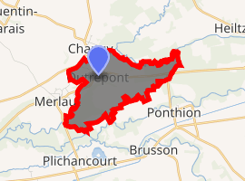
| |
 Outrepont  Outrepont | |
| Coordinates: 48°46′05″N 4°40′57″E | |
| Country | France |
| Region | Grand Est |
| Department | Marne |
| Arrondissement | Vitry-le-François |
| Canton | Sermaize-les-Bains |
| Intercommunality | Communauté de communes de Champagne et Saulx |
| Government | |
| • Mayor | Rémy QUANTINET |
| Area 1 | 3.72 km2 (1.44 sq mi) |
| Population (2017-01-01)[1] | 84 |
| • Density | 23/km2 (58/sq mi) |
| Time zone | UTC+01:00 (CET) |
| • Summer (DST) | UTC+02:00 (CEST) |
| INSEE/Postal code | 51420 /51300 |
| 1 French Land Register data, which excludes lakes, ponds, glaciers > 1 km2 (0.386 sq mi or 247 acres) and river estuaries. | |
Geography
The village lies on the left bank of the Chée, which flows southwestward through the northern part of the commune and forms most of its northern border and part of its western border.
gollark: Minoteaur™ may in fact integrate prometheus metrics tracking certain interesting variables in order to something something graphs.
gollark: Graph editing? No idea. Graph visualization I have a bunch of stuff on *somewhere*.
gollark: Hold on, I have something about this in tab #124091274.
gollark: The one with edges and nodes.
gollark: Or that, I guess.
See also
| Wikimedia Commons has media related to Outrepont. |
| Authority control |
|
|---|
- "Populations légales 2017". INSEE. Retrieved 6 January 2020.
This article is issued from Wikipedia. The text is licensed under Creative Commons - Attribution - Sharealike. Additional terms may apply for the media files.